
-
-
- Not shown on map - Columbus
& Franklin County Bridges | Columbus
Skyline Photos
-
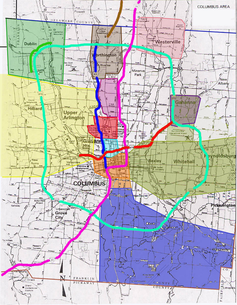
- Westside Columbus (Yellow
region) | Downtown Columbus Pages (Orange region) | Eastside
Columbus (Green/Gray region) | Southside Columbus (Blue region)
-
- Specific Town pages - Dublin (Light Green region) | Worthington (Brown region) | Westerville (Pink region) | Gahanna (Dark Purple region)
-
- The North High St Corridor Pages - Short
North District (Light Blue region)
| Ohio State Campus
(Red region) | Clintonville Pages (Light Purple region)
-
- Specific highway pages - I-71 (Purple line) | I-270 (Blue-Green line) | I-670 (Red line) | Oh 315
(Bright Blue line)
-
- Metro Columbus Plans - Covers 1952
Columbus Expressway Plan | I-270 | I-670 | Spring-Sandusky
| Mound-Sandusky
Interchanges, and more!
-
- Surounding Counties - Delaware County | Union County | Madison County | Licking County | Pickaway/Fairfield
Counties
- Other Related pages - Old
State Rd | I-73 | Central Ohio
Regional Page
-
Links
ODOT - Region 6 (Covers Columbus)
City of Columbus
Franklin County
Ohio State University
Mid Ohio Regional Planning
Commission
Paving the Way
Central
Great Lakes Highways Junction list
2003 Delaware Trip
notes by Eric Stuve
Page first created on August 29, 2001,
last updated on July 3, 2006
Questions, submissions, comments can
be directed to Sandor
Gulyas
Return to Central
Ohio Photos or Ohio
Regional Pages