 Disabled American Veterans
Disabled American Veterans
Disabled American Veterans
|
|
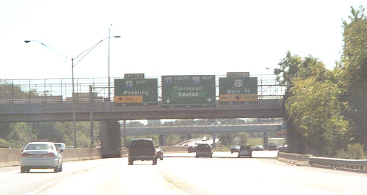
Photos Going from I-270 south to US 36 (in Delaware Co)
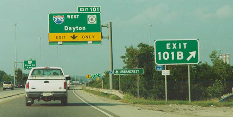
Urbancrest is what I'd term as a suburb of a suburb, in that it plays a secondary role to it's neighbor (it borders Grove City on two sides). ODOT, though, considers it important enough to gander secondary control city status on ramps from I-71 to I-270 WB on the southside of Columbus. Some other items to note in this picture include all the blue milemarkers, the official control city of Dayton for I-270 WB, and the overhead BGS Mast, for Oh 104, is on the leftside of NB I-71 instead of the customary right side. I-71 NB @ I-270 south of Columbus
I-71 NB at I-70 west is one of the rare occasions that through traffic on an interstate goes down to one lane. From 1960 to 1976, I-71 used to be routed both to the right (as you see today), and continuing straight on present day OH 315 north to present day I-670, where I-71 would jog to the east to the other end of I-71. Two other notes about the ramp/through-lane for I-71 NB here: It was originally used as part of Scioto Blvd (see Downtown Columbus Page), and it wasn't always one lane. It was originally striped for two lanes, but was deemed too narrow (Re: vehicles got wider) and sqeezing two lanes onto I-70 wasn't very safe, so it was made one lane. Of course this can change in the future again....
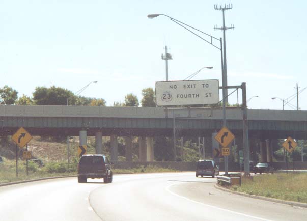
Back in the mid 80s (1985?) after a rash of bad accidents from drivers trying to merge from I-71 SB across all of I-70 WB to reach the 4th St exit (and the southern reaches of Downtown Columbus), ODOT and the City of Columbus decided to prohibit drivers going south on I-71 from crossing the two lanes of I-70 WB in an attempt to access the 4th st exit. This sign above (and another one, 1/4 mile further ahead) were placed to alert drivers what they couldn't do, and double solid white lines were painted to divided I-70 and 71 traffic past the 4th st offramp.
If these two following links tell us anything, this solution hasn't worked very well over the years
ODOT and the City of Columbus have also done a simular setup with Oh 315 SB between I-670 and W. Broad St.
While ODOT has shrunk the width on the ramps at the west I-70/71 split, they haven't done so here. I-71 is still two lanes (I don't know why it was deemed necessary to have I-71 and I-70 marked with seperate ramps through here). Photo from October, 2003
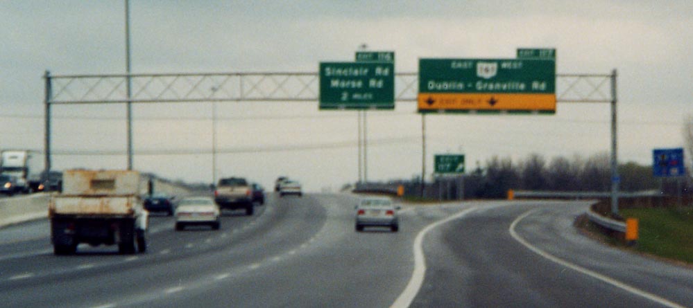
Now that ODOT has placed US 33 shields on the BGS for Livingston Ave along I-70 WB on the eastside of Columbus, what about taking the US 33 shield off the Main St. exit along I-71 SB?
US 33 was rerouted from Main St to Livingston Ave (between
College Ave and US 23 near downtown) in the late 80s.
UPDATE:
ODOT has updated the signs for Main St and removed references
to US 33 there in November, 2003.
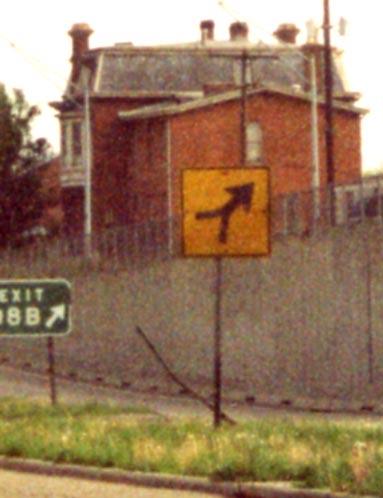
A yellow caution diamond that got turned 90 degrees. Which way not?
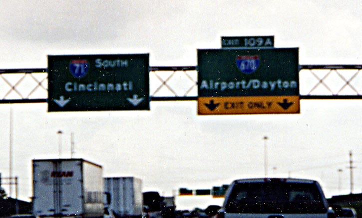
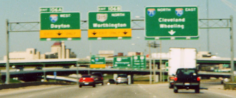
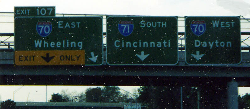
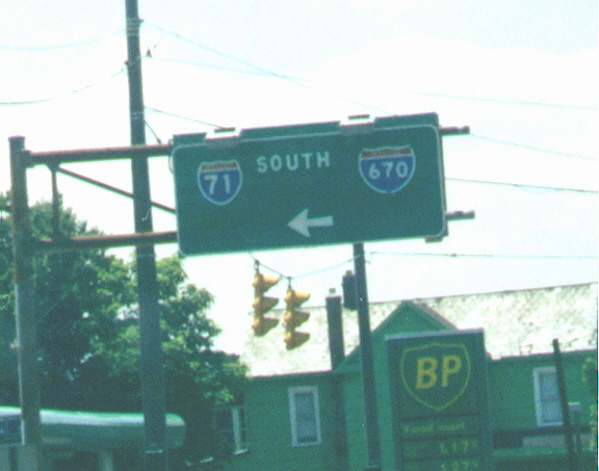
ODOT can't seem to make up their mind as to what the control
cities here should be for I-670. Originally it was Airport/Convention
Center, then Airpot/Dayton, then Airport, then Dayton, now back
to Airport/Dayton but on a single line instead of the standard
double line.
Try reading the MUTCD a sixth time
guys! I-71 SB at I-670, photo taken in May, 2004.
Couldn't ODOT give a little more description with this sign? Going WB on 5th Ave. over I-71
![]()
A sign assembly holder lacking signs. Believed to be for Variable message signs sometime in the future (late 2001 it turns out) on I-71 SB near the Columbus Crew Stadium (to the right)
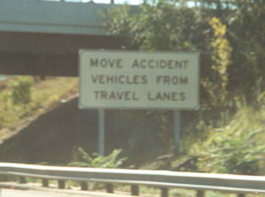
This new addition to Columbus highway sign scene (in summer of 2002) was implamented in an effort to keep disabled vehicles from blocking (and clogging) Columbus freeways. Along I-71 SB @ Weber Rd in North Columbus.
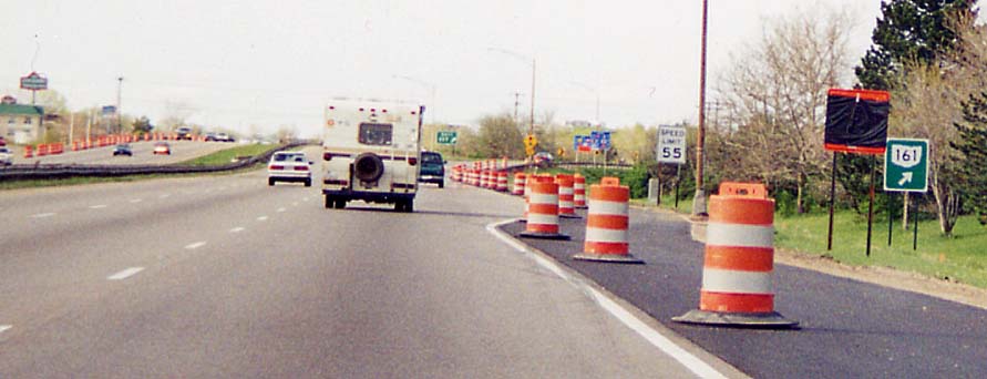
Top picture A temporary BGS for Oh 161 along I-71 NB during the I-71 reconstruction-widening project, 2000-1. The actual reason for the sign; A truck took out the original sign assembly back in February [2001?].
Bottom Picture The new permanent BGS for Oh 161, this time along I-71 SB. What has been put up after I-71 was widen in Franklin/Delaware Cos. A BGS has space for lane # expansion as well.
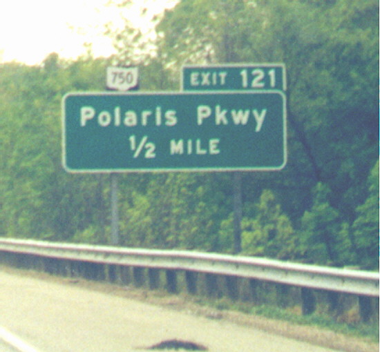
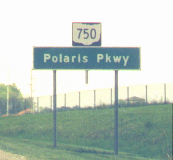
Top picture Polaris Parkway BGS along I-71 SB with an OH 750 shield attached to the top of it (all the SB Polaris Parkway BGS's got replaced after I-71 was widened, and have no mention of Oh 750 on them now. However, NB I-71 BGSs for Polaris Parkway still have Oh 750 shield standing out on top of the green signs)
Bottom picture Let people guess which way 750 goes (the correct answer is turn right). On the exit ramp to Polaris Parkway [from I-71 southbound]. Since this picture was taken, ODOT has added an arrow showing which way 750 goes.
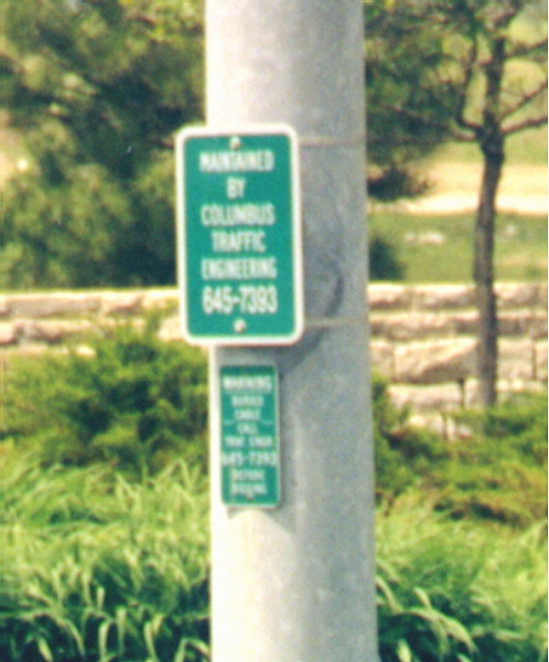
If you ever notice a traffic light going bonkers call the Columbus Traffic Engineers because there is cable buried underneith. At the SB I-71 ramp to Polaris Parkway intersection (looking to the west)
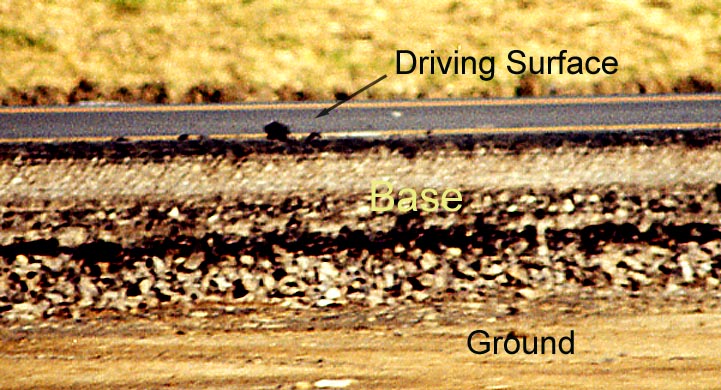
This is a cross section of I-71 during the preparation to widen it from two to three lanes (2000-1). You can see the original pavement and materials after the dirt is dug away here.
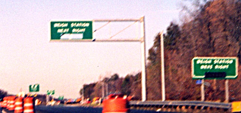
Weigh station signage -- Eventually I suppose, ODOT will add
LEDs to this sign so people will know if the following weigh station
is open or closed. At the time of this photo (Fall of 2000) the
weigh station in question was closed due to the reconstruction
of I-71 (which necessitated the new sign). According to Ryan Dalessandro,
the weigh station had reopened by about December 2001, and LED
inserts were installed in the signs between January 6 and January
20, 2002.
I-71 NB, 1 mile south of exit 131
(US 36/Ohio 37)
Links
I-71.org - Detailing construction sites along I-71 between Columbus and Cleveland
Columbus Crossroads, the I-70/I-71 South Innerbelt Corridor Study (ODOT)
Page Created on November 2, 2002, last updated on June 10, 2004
Questions, Comments, and Submissons can be directed to Sandor Gulyas
Return to Columbus Virtual Tour