I-270
around Columbus
I have little information concerning the history of the Columbus
beltway. We all know it was part of the original national interstate
plans. It's original northern extent was much shorter than what
we have today (can you imagine Bethel-Morse Rd as the northern
extent of this freeway?). Other than the dates of completion on
each section, that is all I know.
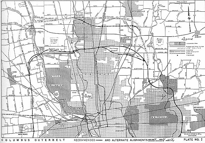
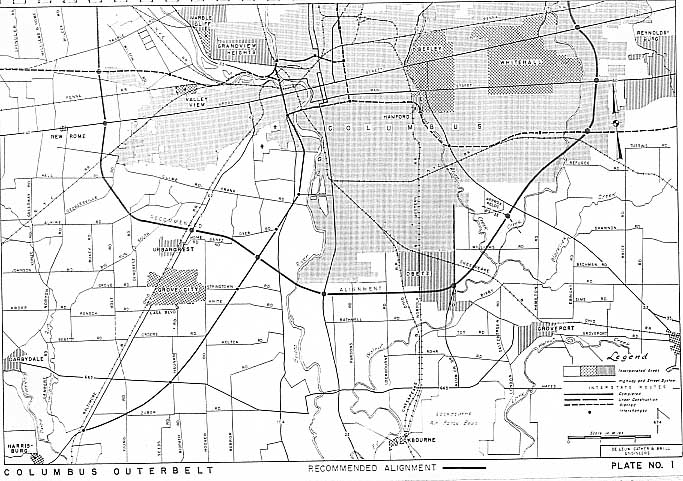
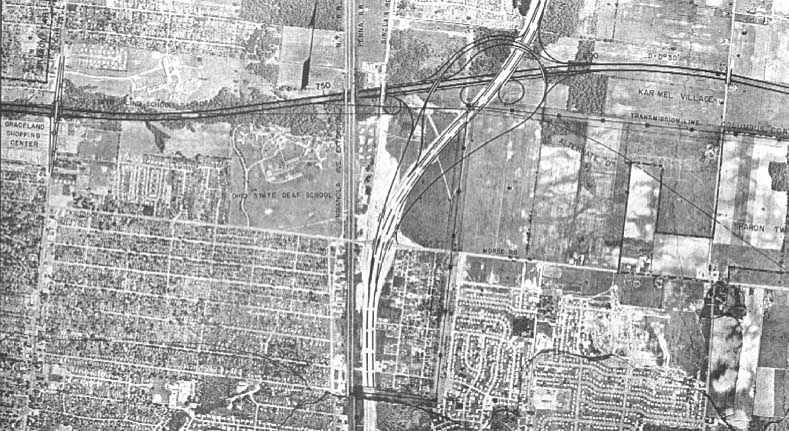
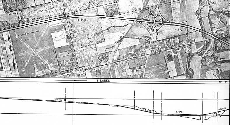
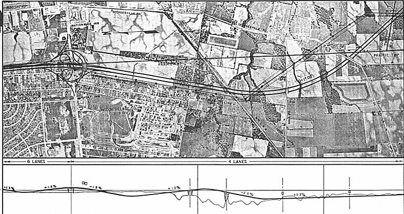
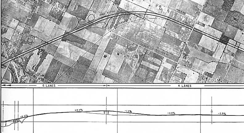
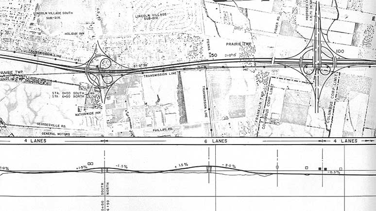
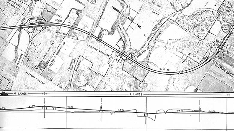
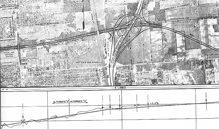
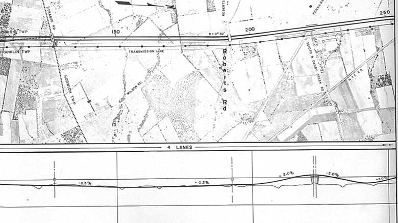
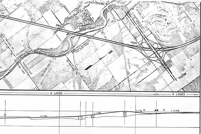
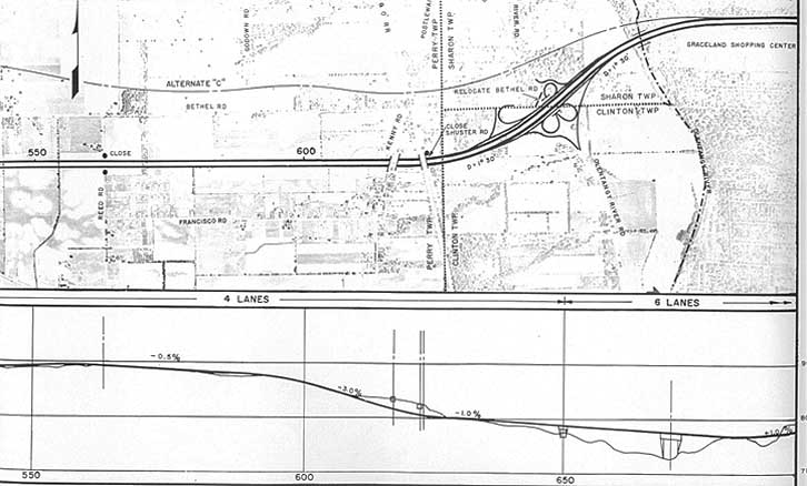
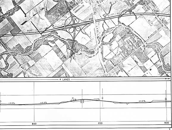
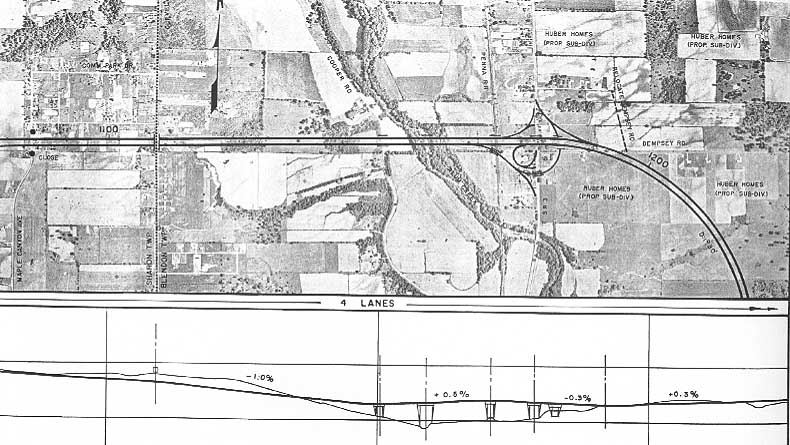
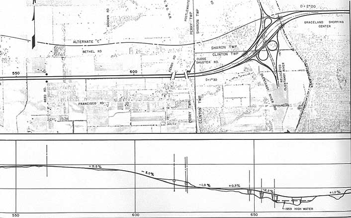
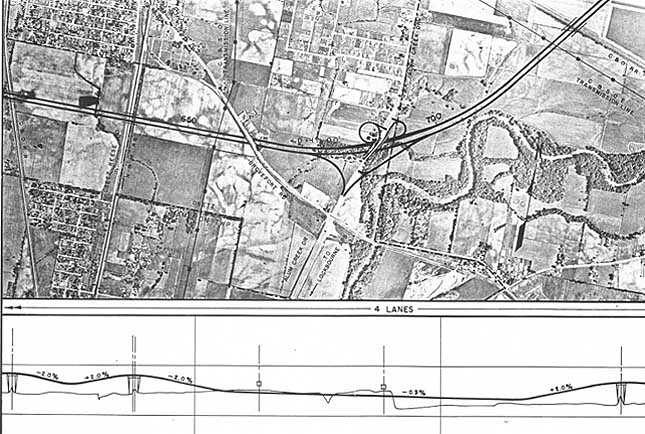
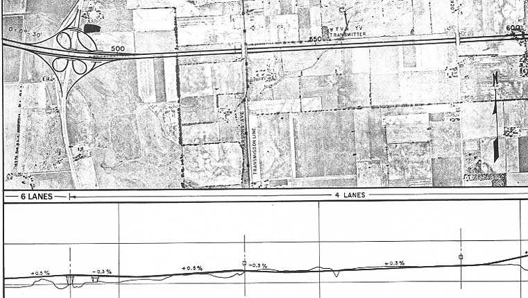
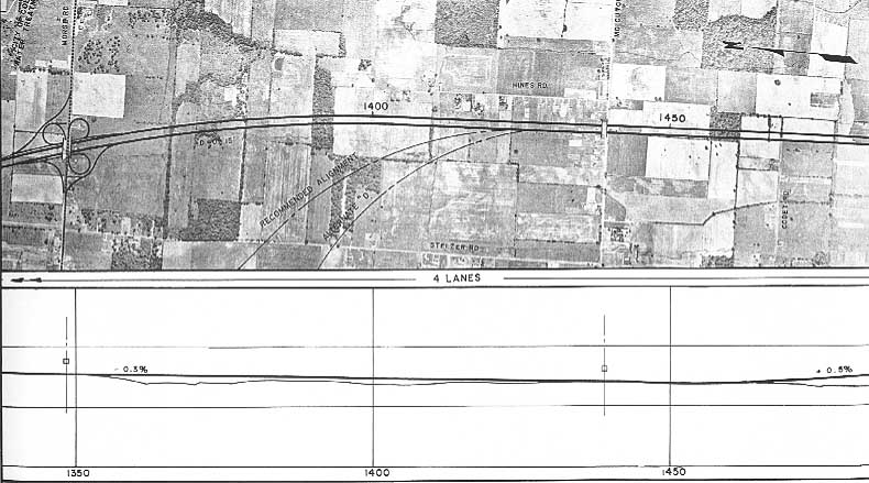
These two maps shows the original plan and all the northen
alternatives.
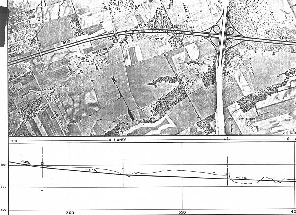
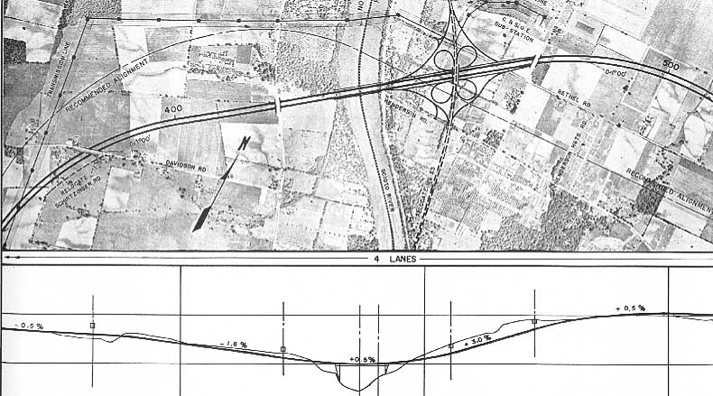
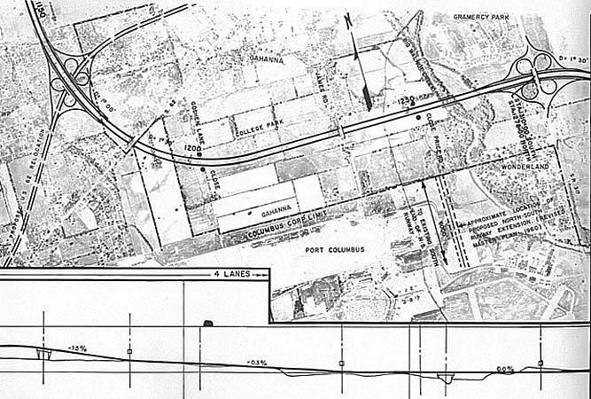
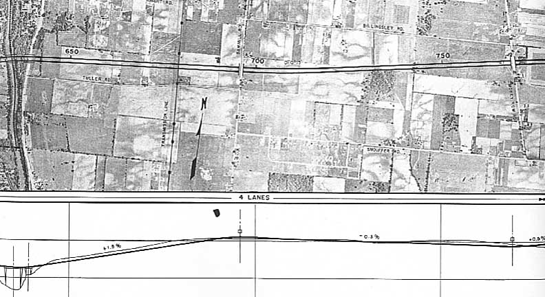
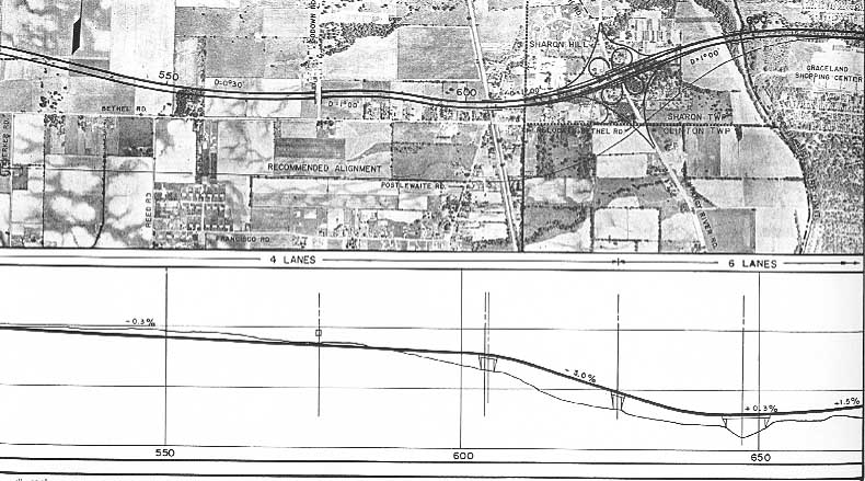
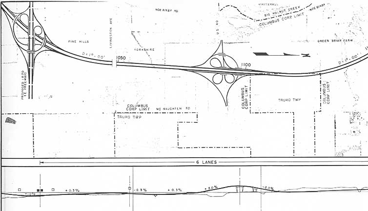
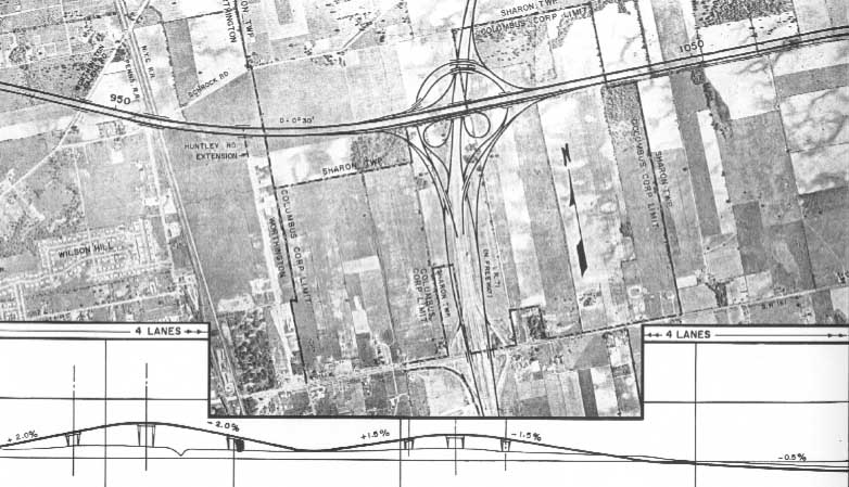
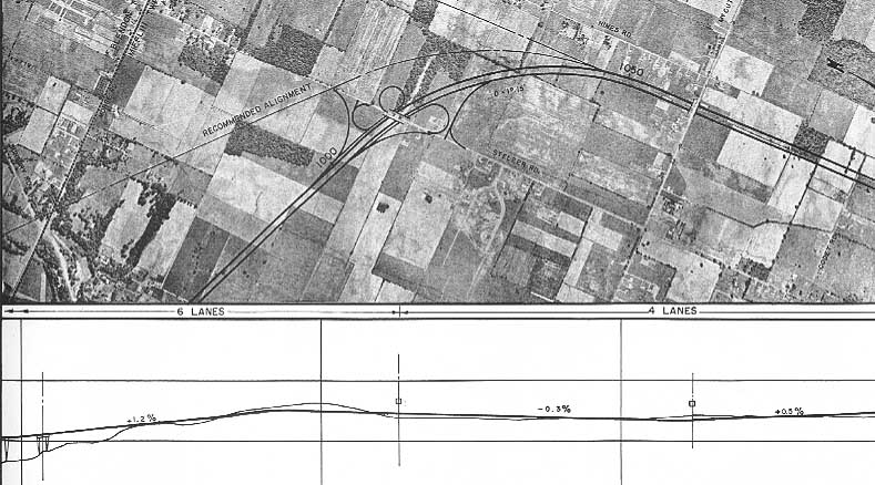
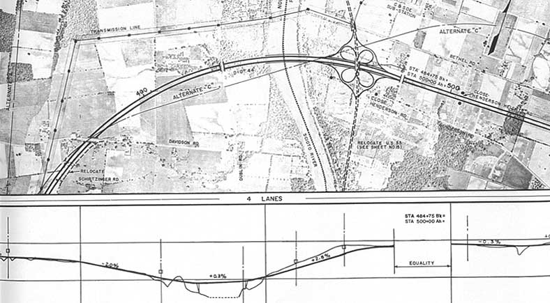
Maps
of the interchange
This table represents all the proposals for I-270. The two
left columns have the original plans (by present day exit location),
the two right columns contain the northern alternatives
|
Original I-270 Plan |
Alternative I-270 North Plans |
-
-
- * = highway located on neighboring map
- As for the northern alternatives, "A" in the west
and "B" in the east became what is I-270 today. In
the original plans, these following roads, that have interchanges
today, weren't originally plan to do so:
- Georgesville Rd.
- Roberts Rd
- Tuttle Rd
- Sawmill Rd
- Cleveland Ave (Oh 710)
-
- On all the maps, most of the interchanges shown got decidedly
downgraded when actually built. In some cases the interchanges
were built as shown on the map, but those few and far between.
- Visionary
or Demon?
-
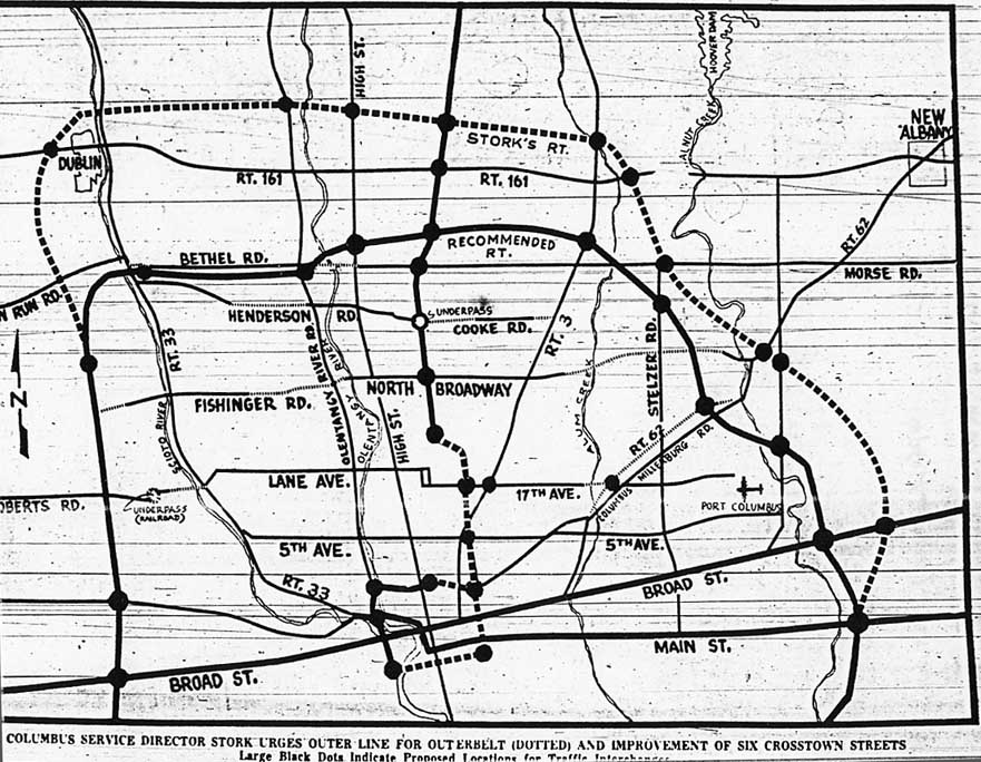
- This map, from the Columbus Dispatch in 1961 show
the two competing ideas for I-270 north at the beginning of the
interstate era. The solid line being the intended route for I-270
and the dashed line being the proposed route of 270 by then Columbus
Service Director Ernest Stork. Stork's reasoning for the northern
extension (variation of alt A above) was that by the time that
I-270 (north) would be completed the Columbus metropolis would
have grown to Worthington and Westerville. Stork already had
E-W arterial plans in the work for Northern Columbus and felt
that a I-270 following Morse-Bethel would do more harm than good
in getting those project completed. Those E-W arterials being:
The Morse-Bethel connector (and 4 laning that
highway) [45 years later, the connector has yet to be built.
Morse Rd was promptly made 4 lanes in the 60s, while Bethel was
finally widened in the late 80s/early 90s]
Fishinger-North
Broadway- Agler (McCutchen) Rd. North Broadway was not a
major throughfare till the 1960s as Columbus wanted to make it
part of it's middle loop. It was extended over the Olentangy
to Kenny Rd (over the objections of land owners between Olentangy
River and Kenny Rds, and the City of Upper Arlington) and have
some other road from Gahanna meet North Broadway at Cleveland
Ave (The article referenced extending McCutchen Rd, when in reality
it was Agler Rd that was extended over Alum Creek to Westerville
Rd). However, North Broadway was never widened east of Maize
Rd and ended up being used for local traffic.
Roberts
Rd-Lane Ave-17th Ave. Here's another proposal that never
came to fruition. Roberts has yet to be extended over Marble
Cliff Quarey. 17th Ave peters out in Mifflin twp. While Lane
Ave has fared best, getting a rebuild from Olentangy River Rd
to High St.
5th Ave. As the dividing line
between "Campus" and the "Short North" it
already was an arterial highway and no major changes were done
to it.
-
- The eastern extension, to the east of Gahanna was
proposed due to concerns about proposed road being too close
to Port Columbus. I guess those fears were unfounded as the original
alignment, going between Gahanna and the Airport was chosen (though
it ended up being the last section built and opened in 1975)
-

- While there was a debate as to whether to place I-270
where traffic was then (1961) versus the future, someone had
some consultants from New York City to look at putting I-270
through Overbrook Canyon and Whetstone
Park. Thankfully that idea never got beyond the paper stage
Links
Source -- Columbus
outerbelt interstate highway 270; preliminary report
Arial
Photos of I-270 (Starts at I-71 south and you can proceed
clockwise)
I-270 Photos Page
Jeff
Kitsko's Exit Guide for I-270
I-270/US
33 NW Columbus Study
I-270 North Outerbelt
Study
Page created on November 19, 2002, Last updated on January
26, 2006
Questions and comments can be sent to Sandor
Gulyas
Return to Columbus Virtual Roadtrip
or Maps & Plans