|
I-270 is one of the few exceptions to non-name protocal of Columbus. Named after one of C-bus's favorite sons after it's completion in 1975, plenty of I-270 through lane overhead signage mentioned the Golden Bear on them. However, at some point during the 1980s all references to Jack disapeared along I-270. The only time you see Jack Nicklaus mentioned with I-270 now is on local maps. |
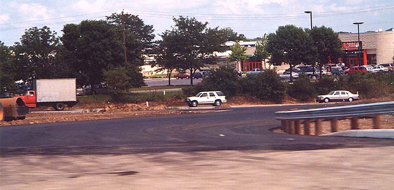
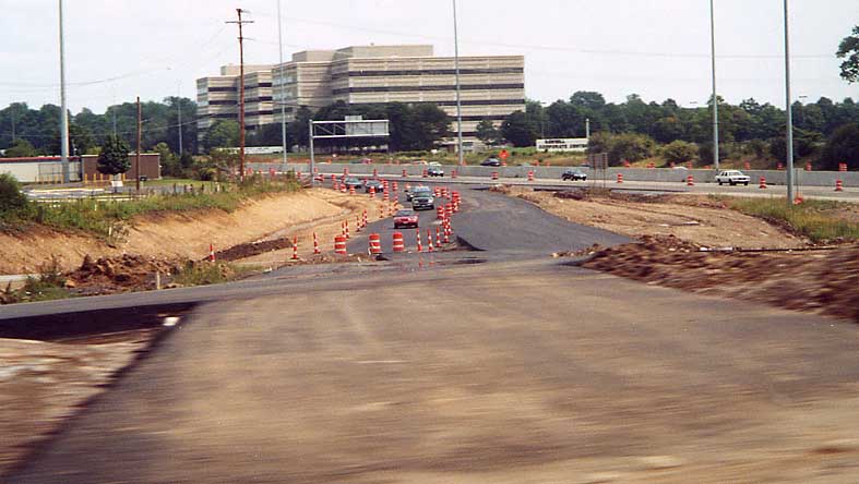
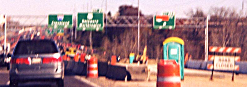
Photos (Going clockwise from I-71 South, following I-270's milemarkers)
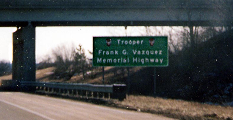
Just west of Georgesville Rd, you'll see one sign, in each direction, mentioning OHP Trooper Frank Vazquez. Frank unfortunetly was killed in the line of duty near where this sign is errected along I-270 (Some drunk ran over Frank who was near the side of the freeway with another driver). The memorial was established in the spring of 2003. (Photo taken in February, 2004)
Just a friendly reminder from ODOT that to go right (west) you need to stay right. Oh yeah, this side sign is on an upright for a BGS telling you to stay right for I-70 already! SB I-270 (westside) approaching I-70
You can go either South or East onto I-270. So much for matching Cardinal directions (North/South; East/West). On US 33/Oh 161 looking west from Dublin towards I-270
I-270 SPUI Interchange with Sawmill Rd
In this picture you are on Sawmill Rd looking south towards I-270 from north of the interchange. Of note here is the combination of Big Green Signs for turning and standard roadside routing arrows to go straight
The middle point of the interchange on Sawmill Rd. The square/diamond divided the directions of traffic coming and going between I-270 & Sawmill Rd.
This time you are looking east from Sawmill Rd northbound on the southside of the interchange. This photo was taken in August, 2000 while the interchange was still being worked on.
A nice picture of a mall. The soon to be ramp from I-270 WB to Sawmill Rd SB at the middle of the interchange/bridge. Taken in August, 2000 while the interchange was under construction
Again looking east from Northbound Sawmill Rd. This time from the north point of the interchange, as you can see the difference between the old ramp direction and the new ramp direction(s). Taken in August 2000
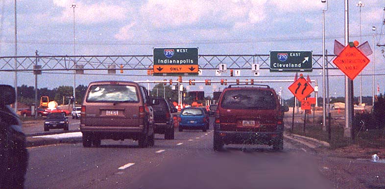
Looking NB on Sawmill Rd from south of the interchange. Note the choice of the control city for WB I-270 and the abundance of arrows all around. Taken in August 2000 (soon after, ODOT realized it's error and made Dayton the WB control city for I-270 here)
Someone forgot to add mileage or at least should of tried to attempt to make the US 23 BGS look like an exit ahead sign. On I-270 EB @ 315
After the reconstruction of I-270 on the northside of Columbus, all the BGSes (big green signs) were redone. In this case ODOT inserted a BGS for I-71 on the collector/distributor ramp for US 23. Of note here is that it's missing an exit tab. Not shown in this picture is that the BGS for the same route, on mainline I-270 (just to the left of this sign), DOES have an exit tab. I-270 EB @ US 23 north
The smallest BGS in Ohio? For Oh 315 on WB I-270
Where the rest of the signs in Ohio that mention something has "exit only" status have it highlighted as black text on a yellow background, this one just shows it as white on green like a normal BGS. I-270 WB between I-71 and US 23 (north end) This sign has since been corrected.
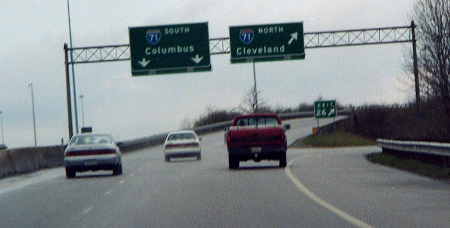
WB I-270 has one exit ramp leading to both directions of I-71. It has been numbered as one exit till I-270 was widened (1997-2001). Now somehow, only the ramp to NB I-71 is exit 26, where as the ramp to SB I-71 is....nothing. In the first picture the BGSes for I-71 are shown with NB having the exit number tag and SB not having a tag. In the second, the sign for the exit is placed in the gore of the I-71 ramps instead of between I-270 and the I-71 ramps.
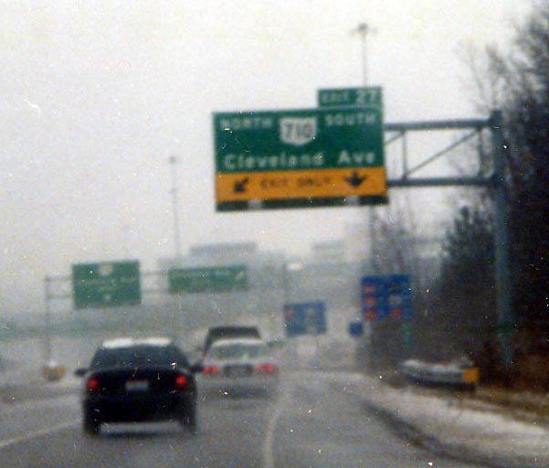
In case there is any doubt, Oh 710 does end at I-270 (look at the blurry signs in the background). However, if you look at this sign, one would think that Oh 710 continues south along Cleveland Ave. Also, don't try to take pictures during a snow storm, you see the results. (Photo from December, 2003)
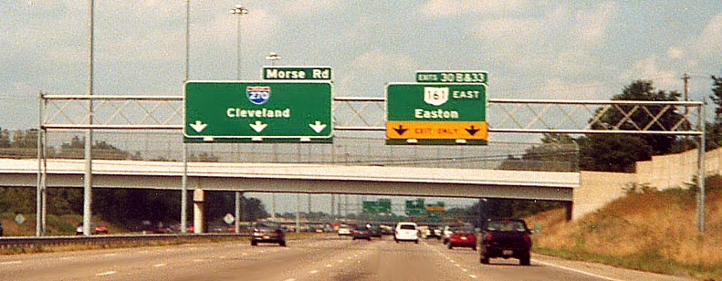
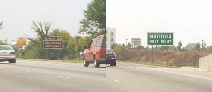
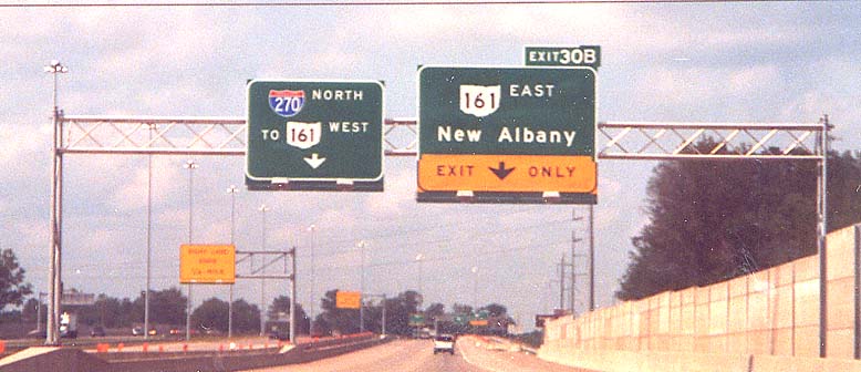
Many items to think about here. On the I-270 directional sign, there is the additional mention of Morse Rd, similar to that of an exit tab. It was placed there so drivers didn't go on the newer section (built for Easton traffic) thinking they could get to Morse Rd. On the BGS for Oh 161, you have the control city being a fictional place (well a mall at best), however the numbered route, in this case Oh 161, doesn't go near the location it's aligned with (potential confusion for drivers?). Also on the Oh 161 BGS, the exit tab mentions two exits (that you can only reach by staying to the right and taking the newer section), instead of the standard of one exit per BGS. NB I-270 between I-670/US 62 and Easton
Blink and you might miss this. This sign is standard brown color for parks. What is of note here is on the exit tab someone added a letter designation in the green color instead of brown. On I-270 NB between Morse Rd and Oh 161.
On the outer NB lanes of I-270 near Easton you have two choices. Take Oh 161 EB or slip over to I-270 mainline and the cloverleaf to Oh 161 WB. This exit configuration will change in coming years. Also note the letter addition to the exit tab on the Oh 161 EB BGS. It lacks a white border around it.
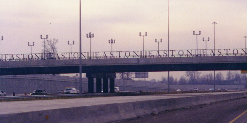
Unique bridge rail design on the Easton Drive bridge over Interstate 270 in the Morse Road/Easton Drive interchange complex in Easton. This section of I-270 is the widest highway in Greater Columbus at this time (four 3-lane roadways at this point). On the outer lanes of Interstate 270 Southbound
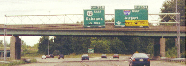
Going SB on I-270 you come upon the Gahanna/Airport interchange. US 62 is supposed to be a through route here. There are no indications, from the BGSes (at least) that there is such a thing. IOW, the sign for I-670 Airport should also included a US 62 shield with it. UPDATE - ODOT did a partial correction, placing an US 62 shield to the right of the 670 west phrase in September, 2003. Still not technically correct, but better than before.
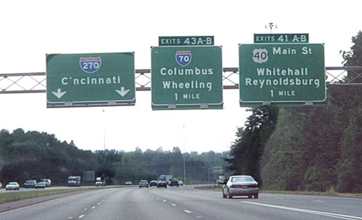
While the exit numbers are different the mileage to their exits are the same. Reason being, I-270 goes to a 3-2-2-3 format between US 40 and I-70 on the east side and it's 1 mile 'til the split. Going SB on I-270 between Broad & Main Sts.
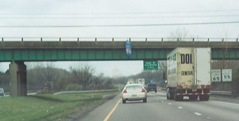
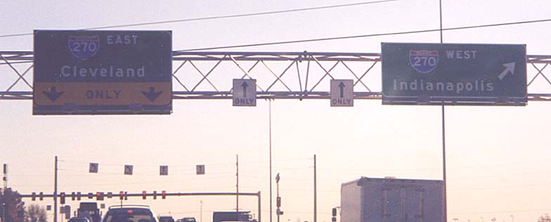
Once upon a time, one would see (at various places) 'To (direction) 70 or 71' on sign gantries along I-270. These faded away during the mid '80s. I liked to think this 'To East I-70' sign is left over from that period. More than likely this sign is left over from the I-70 reconstruction of the last two years. Sign assembly is on the Oh 104 overpass. EB I-270 in South Columbus.
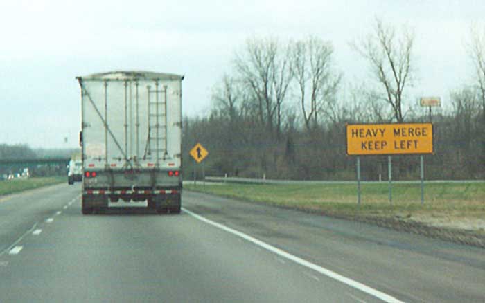
A lot of traffic from I-71 coming onto I-270? EB @ I-71 on the south side of Columbus
Submitted Photo -- Craig Burkin
US 33 Eastbound approaching I-270 on the southeast side
Proposed Exit for Easton
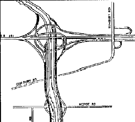
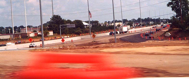
This will be the next highway project of note for Columbus. ODOT has stated this is the next major road project for Columbus starting in 2004. They even made up a website and acronym, NExT (beware, most of the pages there need acrobat reader to view). This map was produced back in 1996 by The Other Paper (one of Columbus's alternative weekly paper) and surprisingly the plan has held through the years. So folks, those dead end ramps along I-270 near Oh 161 will finally be put to use here in the next couple of year.
Related pages on Roadfan
ODOT - 270/161/Sunbury Rd interchanges reconstruction website
Page created on November 3, 2002, last updated on March 27, 2004
Questions, comments, and submissions can be directed to Sandor Gulyas
Return to Columbus Virtual Roadtrip