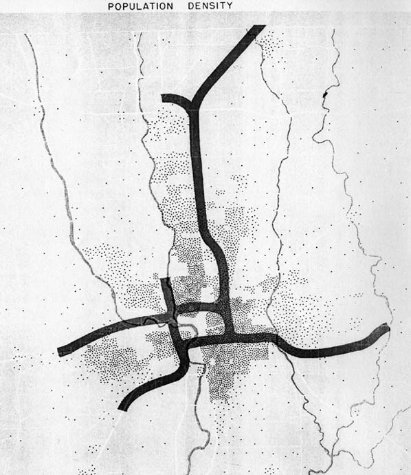
Map 1
This shows the proposed routings for the first Columbus expressways. I also included it for it shows a Worthington Spur. This is the only map out of the collection that showed it however. Design error, or first project removed?
Map 2
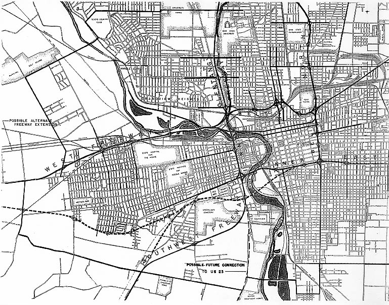
This map shows several alternate routings to the west. One following the Penn RR (staying north of Broad St/US 40), the other stays south of Mound and Sullivant Sts (with a SW Freeway connector following Harrisburg Pike). Ironicly, the SW Freeway would follow the future US 23 connector instead of the route proposed.
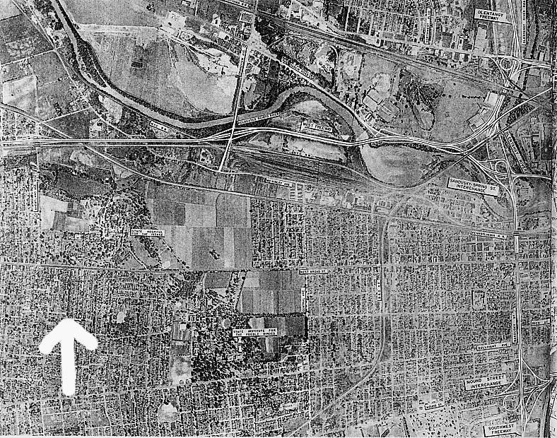
Map 3
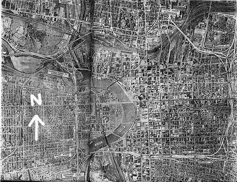
This ariel photo shows the proposed innerbelt in relation to downtown Columbus in the 1950s. That is a fold in the book that prevented me from getting the near westside.
Map 4
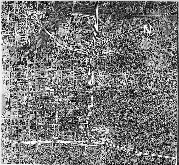
Downtown and the Olde Town East of Columbus.
Map 5
Franklinton and the Hilltop areas, west of downtown Columbus. Present day I-70 would cut a swath from the upper left to the lower right of this photo
Map 6

A closer view of the proposed Spring-Sandusky interchange. In relation to first plan for the west freeway (I-70, I-670), Dublin Rd (US 33) was to run into the freeway (thus the extended ramp to US 33, to be proposed and built later on west of this photo). East and west traffic would cross over one another between Goodale and Spring-Sandusky (that long 3/4 mile ramp is for WB traffic from the north innerbelt to the west freeway). The Service Rd mentioned on this map would become todays Twin Rivers Dr
Map 7
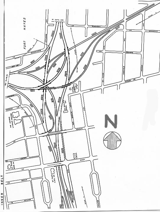
This drawing shows some of the proposed Ft
Hayes interchange (modern day I-71/670). The freeway going
the length of the way would be present day I-71.
The
extension heading NE would be a connector for Leonard Ave. No
mention of an Airport Freeway or rerouting US 62 in this plan.
Map 8
At long last, have you planners no sense of scale?! Can you imagine someone thought you could squeeze TWO cloverleaf ramps from Parsons Ave. NB, one to the Innerbelt south and the other to Innerbelt east (look at a map today and see which one won out). The lack of a sense of proportion comes from all the streets that were proposed to stay put versus what actually happened. Also of note, an interchange was proposed along the east innerbelt to Town St. instead of at Main St.
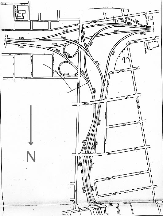
Map 9

This is the first proposed Mound-Sandusky interchange design. In the end, the design got turned 180 degrees with the extra fly-under ramp becoming another cloverleaf loop. The actual interchange also got built a little bit closer to the Scioto (that the present ramp for I-71 NB to the innerbelt south might have been Scioto Blvd in a previous life) than the proposal here shows. The freeway going the length of this map would be I-71 today.
Page created on September 13, 2003
Questions and comments about this page can be sent to Sandor Gulyas