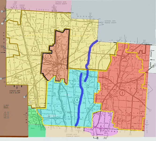
I have decided to group photos here by school district boundaries (roughly). There are 4 primary school districts (as you can see above) and by clicking on any of them you'll be forwarded to those particular regions photos.
2 - Big Walnut (Olive Green-Sunbury-Galena)
3 - Buckeye Valley (Bellpoint-Ostrander-Radnor-Ashley-Kilbourne)
4 - Olentangy (Powell-Lewis Center-Polaris)
Links
Delaware, Oh 43015 - Richard Browning, retired Police Chief for the City of Delaware, Ohio, website. Contains old maps, streetscape photographs, info on streetnames, and a bunch of historic items.
Delaware County Planning Commission - GIS and county thoroughfare material
ODOT district 6 (HQ in Delaware!)
Page created on November 25, 2002/Last updated on December 15, 2003
Questions and comments can be directed to Sandor Gulyas (Buckeye Valley class of 1993)
Return to Central Ohio Photos