Thanks to the privilages of being an student at (The!) Ohio State University, I found documents covering many of the highway projects in Columbus (strangely enough, nothing about I-70 nor I-71 however) in the OSU libraries. It is with that readily available data that I was able to create the following pages:
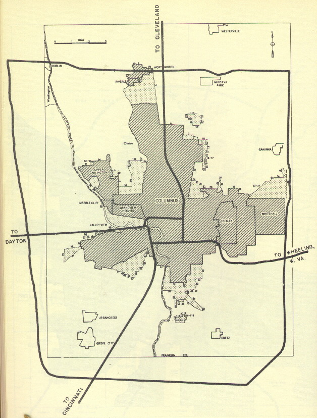
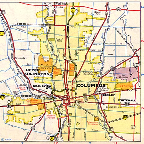
The "Yellow Book" Map of Columbus.
It got the innerbelt right, and I-70 looks to be correct, but I-71 is too straight and I-270 (as you will see) was never planed to follow OH 161 on the north, nor leave Franklin County. This map was produced in 1947.
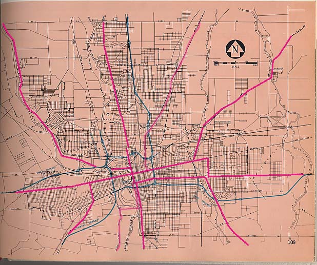
1952 Expressway Plans for Columbus
The finding of this book at Columbus Public Library answered a bunch of questions for me. However, the planners had no sense of scale or size. I have made a seperate page for the maps and photo overlays from this collection. The map below was from a 1962 collection of regional freeway plans done by Needles and Bergendoff.
The 1954 Batholomew Report
I
wish I there was a copy of this report (I have yet to find a copy
at Columbus Public Library, OSU Library, or the State library).
Essentially the report proposes an intermediate Expressway
loop and an outerbelt (the innerbelt was already perscribed in
the Bergendoff Report in 1952).
The intermediate loop would follow:
The outerbelt would follow
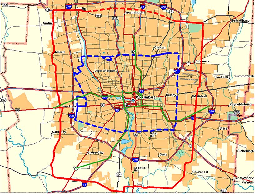
The Red line is the proposed Outerbelt route, the Blue line is the proposed intermediate loop route, the Green lines are the innerbelt and freeway routings from the Bergendoff report (and I left the current arterial system on there for a comparison).
(And he suggested that the bus company (this was long before
COTA) add some lines, abandon some other lines, and start offering
express bus service)
While his report was accepted,
it was never fully adopted by the Columbus City Council.
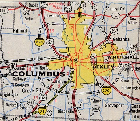
1957 State Plans
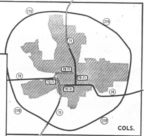
Where as the Yellow Book had I-270 too narrow and long, this map has I-270 too wide. Actually the item on this map that sticks out is the proposed doubling of I-70 and 71 on all four sections of the innerbelt. In actuality, only I-71 achieved that status (with no directional suffix attached to any shield). Future plans for I-70 kept it signed only to the southern leg of the innerbelt. Map from the 1957-8 Ohio Department of Highways Biennial Report.
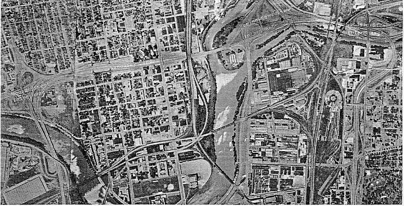
1961 West Innerbelt photo
This overhead view of Mound-Sandusky, Spring-Sandusky and the Goodale St. Interchanges is from a 1961 Ohio Department of Highways (forerunner of today's ODOT) pamphlet entitled 'What Price Stops.' I included this just due to the lack of photos I've seen of the Mound-Sandusky interchange (pre west I-70/71 split days)
Rand McNally Maps of Columbus
1962 was a watershed year for Rand McNally. In that it was the first year they started showing the Interstates. In the case of Columbus, one gets a different idea of routings for I-270 and I-70 than what we see today.
Also check out statewide highway plans on the Ohio Maps page.
Links
While I have covered the past here, these sites cover future road plans for Columbus and Central Ohio
City of Columbus Planning Division
MORPC (2030 Transportaion Plan)
ODOT (State Transportation Improvement Program - 2006-9)
Page created on November 16, 2002/Last updated on January 27, 2006
Questions and comments can be sent to Sandor Gulyas
Return to Columbus Virtual Roadtrip