The Columbus highway project for the 80s (actual construction occured from 1985-1994). Most of the real planning for this part of I-670 came about in the second half of the 70s. However, city fathers were interested in some form of a connecting expressway from Downtown Columbus to Port Columbus Airport as early as 1951. In fact there were two plans that the city wanted to come to fruition. One plan had an expressway following Leonard Ave. from Ft. Hayes to the Airport, and the other plan was to make 17th Ave from I-71/State Fairgrounds to the airport as a through route and made into an expressway as well.
It wasn't till 1974 that the Airport connector was given the I-670 designation. By then the city of Columbus had backed off making 17th Ave a freeway and instead hoped to connect the two sections of 17th Ave.(by make a crossing of Alum Creek to connect Cassidy Ave and Brental Ave). They were going to put all their eggs in the Leonard Ave routing (helped by the abandonment of much of various railroads that skirted the old east side).
From 1977 till construction started in the mid 80s, construction was held up due to neighborhoods not wanting to be divided (more so along the Nelson Rd corridor than along Leonard Ave.) and an early 80s budget crunch that led then head of ODOT, Walter Smith, to publicly admit that he wanted that section of I-670 off the books (a famous quote from him is that it was a "local route" not needing state or federal funding).
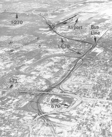
This photo (below) shows the intended routing for I-670. (The routing overlay was placed by the authors of the book, I added the text overlay to this photo/map)
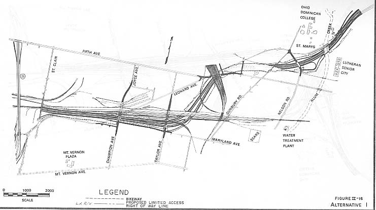
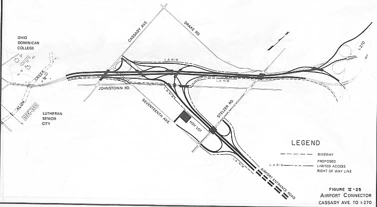
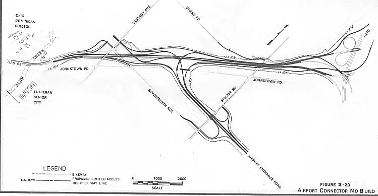
This following map shows all the possible alternatives that all the agencies and planners considered for I-670 between I-71 and I-270.
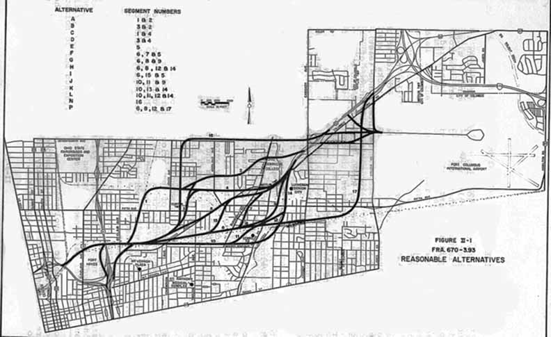
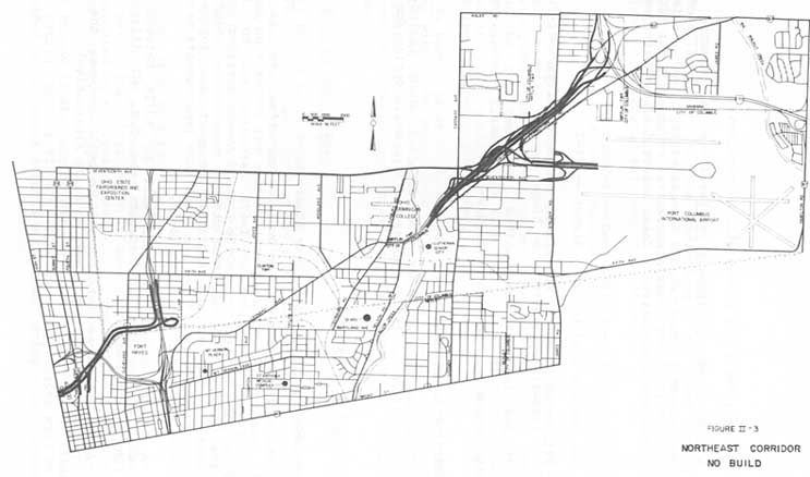
With the new laws governing freeway building, a "no build" alternative had to be considered. In this case that meant only building a connection between I-71 and the Columbus Convention center and a rebuilt Airport interchange for US 62. Strangely, no build on I-670 meant 17th Ave would still get to cross Alum Creek.
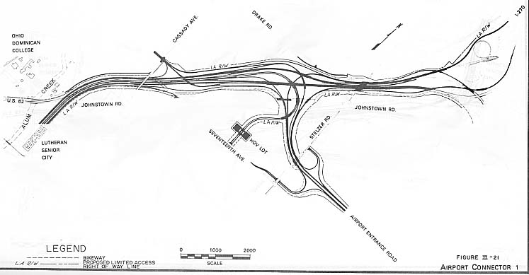
Of the next three maps, the first one is closest to the actual
interchange today. The only noticable difference is there is no
ramp from I-71 NB to new 670 WB (Convention Center). Ft. Hayes
is a former army depot that is now property of the Columbus Public
Schools. CPS has an "Alternate High School" and a radio
studio (WCBE, 90.5 FM) there.
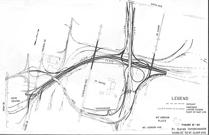
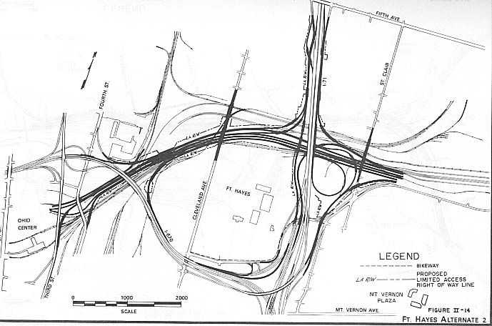
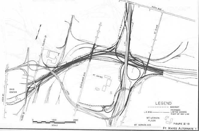
The first map was the closest to what was built with a standard
diamond interchange at the rerouted Leonard Ave.
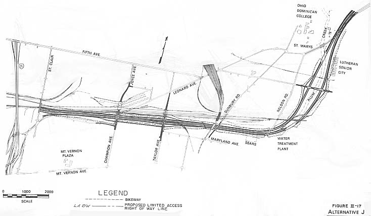
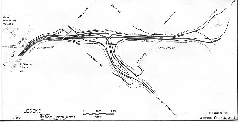
The Busway and HOV lanes shown in all maps were never constructed
(there has yet to be any shown need for HOV lanes along I-670
east as well). The Busway would have gone from the I-670 turn
at Nelson Rd and followed a railroad right-of-way to near the
Defense Construction Supply Center, then south through the middle
of Whitehall, to an end point at Refugee Rd west (behind) Eastland
Mall and Hamilton Rd.
This was one of the few instances that a park was completely wiped
out (Hayden Park near Nelson Rd and 5th Ave) for a highway.
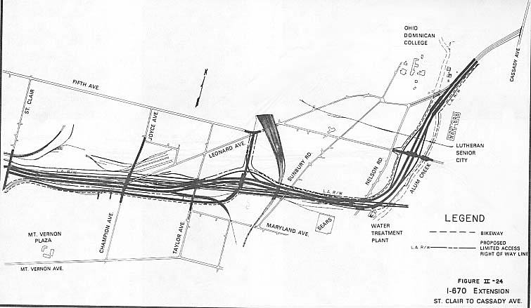
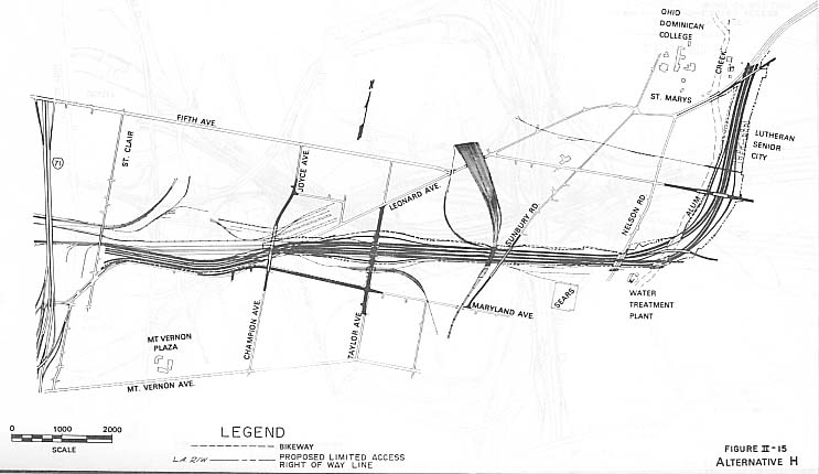
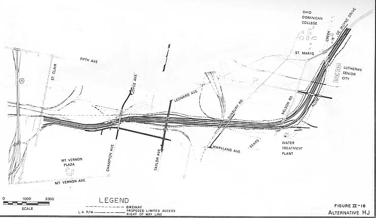
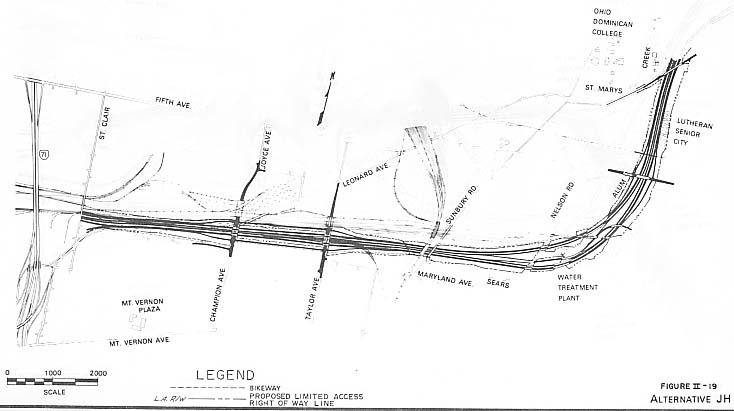
It's hard to distinguish which one of these plans came close to what was built. There was no HOV lot, no interchange nor bridge with Stelzer Rd, and the ramp from I-670/US 62 west back to the airport cloverleafed instead of getting the long approach ramp (giving a little more compactness to the whole interchange). However, I do believe the first map is the closest to what was actually built.
Sources
Interstate 670 extension -- : final joint environmental impact statement, section 4(f) evaluation
Page created on November 14, 2002
Questions and comments can be directed to Sandor Gulyas
Return to Columbus Virtual Roadtrip | Metro Columbus Plans | I-670 Photos