Note: This page has not been revised since mid-2005. Some information may be out-of-date. This will be corrected in the future.
More recent information can be found on the 2009 roadtrip page, written in 2013
Jump to Indiana Toll Road Photos link and new additions | St. Joseph Valley Parkway | Other Michigan | Other Indiana | Other Indiana outside Michiana | Links
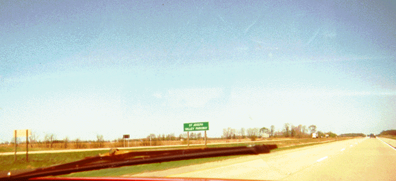
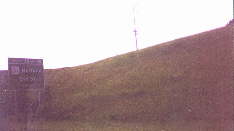
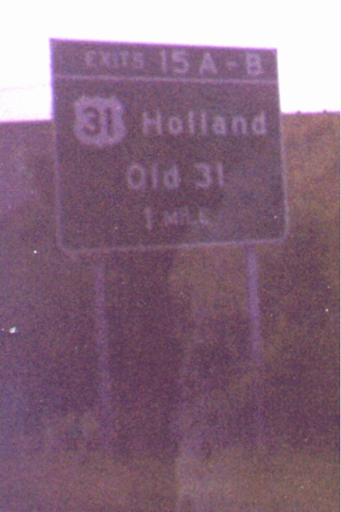
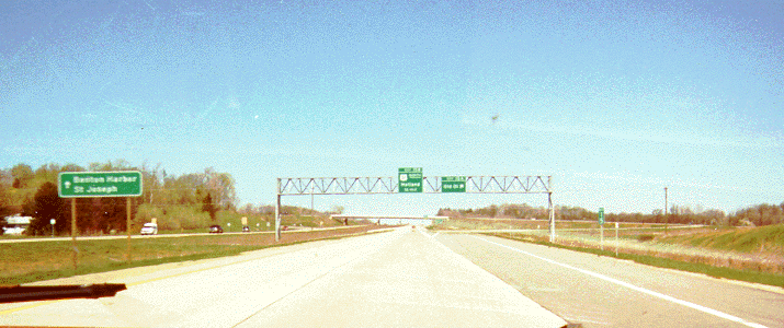
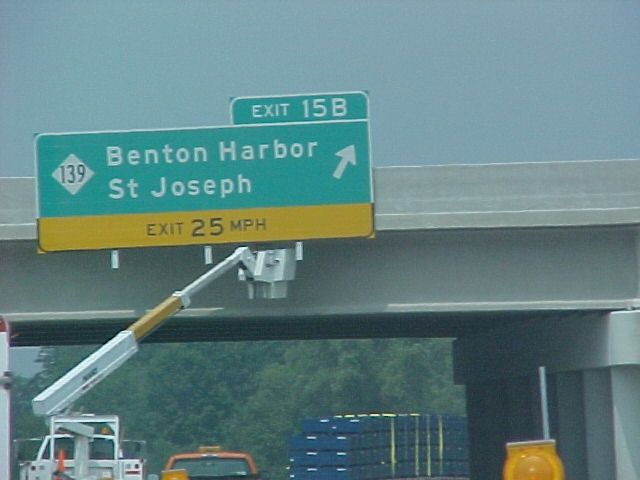
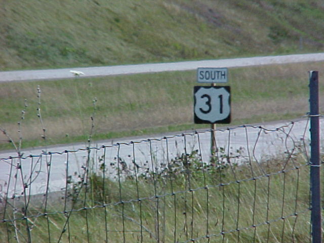
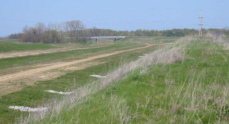
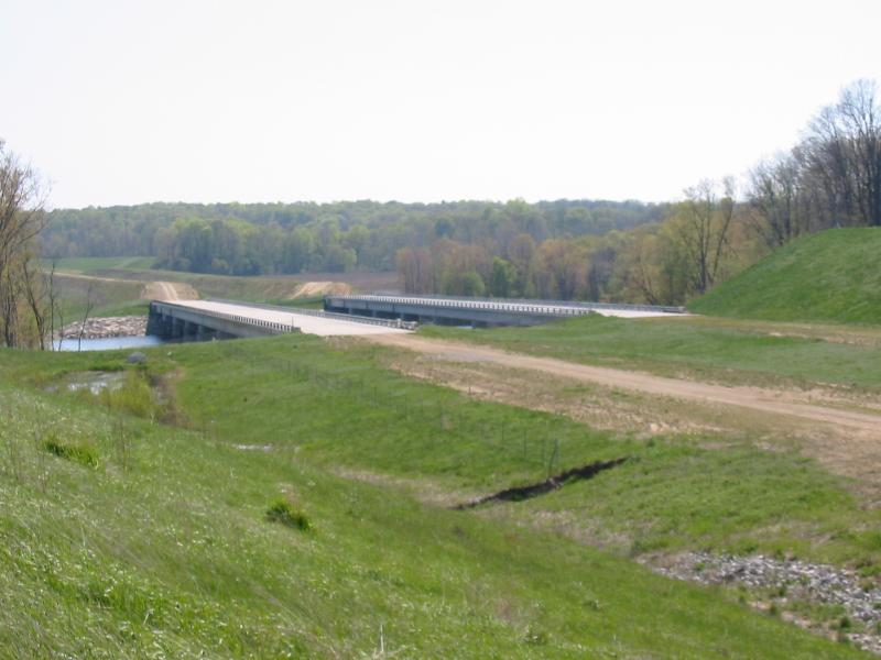
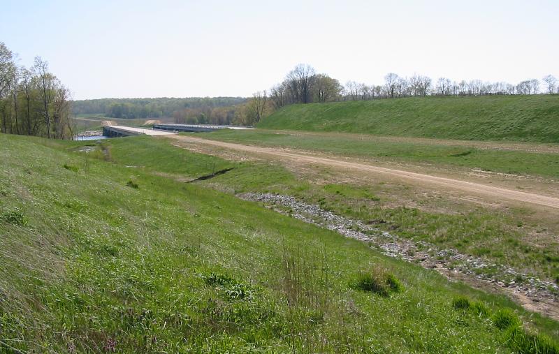
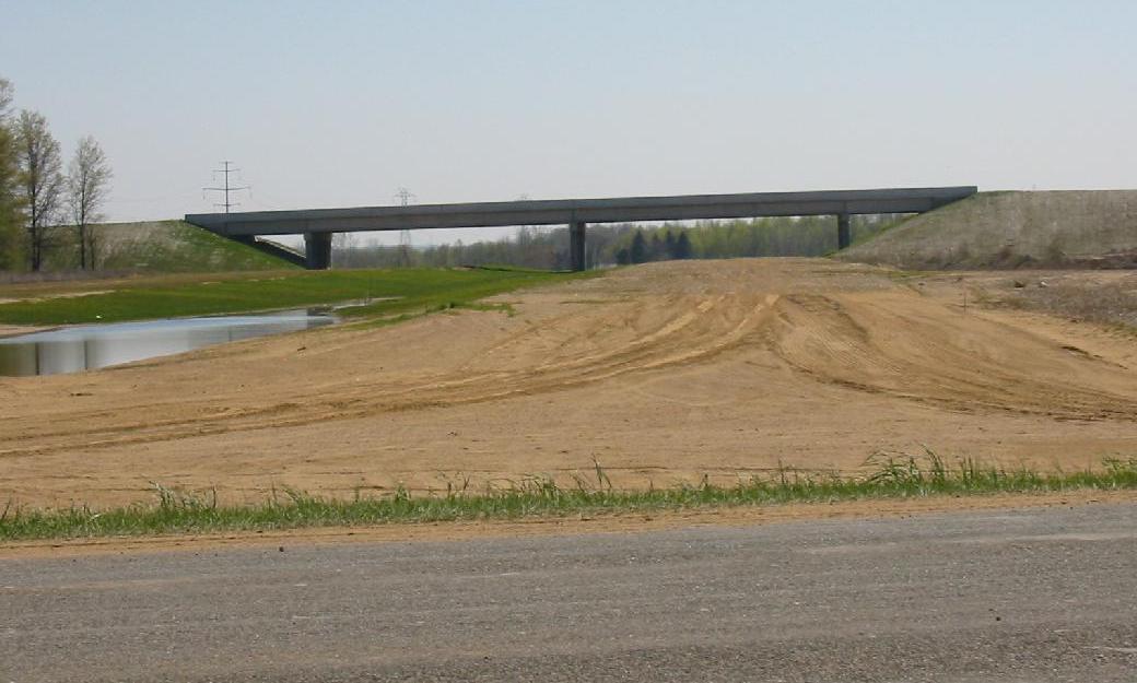
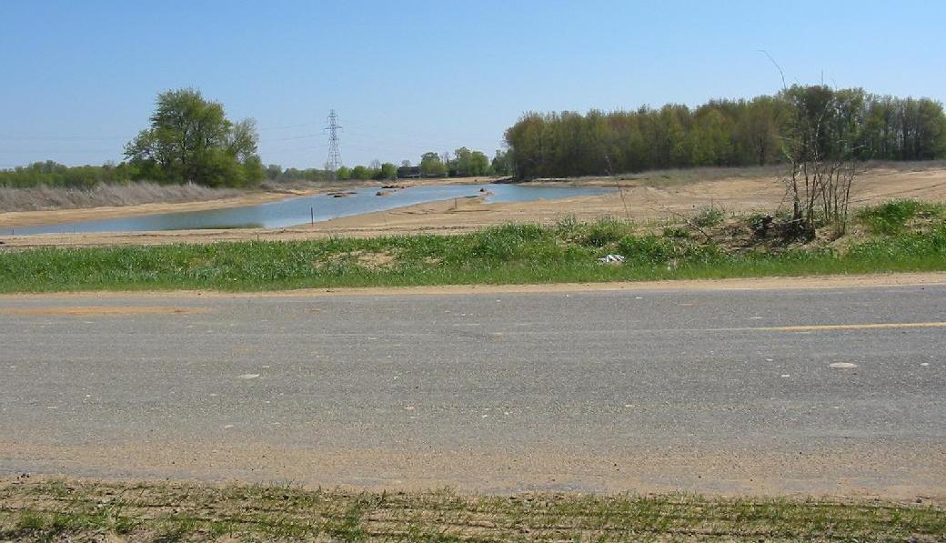
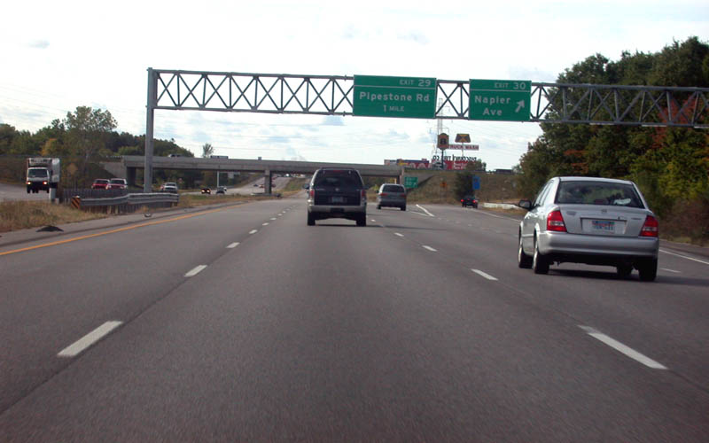
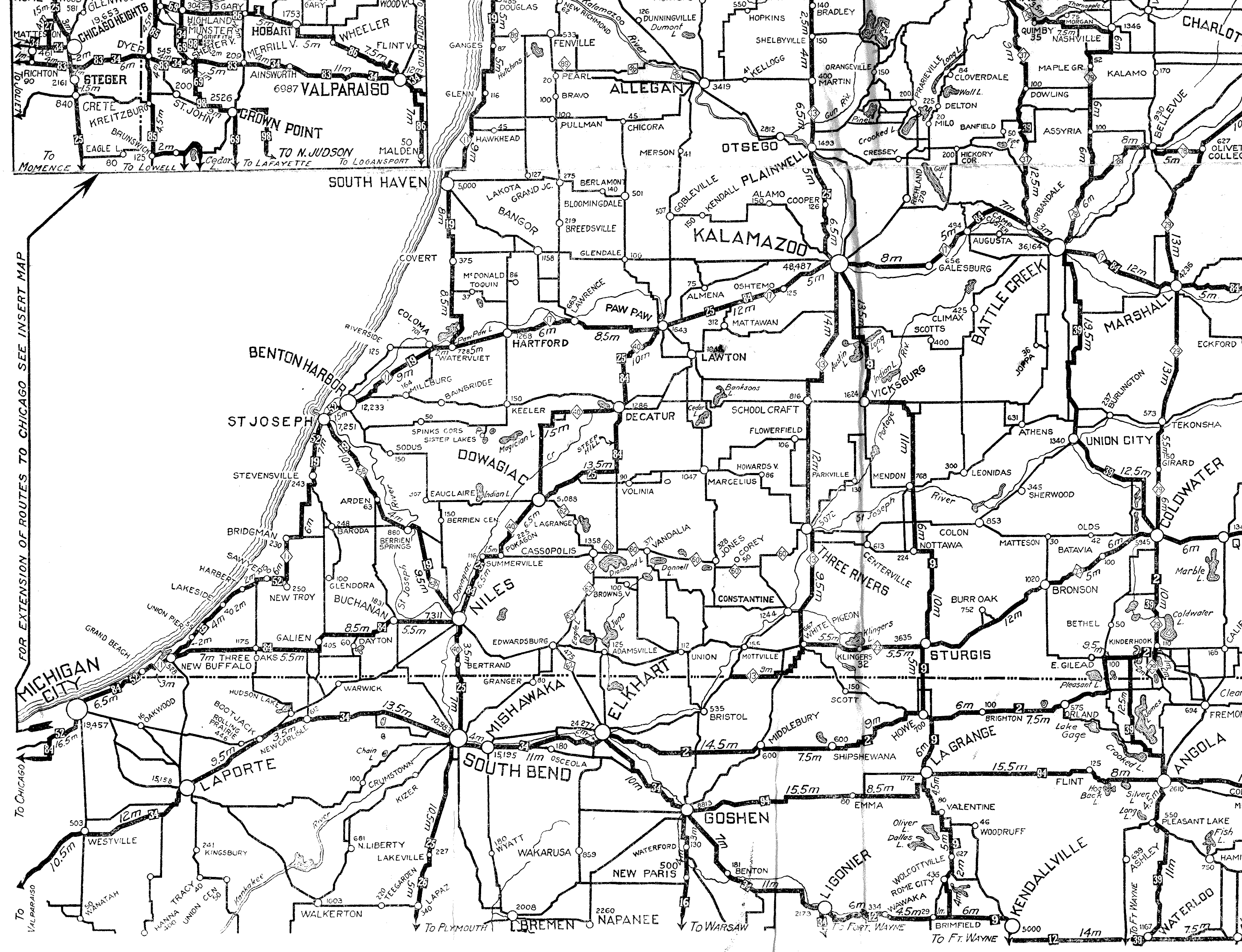
The "St. Joseph Valley Parkway" is the name of the L-shaped western and southern bypass of Elkhart/Mishawaka/South Bend, Indiana, and its northern extension into Berrien County, Michigan, which carries US-20 and US-31 in Indiana and US-31 in Michigan. According to this page, the Michigan section (including the unbuilt portion) was named in 1993. Exit guide, Indiana / Exit guide, Michigan (at Archive.org) The portion in Elkhart County was also named "Dean R. Mock Expressway" in March, 2002, for the state representative from Elkhart who retired that year (Bill 1382 had proposed this, and while the bill failed, INDOT decided to apply the name anyway, and posted signs later in 2002). US-31 and some of its older alignments (like County Road A2 in Berrien, Van Buren, and Allegan Counties) throughout Michigan is also known as Blue Star Highway (see this page, this page, and this .pdf for history of Blue Star Highways and this page for a graphic of the sign formerly posted along CR-A2; see also this page). The first part of the highway completed was the South Bend bypass section from US 31 south of South Bend to US-20 west of South Bend, which was completed in stages from the 1950s to the 1970s; subsequently, it was extended in stages eastward to east of Elkhart, Indiana, and is in the process of being extended northward to the south end of Interstate 196 at Interstate 94 northeast of Benton Harbor, Michigan (for a timeline of construction of the Indiana portion see Routes in South Bend and Metro Northern Indiana on this site, and for the Michigan portion see this article as well as Routes in Niles, Michigan - List by designation on this site). Currently, the freeway in Michigan stretches from the Indiana state line to Napier Avenue east of Benton Harbor, where US-31 turns west to I-94 Exit 30, following a section of Napier widened specifically to handle US-31 traffic. The section from Exit 15 (M-139/Old 31) near Berrien Springs to Exit 24 (Napier Avenue) opened on August 27, 2003, at 6:00 pm (with a ribbon-cutting ceremony at 2:30 pm). Articles from the opening ceremonies:
Niles Daily Star | St. Joseph/Benton Harbor Herald-Palladium (day of opening, published before the actual opening) | South Bend Tribune
Prior/later articles about this section (all Herald-Palladium articles unless noted otherwise):
September 16, 2004 (photo) | August 23, 2003 | August 20, 2003 | September 1, 2002 | August 23, 2002 | Old Michigan Department of Transportation project page (no longer being maintained)
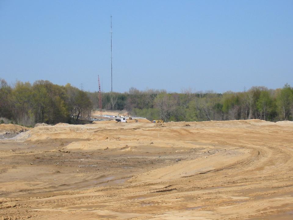
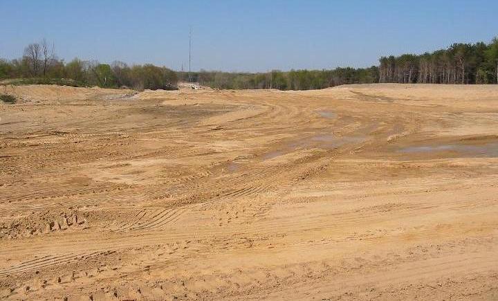
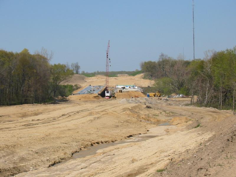
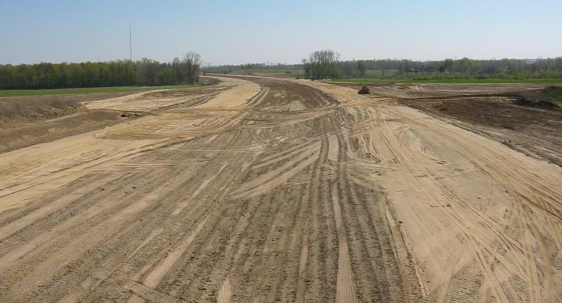
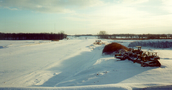
The final section from Napier Avenue to I-196/I-94 or BL-94/I-94 is under development, with construction scheduled to start in 2005 and completion expected in 2014 or later -- see this MDOT page (corresponding press release | Final Supplemental Environmental Impact Statement press release, 6/15/04), this press release plus this .pdf, this article, this message, this message, and this story for details.
Chris Bessert provides this map of the Michigan portion and most of the Indiana portion of the freeway. See also his US-31 Freeway in Berrien County page.
Also, interchange diagrams may be viewed at pages on each DOT's respective website: Indiana | MichiganNote: The Berrien County section (.pdf) of the MDOT Physical Reference/Control Section atlas shows an I-196 marker (it's actually a BR-196 marker with mainline Interstate shield colors) on the St. Joseph Valley Parkway between the Niles/Buchanan area and Berrien Springs. It's possible that this means that MDOT might be considering extending I-196 down the St. Joseph Valley Parkway, or it could simply be a misplaced shield. Thanks to Chris Bessert for the tip-off
The St. Joseph Valley Parkway, east to west to north:
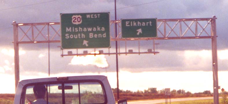
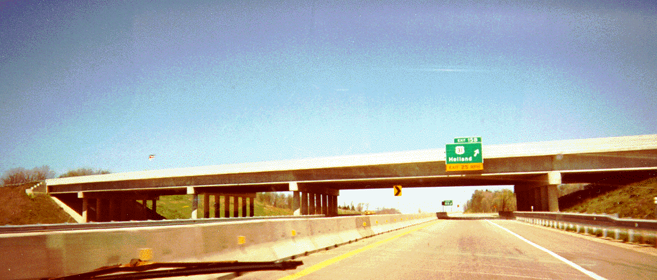
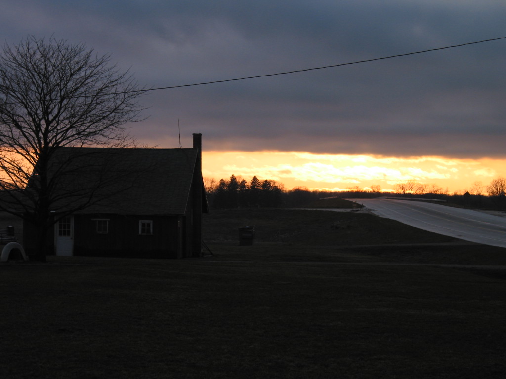
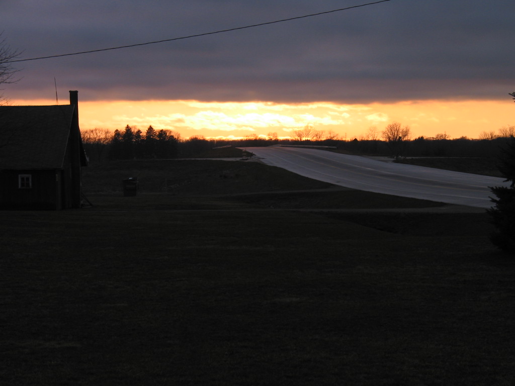
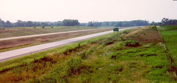
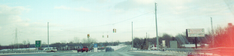
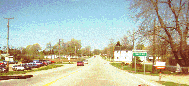
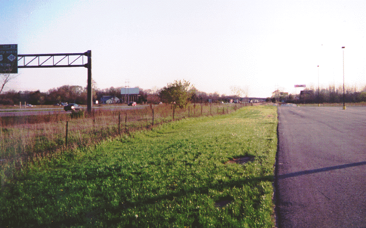
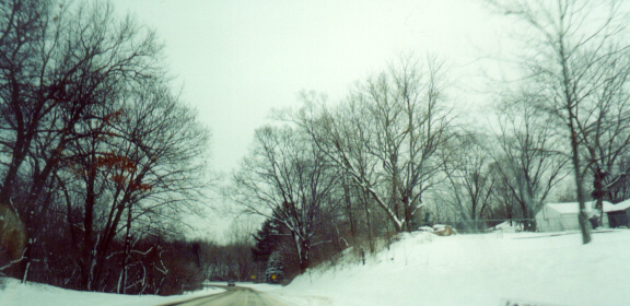
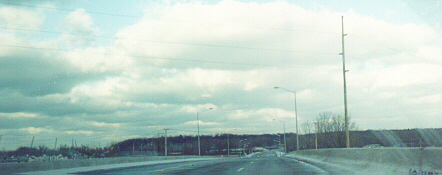
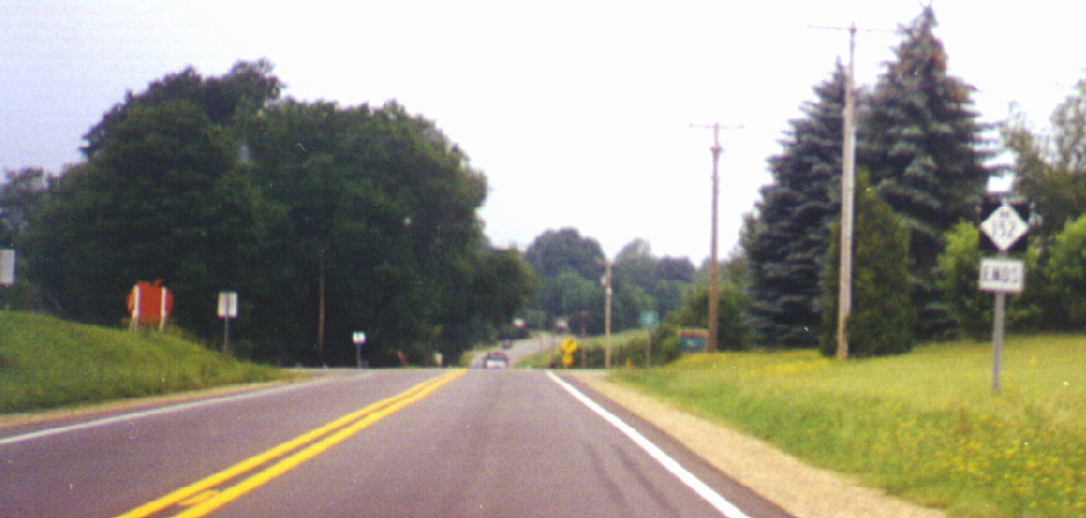
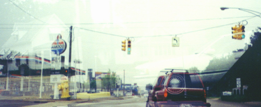
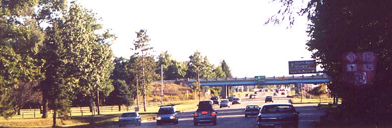
The Elkhart County Road 17 (Michiana Parkway)/Toledo Road interchange
This is at the eastern end of the St. Joseph Valley Parkway. This photo was taken on the ramp from CR 17 (Michiana Parkway) to US 20/St. Joseph Valley Parkway and Toledo Road (old US-20), the "Elkhart" ramp (map).
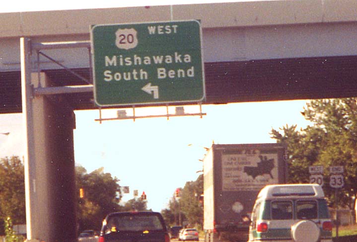
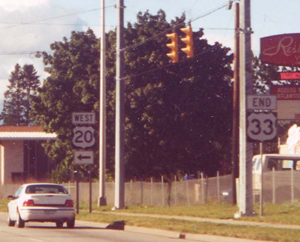
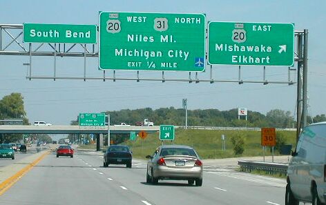
Northern end of US-33
In 1998, the northern terminus of US-33, which at one time had been as far north as Lake Michigan Beach, Michigan, north of Benton Harbor, was moved to the interchange with US-20/St. Joseph Valley Parkway (see the South Bend/Elkhart and Niles, Michigan route pages for more details).
There are actually two "END {33}" signs: This one under the freeway overpass, and, right after that, this one at the US 20 Westbound ramps. Here is the beginning of US 33 from underneath the overpass.
The southern end of US 33 is in Richmond, Virginia.
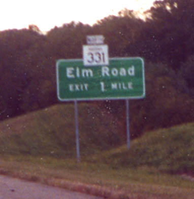
The original and new Indiana 331 exits
Not too long after the relocated US 20 opened, Indiana 331 was rerouted along it from the Bremen Highway exit, where it had formerly continued north, easterly to the Elm Road exit, as part of a project to move it east of Mishawaka (see its entry here for details). Existing signage was retrofitted.
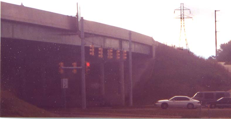
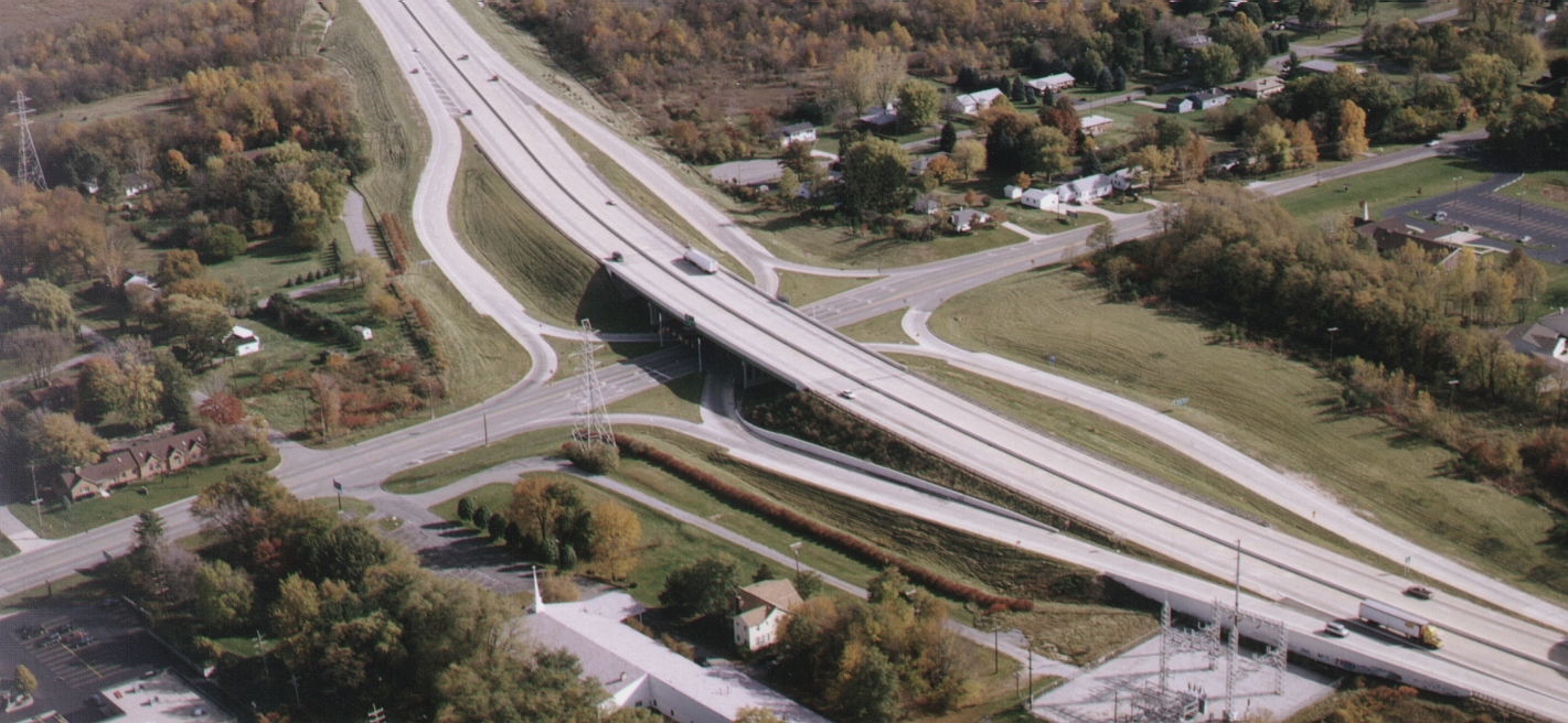
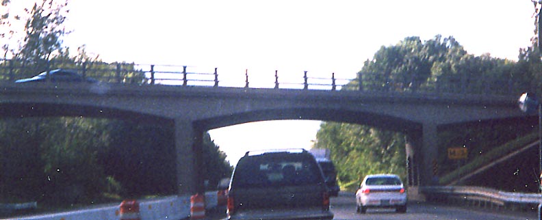
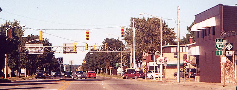
SPUI at Ironwood Drive
When the Parkway was built from US 31 eastward, a Single-Point Urban Interchange ("SPUI") was constructed at Ironwood Drive, the second in Indiana. The key feature of a SPUI is concurrent left turns, which end up taking place over or (in this case) under the freeway.
Notice the horizontal signals just past the overpass. The destinations for US 20 here are Mishawaka (east) and Michigan City (west). The intersecting road in the foreground is Ireland Road.
Aerial photo of the Ironwood SPUI on the St. Joseph Valley Parkway/US 20 (800 KB) Contributed by P.E. Gary Fisk/DLZ
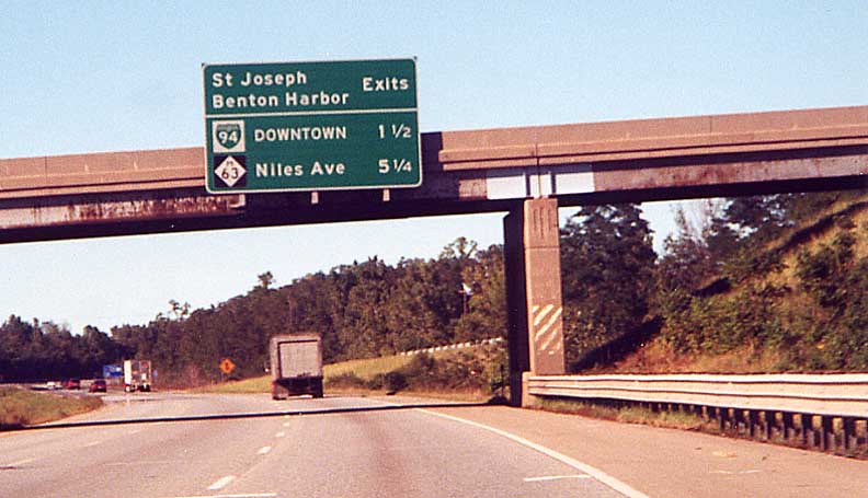
At Michigan Street (US 31 to the south/Business US 31 to the north)
I don't have any photos of this interchange, but the U.S. 31 Coalition website has one from Michigan Street Southbound, on this page, and Neil Bratney has one from US 31 Northbound, here, from this page . Notice the erroneous "BYPASS" signs above the US 20 shields in both approaches.
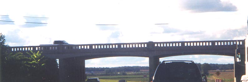
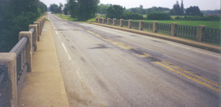
Old bridges on the Parkway
The highway has many old bridges, at least for now. Following is a sample:
Locust Road overpass west of the Michigan Street (US 31/Bus. US 31) interchange
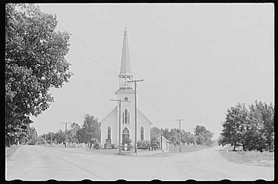
The Parkway/Indiana 23 interchange is near both the North-South Continental Divide sign (profiled in the March 1, 2001 South Bend Tribune, this identifies the division between the Great Lakes and Gulf of Mexico watersheds) and the Ethanol plant, probably the most prominent landmark along the highway.
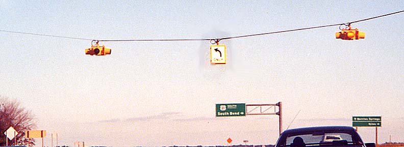
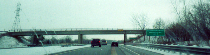
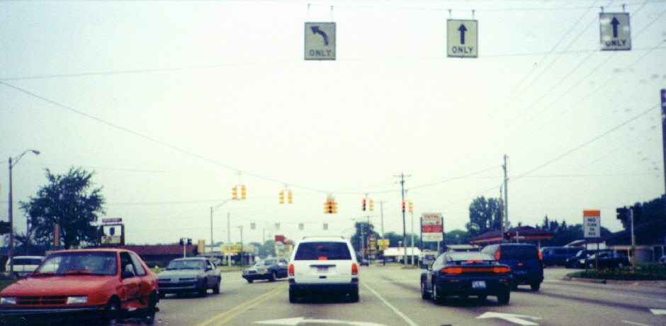
Northbound at Lincolnway West (US 20 to the west)
This was contributed by Jody Aho, and was taken on the way back on a May, 2000 trip from Minnesota to Kentucky. His comments:
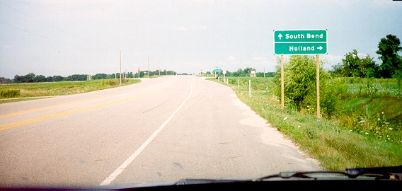
"The next morning, after leaving Rolling Prairie, we head back to US-31 to start the trip to Michigan. This picture is taken along the US-20/US-31 multiplex along the west side of South Bend approaching US-20's exit to the west. US-20 and Indiana State Road 2 run almost parallel a few miles apart from South Bend to near Rolling Prairie [with US 20 following the Lincoln Highway], where they 'bump'. At that point, US-20 continues to the west through Rolling Prairie, while State Road 2 goes to the southwest toward LaPorte [Lincoln Highway continued]. State Road 2 is four lanes from US-31 to US-20, then US-20 becomes four lanes west of the 'bump'. I used State Road 2 to go from US-31 to Rolling Prairie and back on this trip.This interchange is planned to be rebuilt when Lincoln Way West is shifted south as part of the South Bend Regional Airport expansion.
"Note several other features on the sign above. The upcoming junction with the Indiana East-West Toll Road, complete with its marker and the I-80/I-90 multiplex, is signed. By looking really close, you may note that the I-80 marker has the state name in the shield, while the I-90 marker is the newer variety without the state name! Chicago and Ohio are listed as control destinations; the oldies station in South Bend also advertised that it serves the area 'from Chicago to Ohio' in its station IDs. On the far right sign, notice the small airplane in the lower right corner, indicating this exit serves nearby Michiana Regional Transportation Center airport [at the time the airport had actually just reverted to its old name, 'South Bend Regional Airport']."
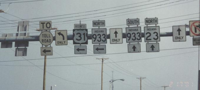
Northbound at the Indiana Toll Road (I-80/90)
According to this report, this exit opened in 1979. This interchange won an award in December 2002. Through traffic can actually continue in both lanes. Aerial photos of interchange complex: Color, close up (1.5 MB), contributed by P.E. Gary Fisk/DLZ | TerraServer The ramps between 31 Northbound and Nimtz Parkway (east-west road paralleling the Toll Road to the south, partially the former Cleveland Road, also known as F. Jay Nimtz Parkway) were built like they were to avoid an adjacent golf course as well as to minimize conflict between traffic going from Nimtz to 31 Northbound and that going from 31 Northbound to the Toll Road. See also Indiana Toll Road Photos
Notice that the [JCT][BUSINESS][SOUTH]{31} assembly is separate from the green exit sign. All mentions of South Bend's Business 31 were formerly handled like this on both directions of US 31 at both Business 31 interchanges. As of December 2004, new large green guide signs with Business 31 shields had been installed in both directions, and the freestanding route marker assemblies had been taken down. The pair of overpasses in the picture goes over the Indiana Toll Road.
A development is planned just south of the Michigan state line, which would include a diamond interchange at Adams Road. WNDU-TV: 3/16/05 | 4/9/05
The welcome sign says "GREAT LAKES -- GREAT TIMES" on the bottom. Note: This welcome center signage was replaced by late 2001.
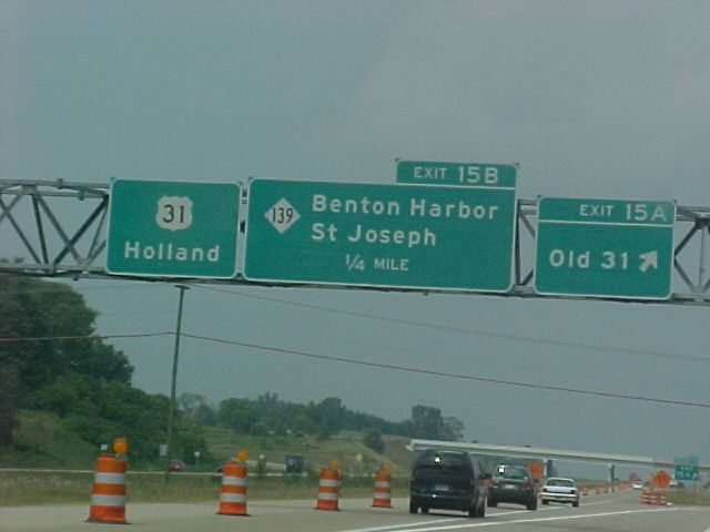
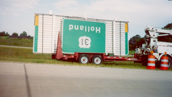
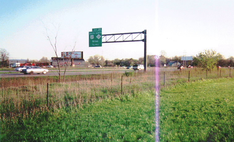
As you can see, Michigan numbers the exits on US 31 (and most other non-Interstate freeways). This interchange was also the southern end of Niles' Business US 31 from the late 1980's to the late 1990's. A "Niles/Buchanan/NEXT 3 EXITS" supplemental sign precedes this exit.
This is a standard Michigan freeway mileage sign. It says "Berrien Springs 7/St Joseph 21/Holland 69".
As you can see, these are placed in pairs (one for each direction) in the median in various locations along the freeway.
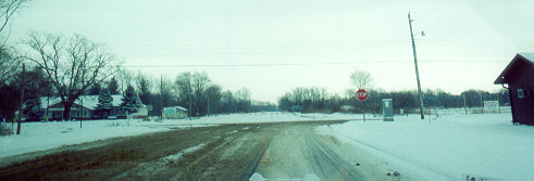
Southbound offramp (courtesy Eric Meier, July 2003) - Shows that the 1926-2003 US 31 from here northwestward to M-63 and the 1962-2003 US 31 from M-63 to I-94 south of Benton Harbor (old M-139) was renamed as a southern extension of M-139.
M-139 Southbound approaching US 31 (prior to the freeway opening to the north when this was still US 31) - The intersection in the foreground is Edgewood Road/Red Bud Trail. Red Bud Trail leads south directly into Buchanan. The sign on the right points to Berrien Springs and Niles.
(Note: The new configuration of roads here can be seen on the official 2003 Berrien County map (.pdf), which is also explained in this editorial letter and this article , as well as this article, though the latter misstates some compass directions)
The remaining at-grade section of US 31
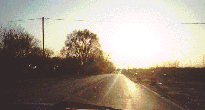
Looking east approaching I-94, Late April, 2000
Reconstruction of I-94 Exit 30 was well underway. The interchange was reconstructed to accomodate the relocation of US 31 onto Napier Avenue. The sign assembly at the base of the I-94 sign is a US 31 sign assembly (the I-94 sign says that 94 East to Detroit is straight ahead, and 94 West to Chicago is to the right). Napier EB at I-94/US 31: Same place, Christmas 2001
Notice the "doghouse" left-turn traffic signal. Until recently, these were rare in Michigan; however, when this picture was taken, there were three in this immediate area alone. Same place, Christmas 2001 Notice that the doghouse is gone.
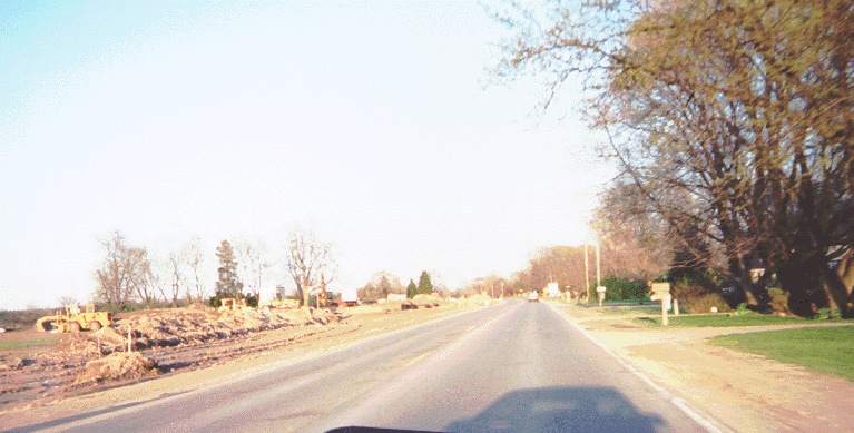
Looking west approaching I-94
Prior to reconstruction
Notice the clearing on the north (right) side for the roadway expansion. (Because this shot was taken into the sun, I also took a picture facing the opposite direction at that point. -- Same place on Christmas 2001)
See also the I-94 section.
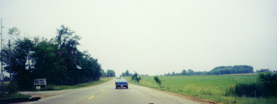
Former US-31
Northwest of US-31 Exit 15 near Berrien Springs, former US-31 is M-139 up to I-94 (the part between a point just south of M-63 and I-94 was originally M-139). Southeast of Exit 15, former US-31 is state-maintained "Old 31" down to Business US 31/relocated Walton Road a couple miles short of M-140, then Business US-31 to Business US-12 to downtown Niles, then Business US-12 then Business US-12/M-51 together then M-51 to the Indiana line (though the Old 31/Business US-31 section may be replaced by a further extension of M-139 according to a proposal). It has been said that this section of former US 31 is dangerous, especially when it carried US-31 (there even was a "Pray For Me, I Drive 31/33" campaign in the 1970's, complete with a bumper sticker, when US-33 followed US-31 from Scottdale to Sample Street south of downtown South Bend (article) -- please contact me if you have any anecdotes about this), but the the condition and design of the roadway itself is good.
Photos, south to north (most taken while the M-139 section was still US-31):
See the Berrien Springs section
About a mile-and-a-half north of SJVP Exit 15
About a mile-and-a-half south of Scottdale
Notice the back-lit left turn sign for M-63/Miners Road wedged in between the left turn signals for M-139 (which have their own back-lit signs).
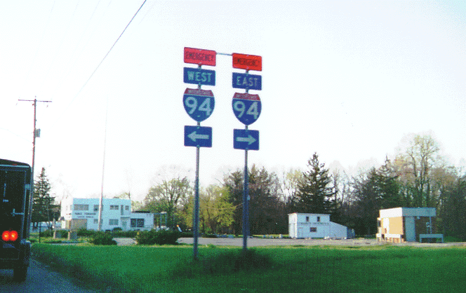
Note the Emergency I-94 assembly in this shot (see below).
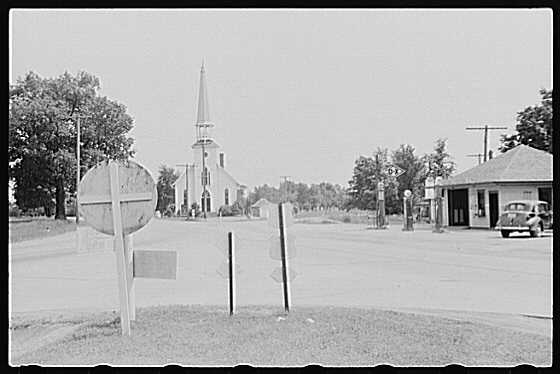
Here and here are two views of the former US 31/33 @ M-139 intersection (Niles Avenue at Scottdale Road) from July 1940, looking south, courtesy the Library of Congress' American Memory collection (search with "sodus michigan" to find the photos there). This intersection is in the background of the southbound view above (note the church).
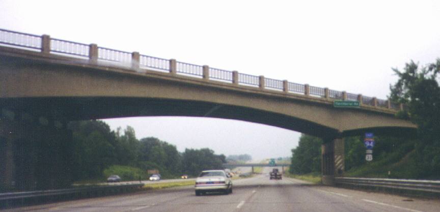
US 31 Northbound joined I-94 Eastbound at this interchange (Exit 28), which had its bridges replaced in mid-2002 (article 1 | article 2). The very short median is an interesting way to go from a two-lane road with no center left-turn lane to a five-lane with one. See also the I-94 section. Between Scottdale and Benton Harbor
Jump to Interstate 94 | Interstate 196 | Emergency Interstate 94 | Territorial Road | Business Loop 94/M-63 | M-152 | General northern Berrien County | Traffic signal section | Sawyer | Berrien Springs | Niles | Mottville | General photos
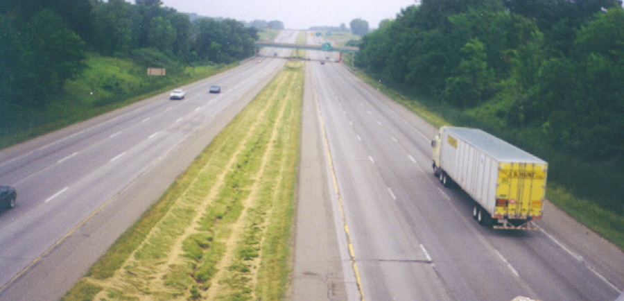
Interstate 94
Interstate 94 runs from Billings, Montana, to Port Huron, Michigan. Around Benton Harbor/St. Joseph, it carries Chicago-to-Detroit traffic as well as a significant amount of local traffic (between Exit 22 in Stevensville and Exit 41 in Watervliet (M-140) there are ten exits, including four in a five-mile stretch). Exit guide: Version 1 (at Archive.org) | Version 2
I-94 in Michigan between Benton Harbor and Detroit was to be I-92 and northeastward from there it was to be a northern I-77 (see these maps). I-94 as ultimately built runs along the old US 12 corridor to Detroit then the old US 25 corridor to its eastern end in Port Huron. US 12 was moved onto former US 112 after I-94 was completed in Michigan. In Michiana old US 12 is known as Red Arrow Highway (see photos throughout this page).
Note: Most of these photos were taken when US 31 followed I-94 from Exit 28 (M-139) to Exit 30 (Napier Avenue), where US 31 now joins I-94.
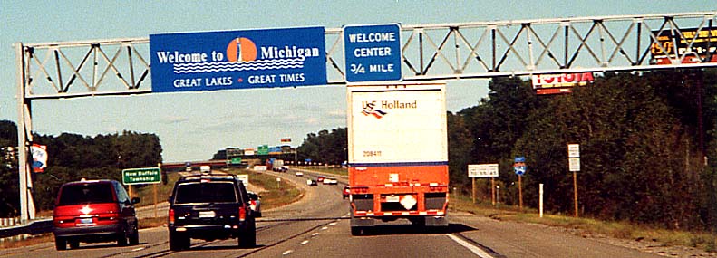
At the Michigan/Indiana state line
Ahead is a Welcome Center with an unusual set-up: the entrance ramp (behind the semi truck) comes before the exit ramp -- the Welcome Center access is a loop (aerial photo). The green signage in the distance is for Exit 1, M-239 (M-239 heads south where it becomes Indiana 39, while the other direction of the road goes northwest into New Buffalo). Note: This welcome center signage was replaced by 2002 according to MDOT. MDOT New Buffalo Welcome Center page | Stories about WiFi: MDOT | Yahoo!Finance
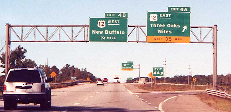
I-94 at US 12 near New Buffalo (Exit 4)
This interchange is almost a standard cloverleaf, but notice the left merge sign ahead -- the ramp from US 12 Westbound to I-94 Eastbound leaves US 12 between the roadways of I-94 since the Amtrak train track just north of US 12 leaves inadequate room for the usual placement of the ramp (map). Notice the Michigan standard practice of underlining directions on large guide signs. US 12 here in the past has been at one time or another M-60 and the retired US 112, which ended just west of here.
Upcoming exits sign at Exit 22
This sign is standard on Michigan freeways when approaching urban areas. The treatment of the Business Loop shield (placed in a white field) is also standard. However, the use of an actual stand-alone highway shield on a guide sign is definitely not standard (it should be a diamond without an "M" and part of the green sign rather than an attachment). It's possible that the M-63 shield is covering up a US 33 marker, though it would have had to have been there for 14 years (1986 to 2000), which is fairly unlikely. Exit 22 is for John Beers Road near Stevensville.
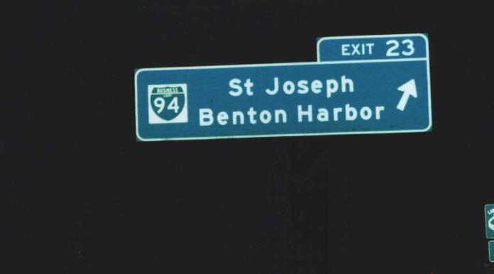
Western end of Business Loop 94, St. Joseph/Benton Harbor (Exit 23)
This interchange was only a quarter-interchange until the complementary ramps were added in the early 1980's (before / after). One of the added ramps (the I-94 Westbound offramp) is unusually long due to the CSXT railroad track which runs to the east of BL-94/Red Arrow Highway.
Photo contributed by Stephen Summers
Old one-half mile advance sign for Exit 28 (M-139/former US 31)
The sign was on I-94 Westbound which is heading roughly southwest at this point. Here is what I-94 looks like beyond where this sign was. The overpass in the distance carries Nickerson Avenue, and the Exit 28 off-ramp is just beyond it. This page has a picture of the current M-139-only sign.
I-94 Westbound at Exit 29 (Pipestone Road)
This is at the Orchards Mall retail area. If you look closely at the center of the picture you can see, left to right, the traffic light for the off-ramp, the "EXIT 29" gore sign, the back of an [WEST]{I-94}[SOUTH]{US 31} assembly, and a stop ahead sign. Crystal Avenue now extends south to this area as a Home Depot access drive (photo of south end at Napier Avenue before the extension / article on the extension
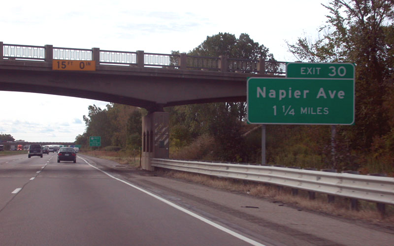
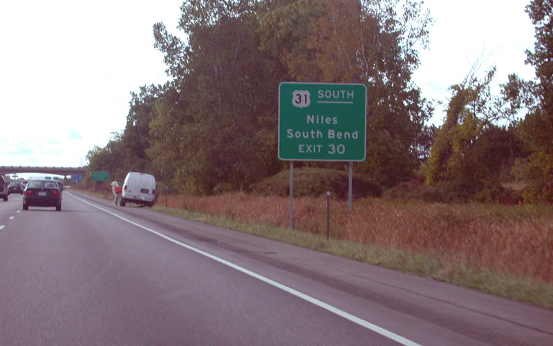
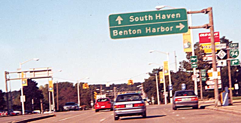
Napier Avenue (Exit 30)
As of 2003 Napier Avenue to the east carries US 31 (see the St. Joseph Valley Parkway and US 31 section). US 31 follows I-94 from here to I-196 (Exit 34) - formerly it joined I-94 at Exit 28 (M-139).
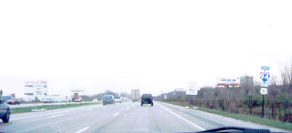
Eastbound, just north of the interchange
The temporary "SPEED LIMIT 70" signs were present because the Napier Avenue interchange project was immediately behind at the time (see the St. Joseph Valley Parkway and US 31 section). They were actually redundant here, however, since a standard speed limit sign remained on the right just beyond them.
Even though US 31 had been routed onto Napier when this was taken, neither the sign at the exit nor the 1¼-mile advance sign (photo) mentioned US 31 southbound, crucial as one is actually on US 31 southbound with I-94 at this point, although a stand-alone supplemental sign identifying it (photo) had been installed just past the 1¼-mile advance sign (visible in the distance in its photo). By Thanksgiving 2003 a supplemental sign had been installed eastbound as well, and stand-alone marker assemblies had been added to the Napier ramps (the one on the westbound offramp was placed on top of a new "Niles/South Bend" destination sign). All three westbound views courtesy Chris Bessert, taken October 4, 2003
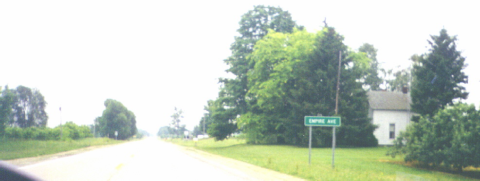
Two miles before Exit 34, eastbound
Note that the sign has no exit tab. Also note the guardrail retrofitted onto the Empire Avenue overpass.
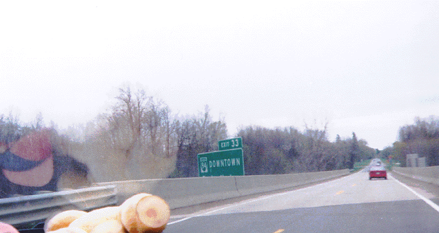
Eastern end of Business Loop 94, St. Joseph/Benton Harbor (Exit 33)
See the "Business Loop 94" entry below
At Territorial Road
See the "Territorial Road" entry below
At Benton Center Road
See the "Business Loop 94" entry below
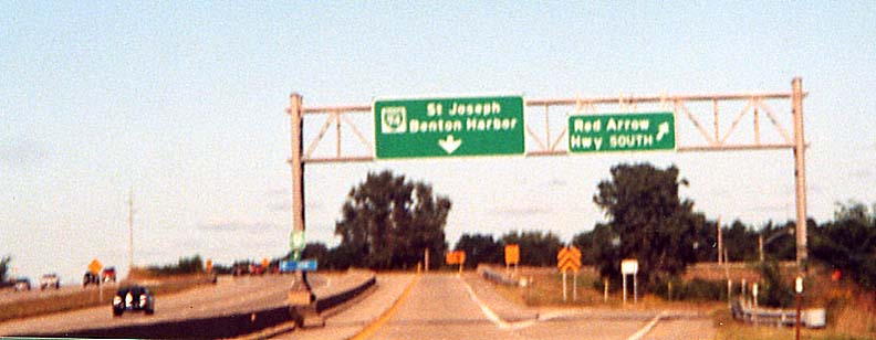
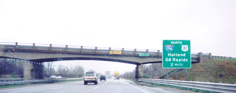
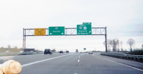
This is the southern end of Interstate 196. I-94 narrows from six lanes to four going eastbound here, but interestingly, rather than having the outside lanes become the ramps to and from I-196/US 31, the inside lanes merge into/branch from the other two lanes on each roadway of I-94 and the ramps to/from I-196/US 31 merge into/branch from the continuous outside lanes. Update: As of Summer 2004, the ramp from I-196 Southbound does become the right lane of I-94 Westbound. The other direction remains the same.
I-94 Eastbound from I-196/US 31
Note the I-94 confirmation marker just above the bridge railing.
See also this page for Exit 34 photos.
This page has photos of most exits along I-94 from Indiana to I-196.
Interstate 196
Interstate 196 runs from I-94's Exit 34 near Benton Harbor to I-96 in Grand Rapids. It was originally planned alternately as a section of a more northerly-routed I-94 by AASHO, now AASHTO (see these maps) and I-67 by MDOT, and ultimately became the western end of I-96 before that designation was switched with the I-196 one west of their split in Grand Rapids. It carries US 31 between its southern end and just south of Holland. See also this page for I-196 information. Exit guide (at Archive.org)
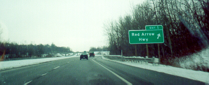
Southbound at Exit 1, Red Arrow Highway
The sign for I-94 is on the overpass ahead.
I-196 Northbound ramp at Red Arrow Highway
Here is an example of Michigan's ramp markers.
Southbound approaching Red Arrow Highway, Exit 1
The overpass carries Benton Center Road.
According to the Berrien County entry at the MDOT right-of-way map collection, this interchange could have two entrance ramps added to become a six-ramp partial cloverleaf if traffic warrants.
I-196 Northbound at Exit 4, Coloma/Riverside (Coloma Road)
Pictured is the sign Michigan uses for loop ramps.
Exit 4 onramp to I-196 Southbound
Here is an example of Michigan's freeway prohibition signs and and another ramp marker.
Two I-196/US 31 marker assemblies:
This page has photos of most exits along I-196.
In the 1990's Michigan set up an "emergency Interstate" system. This system is designed as a permanent set of detours for Interstates in case an impassable problem occurs on the Interstates (in the case of I-94 in this area, the problem is usually very heavy lake effect snow). When the marker assemblies were first installed, the "EMERGENCY" plaque on top was white-on-blue like the directional plaques (the "WEST"/"EAST" signs). On Pipestone Road Northwestbound at Napier Avenue near Benton Harbor
Territorial Road
Territorial Road begins in downtown Benton Harbor and runs eastward towards Decatur, then turns northward and merges into Red Arrow Highway west of Paw Paw. (It is disconnected due to Interstate 94, but retains its name across the gap.) Established in 1829, it was the predecessor to a route which would later become part of US 12, now Red Arrow Highway in Southwest Michigan and Michigan Avenue elsewhere in Michigan (see this page for the likely origin of the name), making it the main route between St. Joseph and Detroit and possibly between Chicago and Detroit. If anyone has specific details about Territorial Road, please contact me at musxf579@hotmail.com (alternate: musxf579@kent.edu ).
West to east:
This is where US 12, later Red Arrow Highway, turned from north to east onto Territorial Road. It may still be considered Red Arrow Highway, but there are no longer signs pointing to Red Arrow Highway at the Business Loop 94/M-139 Southbound (Main Street/Fair Avenue) intersection (see the BL-94 section), as there once were. Since the through traffic uses the south and east legs of the intersection, the green light in the left signal was replaced by a flashing red left arrow. Also, the green arrow is a rare old-fashioned one-piece arrow.
Territorial Road at Euclid Avenue
In a project starting on September 22, 1999, Red Arrow Highway (mostly former US 12) by the Southwest Michigan Regional Airport was claimed by the airport, so Red Arrow Highway traffic is now routed south on Euclid Avenue and west on Territorial Road. Note the wide "ALL WAY" signs under the stop signs, standard in the area and perhaps throughout Michigan.
The large green sign is a sign for the airport.
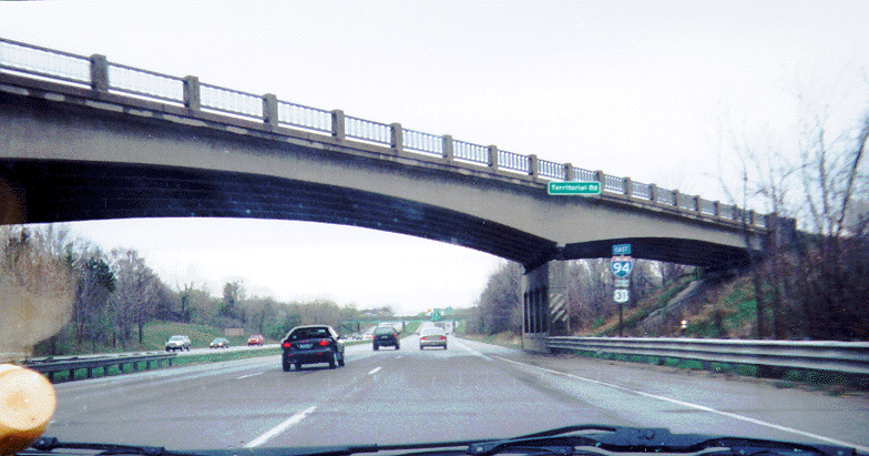
In the distance is the crossroads of Benton Center. Note the Emergency East I-94 assembly, telling travellers to turn left (north) on Benton Center Road.
In the distance is the Benton Center Road overpass and the I-196/US 31 interchange (Exit 34).
In the distance is the Business Loop 94 interchange (Exit 33).
(No difference, just a retake)
Note how the US 31 shield is smaller than the I-94 shield. Standard practice in Michigan on freeways is to give the main route the larger shield.
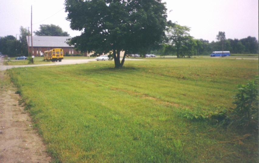
The open space in the foreground is the site of a former elementary school, demolished in the 1990's.
The location where Territorial crosses Blue Creek east of I-94/US 31 and Benton Center is locally known as "Blue Creek Hill". The bridge, built in 1923, was reconstructed in 2001 (see this article).
This is where the US 31 freeway is planned to cross (see this page). As of now, the only indication of this is no trespassing signs posted by MDOT and demolished houses on the south side of the road.
I lived just east of Millburg from early November 1971 until late January 1985.
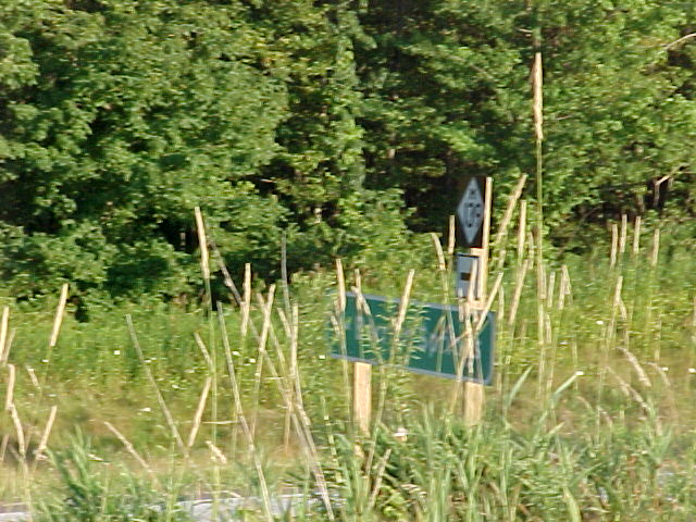
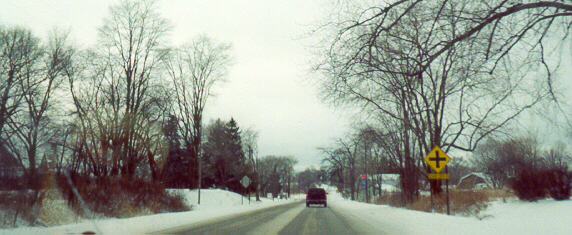
Snowmobile trail with road signs
This goes north from North Branch Road just north of Territorial Road. North Branch Road was apparently named in relation to Territorial Road.
The yellow sign pictured is a Snowmobile Crossing sign (here is a clear rendering of the sign, courtesy Richard Moeur's Manual of Traffic Signs). Snowmobiling is a popular recreational activity throughout Michigan. Trail maps
Michigan's standard green advance street sign is amemded by a sign listing a town when appropriate.
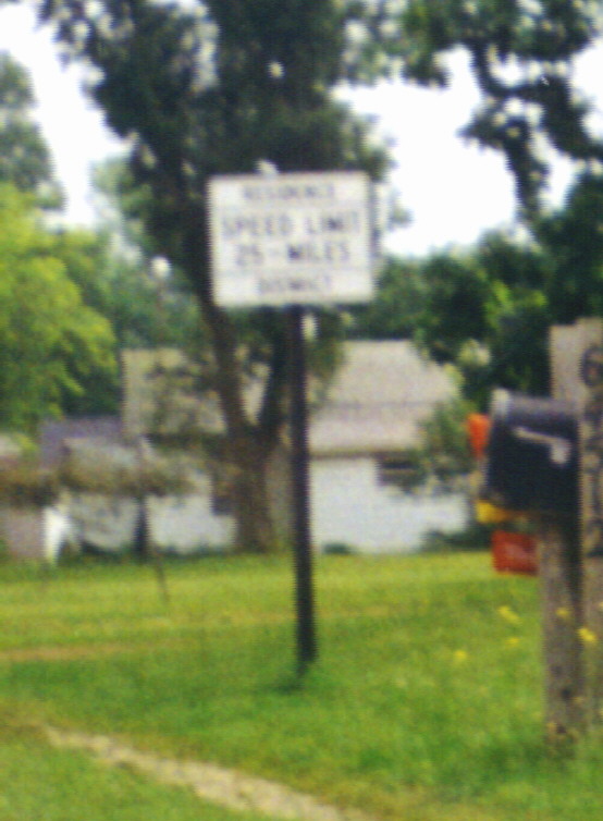
The speed limit sign used to be common throughout the area (close-up of sign -- it says "RESIDENCE/SPEED LIMIT/25 - MILES/DISTRICT"). A version closer to the standard speed limit sign has replaced most of the ones with this design.
This is one of only a few instances that I know of where a named street has its own marker (Red Arrow Highway is one of the others -- go here for a photo of a Red Arrow Highway marker taken by me, and here for a graphic representation). This is approaching the south intersection of Territorial and north-south Van Buren County Road 687 (Territorial jogs onto CR 687 in Keeler).
This monument to Territorial Road is located in the northwest corner of the southern Territorial/CR 687 intersection.
The plaque reads "THIS STONE MARKS THE/OLD TERRITORIAL ROAD/SURVEY AUTHORIZED 1829/THE WOMAN'S LITERARY CLUB/OF KEELER/AND/ALGONQUIN CHARTER D.A.R./DEDICATES IT TO THE/PIONEER MEN AND WOMEN OF/VAN BUREN COUNTY/1916"
This 1938 photo of Territorial Road in Berrien County (location not specified) is part of the online photo collection of the Berrien County Road Commission.
Business Loop 94 and Michigan 63 in St. Joseph and Benton Harbor
Many states have Interstate Business Loops, usually a surface-street loop connecting an Interstate to a town center. Michigan's are full state highways, and are fully signed with the exception of not being identified on guide signs on the parent Interstate for the Business Loop in the opposite direction.
Business Loop 94 in St. Joseph and Benton Harbor runs from I-94 south of St. Joseph along former US 12 into St. Joseph, then goes eastward on former US 12 through Benton Harbor until the Main Street/Fair Avenue (BL-94/M-139 Southbound) intersection, where BL-94 continues eastward on Main Street, which turns into a short, part-expressway, part-freeway divided highway. This divided highway is interesting for a couple of reasons; see the end of this section for details. The eastern end of that divided highway section is also the eastern end of BL-94 at I-94. BL-94 was at one time planned to follow what is now M-63 south to the Washington Avenue split, where it would then follow a new alignment due south to I-94 (see this article), and for a short time was even planned past that point, curving eastward to what is now the US 31 freeway (see the 1968 Michigan State Trunkline System planning map (see here). On the other end, where BL-94 ends at I-94/US 31 just southwest of I-196, a short eastward extension may have been planned here as well to the proposed US 31 freeway (see this page).
M-63 through the area was US 33 until 1986 when that route was truncated south of Niles (see this page for details). Before that, it carried US 31 and US 33 into St. Joseph from the south and US 31 from the north.
View of Lake Michigan just south of St. Joseph
Business Loop 94 heading into St. Joseph is called Lakeshore Drive, just like the thoroughfare across the lake in Chicago (fitting, since many Chicagoans have summer residences along this stretch of highway). As the photo shows, it lives up to its name, also just like its counterpart.
Southern junction of BL-94 and M-63, St. Joseph
Notice that the ramp from BL-94 Eastbound to M-63 Southbound prohibits trucks; they are directed to M-63 Southbound via Central Avenue just before the intersection. Conversely, there is no access from M-63 Northbound to BL-94 Westbound, so all traffic wanting to make that movement must use Central Avenue. Also, while BL-94 Westbound doesn't need a signal for the intersection, one is there anyway due to a crosswalk in the foreground. This intersection is where US 33 ended from about 1951 to 1960 when it was extended northward out of St. Joseph along present-day M-63 (and ended here). Another view, looking south, by Neil Bratney, from this page
Northern junction of BL-94 and M-63, downtown St. Joseph
The overhead green destination signs are found at major intersections in cities and towns throughout Michigan. The traffic signal in the background (where BL-94 comes in as a one-way street from the east and turns south onto M-63) is the original northern terminus of US 33, from its inception around 1935 until about 1951 (US 12 and 31 continued east into Benton Harbor from here). In the distance is the Blossomland Bridge, opened in 1953 (see below).
Lake Michigan is in the background. The Blossomland Bridge is just to the right.
The Whirlpool Bridge replacement, St. Joseph
Around 1953 a highway was built northward out of St. Joseph, traversing the large Whirlpool Corporation complex with long bridges. This highway was built as US 31, then US 33 was extended along it as US 31 was moving to I-94 and I-96 (today's I-196), and now it carries M-63. In the meantime, some of the buildings in the Whirpool complex fell into disuse and were eventually demolished, leaving M-63 crossing a large void. In the late 1990's it was decided to lower M-63 to ground level in order to provide potential access to a planned development. As part of this project an expansive interchange with Klock Road north of Whirlpool was removed and replaced with a signalized intersection. In December 2002 St. Joseph gave this new stretch of highway the honorary name "Harry Gast Parkway" (see this article). Go here for the archived MDOT M-63 project page courtesy the Internet Archive (note: The page is no longer active), here for a detailed newspaper article on the project, and here for a map of the area, pre-construction. Here is a story about a new bridge on adjacent Edgewater Drive.
Here are photos, from south to north, of the doomed viaduct in September, 2000. Generally the background in one photo is the subject of the following one.
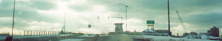
The Blossomland Bridge is a drawbridge crossing the St. Joseph River, which essentially separates St. Joseph and its "twin", Benton Harbor. Extensive history by MDOT | Photo from the Herald-Palladium, 11/24/04 | One from 11/29/04 Just beyond the bridge is the half-interchange with Upton Drive, which parallels M-63 to the west through the area. While the traffic signals where the Upton ramp meets M-63 function with the bridge, they also function as normal signals when the bridge is closed. By Christmas, 2001, the Upton Drive sign had been replaced with an Edgewater Drive one, and the offramp from M-63 Northbound had been removed.
Bridge over the CSXT track and the abandoned area (Same place, Christmas 2001 )
Approaching the Klock Road interchange (Same place, Christmas 2001)
Notice the great distance between the two roadways of Klock Road. It was almost the same distance as the length of Klock Road itself! Thanks to a tip-off from Chris Bessert based on an observation in the 1960 Michigan DOT Control Section atlas (current version), it's a fair assumption in that this interchange was built the way it was because it was planned to be at the western end of a relocated M-139 (maps in the MDOT right-of-way map collection call this the "Waukonda-Klock Freeway", which was deleted September 24, 1965, and would have run nearly due east from the eastern end of the Klock Road bridge over the Paw Paw River, later running along Waukonda Avenue the turning south along Fair Avenue [carries M-139 southbound south of BL-94]).
Upton Drive Southbound just west of the viaduct
Notice the "STOP ON RED SIGNAL" sign on the railroad crossing assembly, common in Michigan. Upton is just about to swing to the left to meet M-63 in the interchange pictured above. In the background are buildings across the river in downtown St. Joseph.
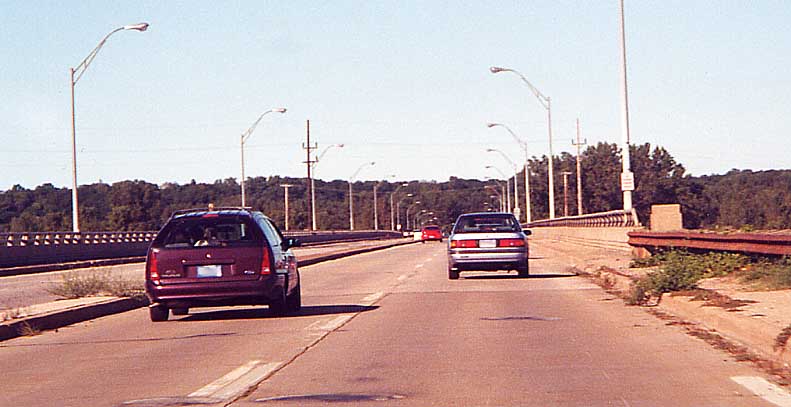
Business Loop 94 Westbound over the St. Joseph River
This is the Bicentennial Bridge, so named because it was built in 1976 to replace a bridge immediately to the north. The green sign is a St. Joseph city limit sign. The Bloosomland Bridge is just off the picture to the right.
Business Loop 94/Main Street in downtown Benton Harbor
This was originally US 12 and US 31, then later just US 12, before becoming BL-94.
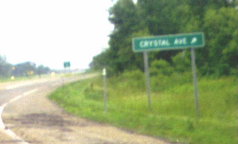
The Crystal Avenue no-bridge diamond interchange east of Benton Harbor
Maps that show detail of the BL-94/Crystal Avenue diamond interchange (see Kurumi's Field Guide to Interchanges), including this one, do not show a grade separation between the two roads. That is not an error. Crystal Avenue does cross BL-94 at-grade. As a result, there are numerous "NO TURNS" signs at the intersection controlled by a pair of flashing beacon assemblies (one over each roadway of BL-94).
A bit of history: Apparently, according to older maps and some of my relatives, there were originally two half-interchanges here, both with overpasses -- a half-diamond at Crystal (with ramps towards/from Benton Harbor) and a complementary half-diamond a little to the east at Euclid Avenue (ramps towards/from I-94). Sometime between 1965 and 1975, the ramps at Euclid were removed and the interchange at Crystal was rebuilt to today's configuration. Why the grade separation wasn't retained at Crystal, I don't know.
You can see a gap on the right beyond the overpass where the former on-ramp went.
The interchange at the east end of BL-94 is unusual because it provides three-quarter access with I-94. There is no I-94 Eastbound-to-BL-94 Westbound ramp (while most traffic to Benton Harbor using I-94 Eastbound would have already exited, making the ramp somewhat redundant, there are in fact plans to build one in conjunction with the nearby US 31 relocation project [see practical and preferred alternatives pages] even if US 31 ultimately does not get relocated), but there is a BL-94 Eastbound-to-I-94 Westbound ramp, as seen in the background in the photo and in the map linked above. There may have at one time been a plan to extend this to the future alignment of US 31 just to the east (see the bottom of this page). Also note the assembly in the foreground: This illustrates Michigan's practice of identifying the ends of highways with an "ENDS" plaque under the route shield rather than an "END" plaque above it, in the process forming a complete sentence. See the I-94 section for a photo of the western terminus south of St. Joseph
This assembly is an example of how Michigan treats Business Loop references on large green guide signs: it places a white background behind the shield. The "DOWNTOWN" indication is also standard. Notice another Emergency I-94 assembly in the background. On Benton Center Road Southbound approaching Territorial Road and Benton Center (see above)
Maps which show M-152 ending at the Berrien/Van Buren County Line are correct, as this photo shows (the green sign in the background beyond the M-152 assembly is an MDOT-standard "Enter Berrien County" sign -- see below). Facing west
General northern Berrien County
New Nickerson Avenue at Pipestone Road
A couple miles south of I-94 the eastern end of Nickerson Avenue was rerouted from southeast to east to meet Pipestone Road a few hundred feet north of where they had met (the stub of the old road dead-ends near the western end of the new section). There is right-of-way cleared for an eastern extension of the rerouted road, though I haven't heard what's going on with that. Update: This is Sodus Parkway, which will now be the main route southeastward, making Pipestone Road somewhat of a frontage road. See this map (.pdf), this article and this response letter. Stephon Watson supplies this photo (better one to be taken later) of the intersection from the north after Sodus Parkway opened.
Red Arrow Highway (old US 12) Westbound approaching Benton Center Road
Notice the Emergency I-94 assembly in the distance.
Various signal assemblies
Michigan's traffic signal assemblies consistently have certain features not usually found in other states, most notably internally-lit ("back-lit") signs. Note that these features may also be found in conjunction with flashing beacons as well.
Back-lit left turn signs
These are located at almost every signalized intersection in Michigan without a dedicated left turn signal.
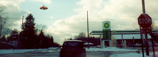
M-63 Southbound at Napier Avenue
Also note the four-head signal, still more common in Michigan than the "doghouse" assembly . (Sorry for the double exposure) Just south of St. Joseph
US 31/M-139 at the I-94 Westbound ramps
An example of the sign at dusk. South of Benton Harbor, looking north
Back-lit signs above the turn signals
Any signal with arrows in Michigan (including single-head arrow signals) will have a back-lit "LEFT", "RIGHT", or "THRU" sign above it.
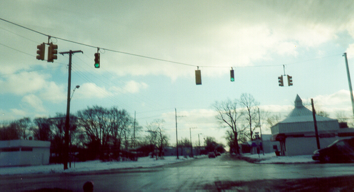
M-139 Southbound at Nickerson Avenue
This intersection also displays another of Michigan's practices: A flashing red light in the left turn signal when the through traffic has a green (the green arrow comes on right after the through signals turn red, before the cross traffic gets their green). South of Benton Harbor
M-139 at Napier Avenue
Unlike the set-up at the M-139/Nickerson intersection above, the reds in the left-turn signals here do not flash, and the left-turn cycle precedes the through cycle. Also note the orange strips above the "NO TURN ON RED" signs.
Napier Avenue Eastbound at Pipestone Road
The left turn assembly was added a few years after the rest of the signal assembly was installed in the late 1970s. As with the M-139/Napier signal set-up, the reds in the left-turn signals do not flash, and the left-turn cycle precedes the through cycle. Update: By March 5, 2003, all signals but the left-turn signal four-way in the middle had been replaced by all 12-inch assemblies using LEDs, and by May 22, 2003, that had LEDs as well. Thanks to Stephon Watson
The set-up at the US 31/M-63 intersection pictured in the US 31 at-grade section contains both types of signs.
New signal installation at M-139 and Fairplain Drive south of Benton Harbor
In the late 1990's, Fairplain Plaza, a shopping center on M-139 south of Napier Avenue, was rebuilt from its original configuration built in the 1950's. During this rebuild, a new road, Fairplain Drive, was created to connect the Fairplain Plaza area to the nearby Orchards Mall area.
Northbound on M-139 in Mid June 1999, before the installation
Westbound on Fairplain Drive in Late April 2000
The dark signs on the ends of the assembly are variable "NO TURN ON RED" signs. They light up when the opposite traffic has the green (Fairplain Drive and the Wendy's driveway both have their own phases).
Other Michigan signals in Michiana
All of the signal photos on Mark O'Neil's "Traffic Signals of Michigan" are from Berrien County (one is of the Napier/Pipestone signal also pictured above).
Signals elsewhere in Michigan
Following are links to photos of Michigan signal assemblies which aren't in Michiana but whose set-ups are the same as some in Michiana.
M-28 in Munising: Backlit stop signs and right-only yellow flasher
Backlit stop signs are found throughout Michiana and the rest of Michigan, and this particular signal set-up occurs twice on Business US 12 west of downtown Niles. Contributed by Jody Aho
This contains some great photos of modern assemblies which include large backlit signs for traffic at right angles.
Traffic Signal Pictures -- Eastern U.S. by John Rietveld
This has only one photo (from Ironwood) but has a good explanation of Michigan signal practices.
Michigan Highway Endings by Dan Garnell
There are other traffic signal shots elsewhere on this page.
A Red Arrow Highway junction assembly near Sawyer
Here is another example of the Red Arrow Highway sign (see the Keeler entry in the Territorial Road section above for a link to the first). Photo contributed by Stephen Summers
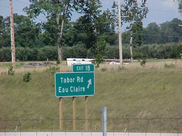
When US 31 was moved to the portion of the St. Joseph Valley Parkway completed in 1992 (see above), the section of 31 between the temporary northern end of the freeway and Business US 31 north of Niles retained its state maintenance but became known as "Old 31". Old 31 is not marked with markers, except here in downtown Berrien Springs -- workers simply placed "OLD" signs above the previously-existing US 31 assemblies. This is Old 31 Southbound, which actually turns from southeast to northeast at this intersection (Cass and Ferry Streets).
Niles area
To better understand the Niles pictures, visit my Routes in Niles, Michigan page.
Niles is known as the City of Four Flags.
Main Street Bridge over the St. Joseph River
This bridge carries Business US 12 westward out of downtown Niles. History by MDOT Looking north
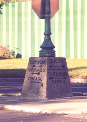
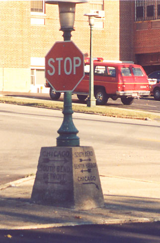
Old directional pedestal in downtown Niles
Inside a traffic island at the intersection of Broadway and Second Streets along the river one block south of the Niles business district sits a very old streetlight post base which gives directions to Chicago, Detroit, Benton Harbor, and South Bend. Although US 31 or its predecessors might have followed Second Street and Broadway between Second and Third, I have found no evidence that any numbered route has ever followed the length of Broadway, so this must predate numbered routes. Keep in mind that Michigan has numbered its routes since 1918! It might be that old auto trails met here (see this 1921 map excerpt, scan by Chris Bessert).
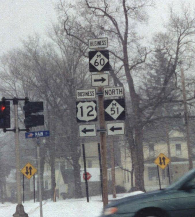
BR-12/M-51/Bus. M-60 assembly at Twelfth and Main east of downtown, looking north
This is where BR-12 and M-51 turn from north to west. BR 12 used to continue another block east here. Photo contributed by Stephen Summers
The US 12/Business US 12/M-51 interchange
This interchange is where US 33's northern terminus was from 1986 until 1998. It's the current eastern terminus of Niles' Business US 12.
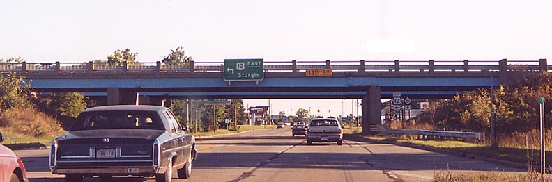
Approaching the interchange on BR-12 Eastbound/M-51 Southbound (old US 31/33 Southbound)
The destinations on the sign ahead are South Bend/Sturgis and New Buffalo.
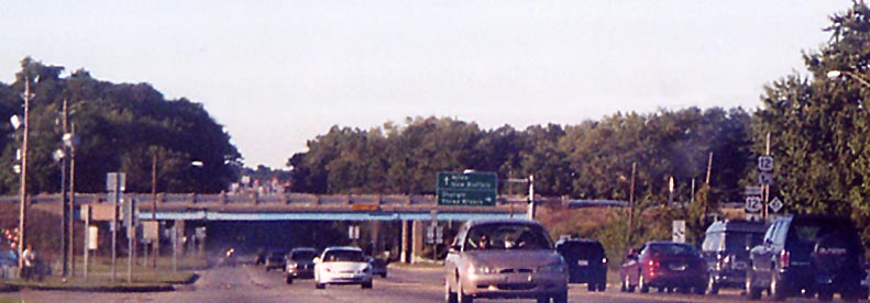
Approaching the interchange on M-51 Northbound
The assembly on the right is where the "{33} ENDS" sign was (the M-51 signage replaced it). The destinations on the sign in front of the overpasses are Niles/New Buffalo and Sturgis/Three Rivers (Three Rivers is via M-60, which begins just east of here as the continuation of the expressway). (The quality of this photo is pretty good for having been taken out of the back window of a car from the passenger seat!)
M-51 from the east side of Niles to the Indiana line is Eleventh Street. Around 1930, Eleventh Street in Niles proper was widened and extended southward as a thoroughfare, and US 31 was moved to it from Third Street. US 31 followed Eleventh up until 1982, when it was rerouted to what is now called the St. Joseph Valley Parkway west of town. As a result of US 31's long stay on this highway, many businesses along the route took the US 31 name, and most still retain the highway number in their names, such as this one on the west side about a mile north of the Indiana line.
M-51 at the Michigan/Indiana state line
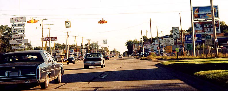
To the right of the picture is an Indiana welcome sign. M-51 becomes Indiana 933 here (if you look closely, you can see an Indiana 933 assembly just beyond the intersection). The road at the intersection is, predictably, State Line Road. The flashing lights are Michigan-standard, not because Indiana and Michigan decided that Michigan would maintain signalling, but because the intersection is completely in Michigan, since State Line Road runs juuust north of the state line here (map).
See also Eric Meier's Roadpix page which covers Michigan's new M-217 (Michiana Parkway) and this information about it.
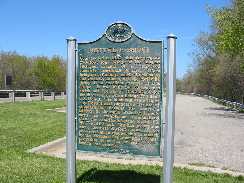
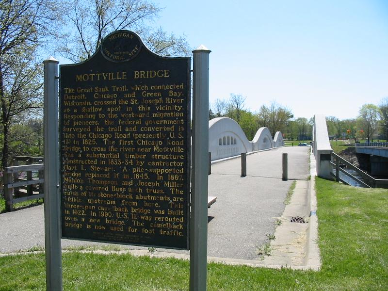
Mottville
Camelback bridge formerly on US 12 Courtesy Brian Reynolds from April 2002
US 12 crossed this bridge from its construction in 1922 until 1990 when a new span was built immediately west (upriver).
Standard Michigan advance street signage
Signs like these are found on all state highways prior to intersections with all but the most minor intersecting roads. Sometimes a sign with a town will be added below if the town is nearby (see the M-140 portion of the "Territorial Road" section above). On M-140 Southbound south of Territorial Road
Standard Michigan non-Interstate county line signage
The sign says "ENTER/VAN BUREN/COUNTY" On M-152 Westbound at the Cass/Van Buren County Line
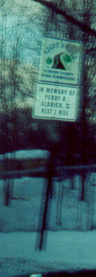
Berrien County Adopt-a-Highway sign
These have a similar design to MDOT's. On Benton Center Road Southbound south of Red Arrow Highway
Jump to South Bend | Elkhart
South Bend
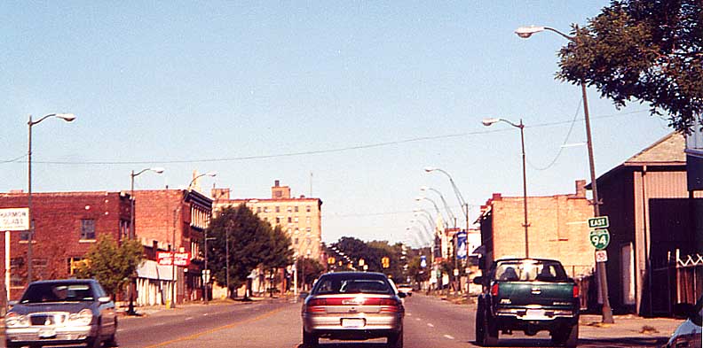
Sample Street Eastbound at Michigan Street (Jct. Business US 31/Indiana 933/Indiana 23)
Business US 31 is former US 31, and Indiana 933 is former US 33. This is where 933 leaves the Main/Michigan street one-way couplet to join Sample Street (Indiana 23 here) for a few blocks just south of downtown. This marker assembly style is standard in Indiana. The (Indiana) Toll Road trailblazer, however, is very unusual. (This page has photographs of standard Toll Road markers as well as more Business 31 photographs.) Photo contributed by Stephen Summers
Elkhart area
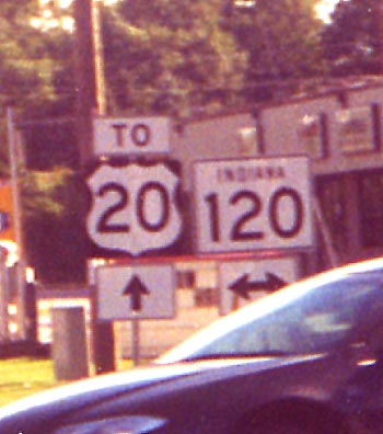
Elkhart County Road 17 (Michiana Parkway) at Indiana 120
According to this press release, on September 11, 2000, Indiana 120 was supposed to be rerouted onto Elkhart County Road 17 southward to end at the US 20/St. Joseph Valley Parkway/CR 17/Michiana Parkway/old US 20 (Toledo Road) interchange complex southeast of Elkhart, but this photo shows that signage had not been changed as of September 15, 2000. It still had not been changed by April 26, 2003. CR 17 now continues as the new M-217 (information).
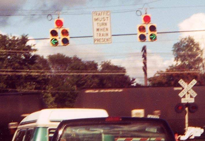
Traffic signals coordinated with a railroad crossing along US 33
With the busy railroad tracks running along the east side of US 33 south of Elkhart, it was necessary to arrange things like this in order for the traffic crossing from one of the shopping centers south of US 20/St. Joseph Valley Parkway onto the residential street across 33 not to end up wedged between 33 and the tracks.
See also the St. Joseph Valley Parkway section above, Indiana Toll Road Photos, and Lincoln Highway Photos
Hoosier Roadway Photos -- This is a page for Indiana road photographs outside of the Michiana region.
Links
Michigan's Historic Bridges by MDOT
Berrien County Road Commission Photos -- Collection by the commission which includes some historic road photographs.
US 12 Photos -- Kalamazoo Gazette collection, New Buffalo through Coldwater, created coincident with the creation of the Historic Heritage Route designation along US 12 in Michigan.
Roadpix by Eric Meier -- features Michigan's new M-217 (Michiana Parkway).
Fields Trip by Eric Stuve
Michigan Highways (the photo page by Jeremy Lance, not the route log by Chris Bessert)
Chris's [May, 2001] Road Trip Picture Page by Chris Saylor
Day 1 and Day 3 from Summer '02 Roadtrip! by Neil Bratney
Interstate-Guide.com by Andrew Field and Alex Nitzman
Indiana and Michigan from Road Signs by Mark O'Neil
Indiana photos from Illinois and Indiana Highway Photos by Adam Taylor
Highways by Barry Camp
Roads of Michigan and Roads of Indiana from Roads of the Mid-South and [Mid-]West by Bill Burmaster
This page created August 5, 1999 (old version)/Page revamped August 2, 2000/Transferred to roadfan.com April 14, 2001/Last revised June 27, 2005
Return to Marc Fannin's Michiana Roads