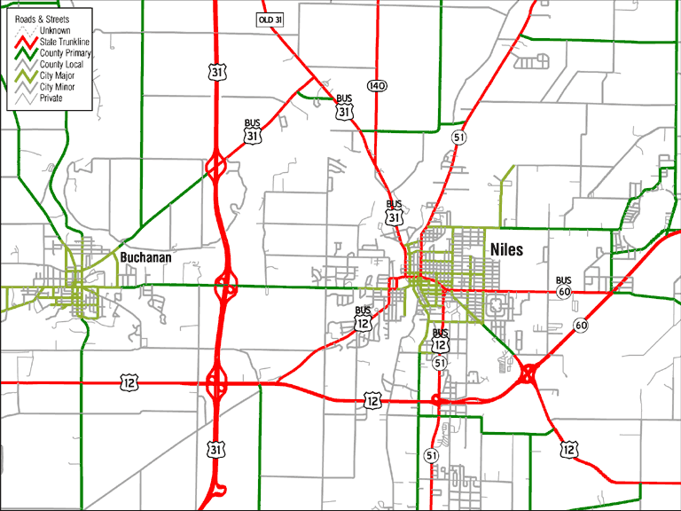
This is a listing of the route confirgurations, past and present, in Niles, Michigan, a town which has had many routes in many places despite only having 12,458 people (1990 U.S. Census). Because of its small size, many maps don't have the room to clearly identify all the routes through there. I used to go through Niles frequently, and now still do occasionally, so I have the information that most maps don't have.
Overview of the Niles area: Chris Bessert (5/31/03) | MapQuest
Much of the information on this site, as well as the form of the "List by designation" page and the route marker graphics on that page, is from Michigan State Highways by Christopher Bessert (except the "BUSINESS" plates, which are from Manual of Traffic Signs by Richard C. Moeur).
This page created Saturday, May 23, 1998/Page divided May 31, 1998/ Moved to XOOM November 2, 1999/Page divided again July 27, 2000/Last revised July 9, 2007
Return to Marc Fannin's History of the Routes in Berrien County, Michigan