
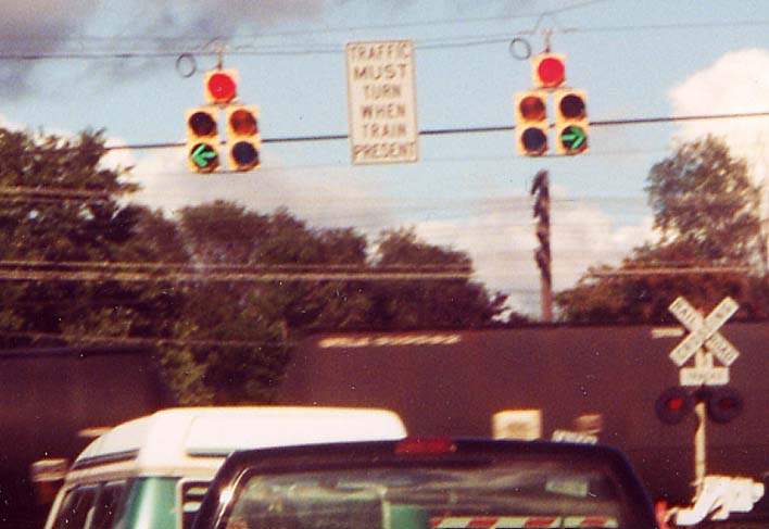
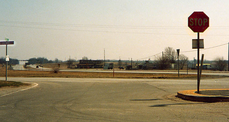
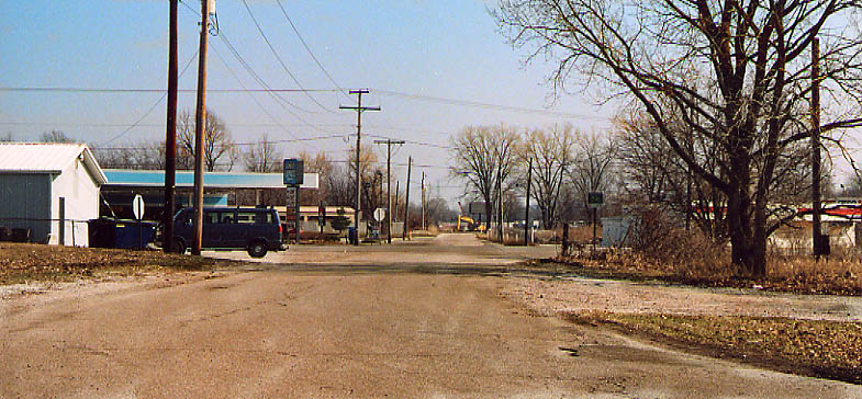
With the busy railroad tracks running along the east side of US 33 south of Elkhart, it was necessary to arrange things like this in order for the traffic crossing from one of the shopping centers south of US 20/St. Joseph Valley Parkway onto the residential street across 33 not to end up wedged between 33 and the tracks. This was probably one of the "six railroad crossings" that Michael Buettner discovered in his research of the 1913 LH routing, discussed in a 1998 edition of the Lincoln Highway Forum. Along US 33, south of Elkhart (from Sept. 2000)
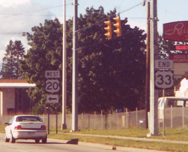
The current north end of US 33, at US 20 south of Elkhart (from Sept. 2000)
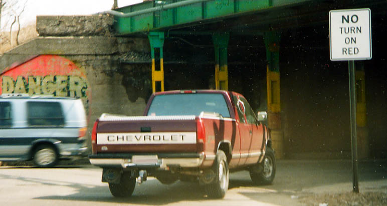
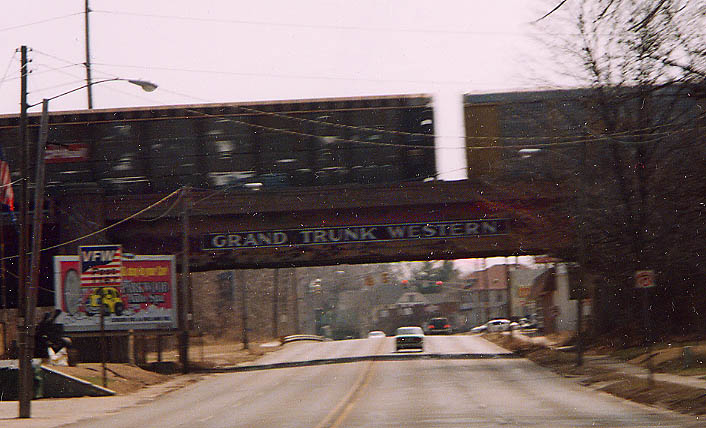
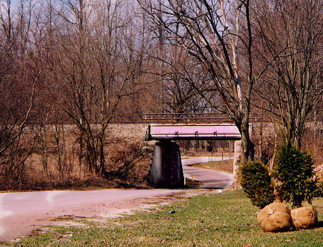
I'm not sure how the Lincoln Highway was routed through Elkhart.
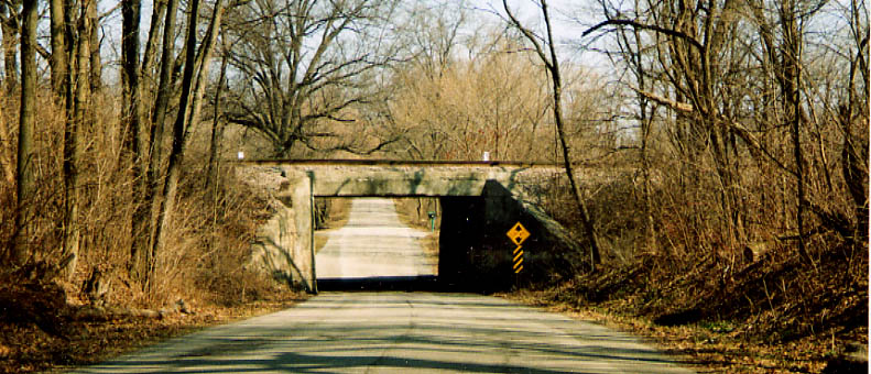
The maps I followed had me going along Indiana Ave. With that,
I had to do this quick right-left underneath this Railroad bridge.
The color arraignment for the bridge supports are also of interest
here (Black pride?).
Indiana & Oakland in
Elkhart (from March, 2003)
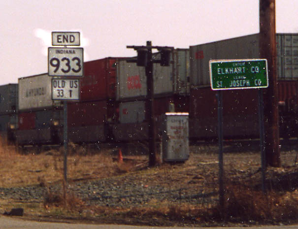
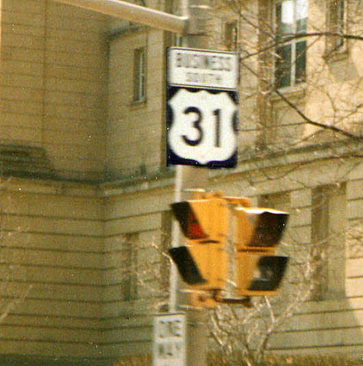
The eastern end of Ind 933. Why state designation ended at the county line I don't know. (from March, 2003)
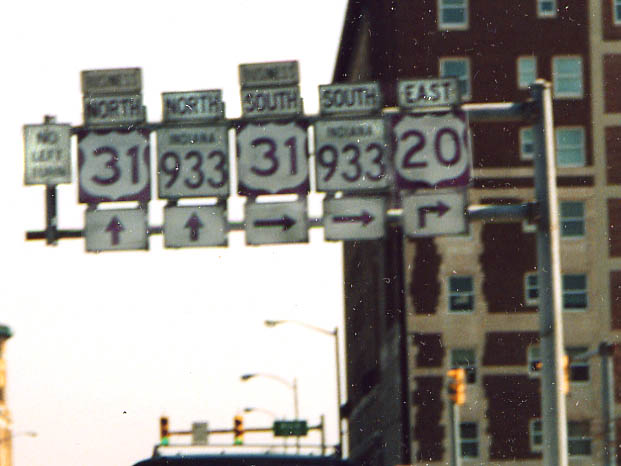
You got to like any railroad name that inspires the name of a rock band (March, 2003)
Left Picture - South Bend squeezed both the business prefix
and cardinal direction into one banner over the route shield instead
giving them separate banners (which would be standard practice)
Main St SB in front of the St. Joseph Co. Courthouse (March, 2003)
Right Picture - Sign assembly for the routes through
South Bend (and what is up with the US 20 shield?), Lincolnway
West at Main St (March, 2003)
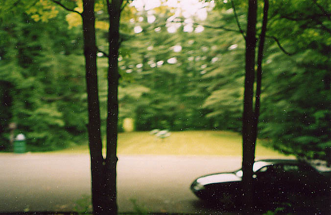
Part of the Studebaker Forest at Bendix
Woods. (Not along the Lincoln Hwy, but the LHA party stopped
here for lunch during our tour through Indiana),
Here
is the Terraserver
link to see the Studebaker forest from above. Photo from
June 2003
Rolling Prairie
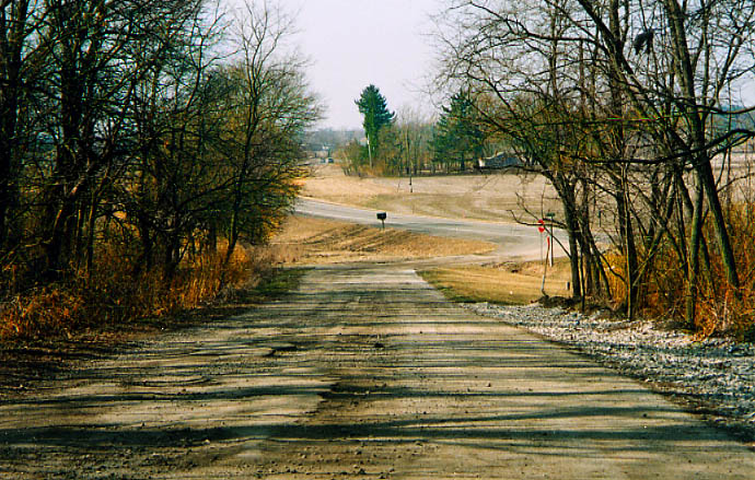
This was the eastern end for Ind 220 (an one year wonder?), or maybe this was an routing for US 20 many years ago. The traffic lights on the left horizon go with the modern US 20/Ind 2 intersection. (from March, 2003)
Ind 220 went underneath this railroad underpass and then turned left (going to Rolling Prairie) (from March, 2003)
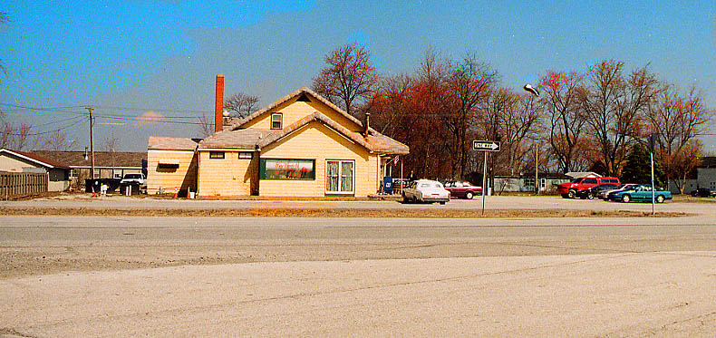
Once upon a time, this was Bob's Bar-B-Q, a restaurant and tourist cabins stop along the Lincoln Hwy. Now it's the L&L restaurant (?) and the tourist cabins have disappeared. Oak Knoll Rd at US 20, east of Rolling Prairie (from March, 2003)
More about Rolling Prairie
Back in
the last week of September, 2003 I received the following e-mail....
Saw your photos of the road east of Rolling and the viaduct.
Perhaps you'd like to know more facts. The original road went
thru New Carlisle - it followed the Chicago Trail - an Indian
trail from New York to Detroit and to Chicago. The four lane highway
that goes to the south of Rolling Prairie was built when I was
eight years old in 1941. I remember specifically because my friend
Marilyn, lived with her parents in a new house they had just built.
It stands today beside the
highway at the base of the viaduct over the train tracks. The
photo of the viaduct on your web site is the original viaduct
- built when the two-lane highway was the only way to get from
Detroit to Chicago (thru South Bend). My father and my uncle owned
Jones Garage in Rolling Prairie and my Daddy drove the huge wrecker
to pull semi-trucks and other vehicles out of the ditch after
accidents. I still have some photos of such wrecks. I have copied
below what I wrote to accompany the beautiful murals in the new
Rolling Prairie Post Office - built in 2000. It tells the story
of our little town and includes some of the delicious history
that makes Rolling
Prairie so unique.
The Story of the Rolling Prairie Post
Office Murals
These murals depict a history of
the town and surrounding area
South wall:
Glaciers covering the area receded north around 16,000 years ago,
leaving the rolling terrain of today. As forests, prairies and
marshlands established themselves thousands of years of plant
decay created a rich soil for farming. Historically, major farm
crops in the area are corn, wheat, soybeans and hay. On the left
side of the landscape mural several figures stand around a well.
The man wearing the vest is Ezekiel Provolt , the first settler
in this area, who built a cabin by a large oak tree in 1831. Its
original four inch thick door is on the white house beside the
same oak tree across the road from the cemetery. Provolt befriended
the native Potawattomie Indians, who camped a short distance from
his cabin. The Indians often visited the Provolt family to drink
from the well.
Behind the cabin are the primeval forests of the area. Three covered wagons travel west on the trail known to pioneers as the , originally the connection between Eastern Canada and Detroit with the Great Plains. The Trail later became US Highway 20. Just below the wagons is a cluster of trees depicting Plum Grove a stand of wild plum trees used as a meeting ground by local Indians near what is today the intersection of Boot Jack Road and State Road 2, west of Rolling Prairie. The Potawattomies gathered here to pick and dry fruit. This was where Indians were brought together by white men for what became known as The Trail of Tears, a forced march of Indians to Kansas.
Plum Grove, in the mural, also represents the wealth of fruit orchards in the area. Below the corn field is an early settler tilling his field using one of the dangerous early hand plows with leather reins on his shoulders to direct the horse. Farmers were often injured by the tension between the horse and plow. In the days before machines, wheat was harvested through communal labor as families worked together, singing and exchanging stories. Women produced huge meals to feed the hungry crews. Small children supplied water out in the field on hot days. To the left of the wagon is a man using a hand tool, called a cradle, to cut the wheat which was then collected into bundles called shocks and thrown into heaps called strawpiles In the field behind the harvest scene are farm machines used after the Civil War. The steam engine on the left powers the threshing machine on the right through the use of a long, long belt. The threshing machine separates husks of chaff from the seeds. Although machines made harvesting much faster and easier, their cost eventually forced many farms to close as they were so indebted to banks. To the right of the threshing machine is a farm house and barn from the pre World War II era. Below, Holstein dairy cows graze showing another traditional aspect of farm life.
North wall:
This mural depicts a more detailed history of Rolling Prairie.
In the center of the mural above the row of buildings is the Ezekiel
Provolt cabin, symbolizing the first settlement of four cabins
called Nauvoo. Nauvoo remained small until 1852 when the New York
Central Railroad bypassed the larger town of Byron to build tracks
through Nauvoo. A locomotive engine from that period, at the left
of the cabin brought important changes, increasing trade and commerce
and the little town on the prairie began to thrive. In 1853, the
United States Post Office was established and the town was renamed
Portland. Four years later, the name was changed when postal authorities
discovered there were two Portlands in the state. The identity
of the postal employee who changed the name to Rolling Prairie
is unknown. To the right of the Provolt cabin is Michigan Street,
also the original US Highway 20, later diverted when a new four
lane highway and viaduct were built in 1940. On the right is the
First Christian Church, established in 1854. Next, the Kankakee
Township Volunteer Fire Station and the Rolling Prairie United
Methodist Church, established in 1835. The row of buildings in
the center of the mural are as seen in a photograph of Depot Street,
circa 1912. All but one of these buildings remain standing today.
Buildings, right to left:
The bank owned by A.J. Stahl which closed during the Great Depression in 1929;
A shop selling farm equipment;
Reese Brothers Hardware;
A residential building;
The blacksmith shop (one of two in town) and
The John A. Noble General Merchandise Store.
The street had raised wooden sidewalks, hitching posts, and there was a town pump connected to a community well where a woman and girl can be seen pumping water. A man drives a wagon filled with supplies follows a buggy containing milk and cream cans used before refrigeration. The large red structure in the corner is Rolling Prairie High School, portions of which were destroyed in two separate fires. The building was later demolished. The Post Office is to the left with a flag flying. The Post Office has been located in several buildings a one story built by Arthur Fissgus in 1954, beside the new two-story post office built in 1997 by Gene and Debbie Jonas. To the right of the Post Office, Coy Brown, long time rural postal carrier, sits astride his Harley Davidson motorcycle. Facing him is Dr. Carl David Fuller, carrying a large postal bag. Born in 1867, Dr. Fuller practiced homeopathic medicine in Rolling Prairie, was a prolific songwriter and poet, and later became Postmaster of Rolling Prairie. To the left is Jones Garage and Service Station, operated by Orlando and Basil Jones, sons of Orlando Wilson Jones, who had operated his blacksmith shop on the property where the filling station was built. This building stood on Michigan Street, then U.S. 20. Several Indianapolis 500 race cars were built at the garage. Mauri Rose won the race with a car built in Rolling Prairie. During the 1920s and 30s the highway brought a steady stream of traffic from the east coast to Chicago and the west including many famous people. At one time there were eight gas stations in and around town. Above the gas station is a crowd of people watching singers perform
Hoover Park
Hoover Park (named after President Herbert Hoover) was located
at the corner of Depot and Short Streets on an empty lot. In 1937
the country was suffering through the Great Depression. People
had little money but plenty of time on their hands. A local resident
Corky Llewellyn, a retired circus animal trainer, decided to make
an amusement park and zoo, of sorts, on the spot. People had plenty
of time on their hands and not much money so Corky and friends
created the large wooden elephant and various contraptions, each
with its own satirical sign in front. A stuffed dog sits above
the stage and a man is perched high on a telephone pole to watch
the show. One of the signs reads, McNutt Zoological Park , referring
to Indiana Governor Paul McNutt who served from 1933 1937.
South of Hoover Park was the trolley car or Interurban, the railroad that connected South Bend, LaPorte and Michigan City to Rolling Prairie and brought people to watch the free entertainment at Hoover Park. Movies were shown on the sides of buildings and on huge white fabric sheets stretched between light poles. The movie in the mural stars Clark Gable, who was once seen passing through the town. That might be his black Packard parked in front of Jones Garage. A popular destination of the era, Bob's BBQ, a restaurant and dance hall featured a live orchestra on Saturday nights. Bob's became so famous that at one time twenty buses transporting people from coast to coast stopped daily. Bob's offered cabins for overnight stays amidst manicured grounds and rock gardens. The restaurant was destroyed by fire in 1933 but later rebuilt. Another attraction was the Peacock Fountain Inn, owned and operated by the Jacob Offenbacher family who had learned to cook in German and Swiss hotels. They had live peacocks roaming the beautiful gardens of the Inn, site of the annual Rose Tea sponsored by women of the Rolling Prairie United Methodist Church. The Inn closed after the tragic death of Mr. Offenbacher when his car was hit by a South Shore train north of Rolling Prairie.
Long dry summers meant fires and many buildings burned down or were damaged in the early 1900s. In 1942 residents agreed to stop relying on bucket brigades and neighboring fire departments and organize their own fire department. Charles Houseknecht, Charles Hunt, William Ludtke and H. C. Wolcott agreed to lead a campaign which raised $225. Houseknecht purchased an abandoned filling station and turned it over to the township in July, 1946.
In 1948 the Rolling Prairie Lions Club hosted a benefit performance for the department by PeeWee King, a popular country western star, that brought in more than $2,600
The all volunteer unit was put to the test in the early morning hours of Oct. 20, 1963 when the town's citizens were awakened by a deafening blast as two freight trains collided beside the grain elevator. Mrs. Rita Buss, wife of Fire Chief Walter Buss, sounded the alarm for firemen who prevented the blaze from spreading to the grain elevator. The force of the blast was so great it actually moved several inches from its foundation by the blast. Five diesel engines and fourteen cars derailed, flames shot several hundred feet in the air and three engineers were killed, one of them Dennis Culvahouse, born and raised in Rolling Prairie. Culvahouse was buried in the Rolling Prairie Cemetery, shown on the right side of the mural above the fire station. Grave markers date back to pre Civil War times. It is here our story draws to a close.
M.C.Porter
It is my hope, that rather than just having sentimental value, my murals cause people to reflect on the ways that things have changed over the last 200 years, what can be learned from the past, what is worth saving or returning to, and what a model of a sustainable rural community could be like.
Acknowledgment by the artist:
I wish to thank some of the many people who contributed to the
Rolling Prairie Post Office murals:
Schroeder for his stories and the use of
his photos;
LaVerne Carpenter for showing me old yearbooks, his Indian hatchet/pipe
and mastodon fossils;
Lavonne Lange for stories,
Gloria Fuller for historical data;
LaPorte County Historical Society for research assistance; and
Rolling Prairie postal workers for their patience.
A special thanks to Marcia Porter for her gracious help in writing,
editing, and printing the story of the murals.
Finally, to Gene and Debbie Jonas for commissioning me to paint
the murals.
Michael
All of this was sent to me from Marcia and Michael Porter,
retired painter, newspaper editor and historian.
This would be the western intersection of the Lincoln Hwy and the G.A.R. hwy in Indiana (they also cross paths south of Ligonier). In this case I'm on an older section of the LH (Ind 2 is to my right in this picture), west of Westville (from March, 2003)

The original Lincoln Highway routing, near Westville, goes through a cemetery once more (just like in Merriam). However, you can't drive the old LH through this cemetery. Just south of US 6, west of Westville (from March, 2003)
Before the Lincoln Highway got shifted away from the northern route, it had enough traffic (important enough route) to get this railroad overpass. Current Ind 2 is off to the left somewhere. (SW of Westville, from March, 2003)
This nearly abandoned section of Lincoln Highway is just south of the above photo. In this case, you can try to use the road, but lack of maintenance and a house on top of this hill (behind me), should discourage attempts to cross this portion.
Page created on July 24, 2003 /last updated on October 7, 2003
Questions, comments, and submissions can be sent to Sandor Gulyas
Go west to Valparaiso to Ill state line section | Go east to 1913 route - Goshen to Ft. Wayne | Return to Indiana LH page