History: South Bend Tribune articles 1/22/06: "Indiana's toll road seen as link in a chain" , "The people behind the names" [of the service areas] | Early plans | Old exit guide (no longer extant page)
Toll Road lease information: Indiana Finance Authority page | INDOT Major Moves program | Indiana House Bill 1008 text | Toll Road for Sale, special series by three newspapers | Investor page (choose "English") (press release, 1/23/06, with link to .pdf)
Selected newspapers along the Toll Road: Gary Post-Tribune | South Bend Tribune | Elkhart Truth | Fort Wayne News-Sentinel (others are here)

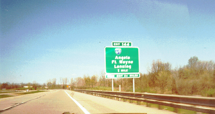
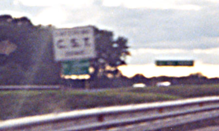
The eastern end of the Toll Road
The sign next
to the welcome sign says "FASTEN YOUR/SAFETY BELT/ITS THE
LAW". Note the Toll Road markers on each post of the overhead
gantry. The Speed Limit 45 signs were there because of an overpass-redecking
project on the eastern end of the Toll Road.
As of August 1, 2004, the welcome sign is now located on the right side of the highway.
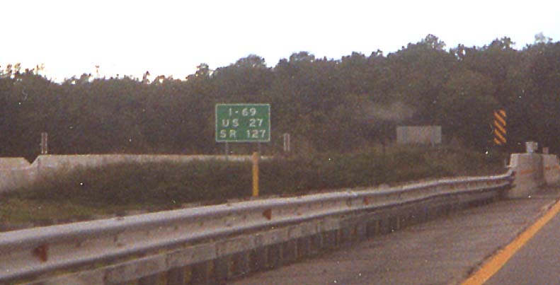
In the late 1990's Indiana and Michigan decided to remove US 27 north of Fort Wayne (go here and here for details). In April 2000, the US 27 shields had been removed from the guide signs on the Toll Road (here is another shot showing another example, the two-mile advance sign located before the one above, as well as a dormant variable message sign), but note what the sign at the I-69/I-69 frontage road overpass says (SR 127 has been gone from the frontage road for some time, making I-69 the only correct highway designation on the sign). Note: By August 27, 2003, the "U.S. 27" portion of that sign had been covered over.
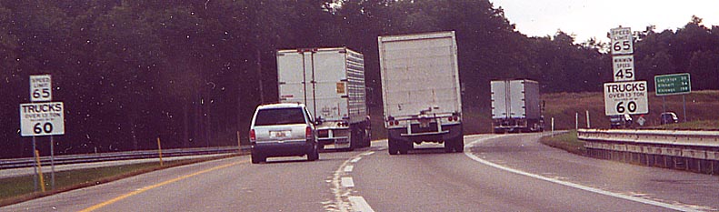
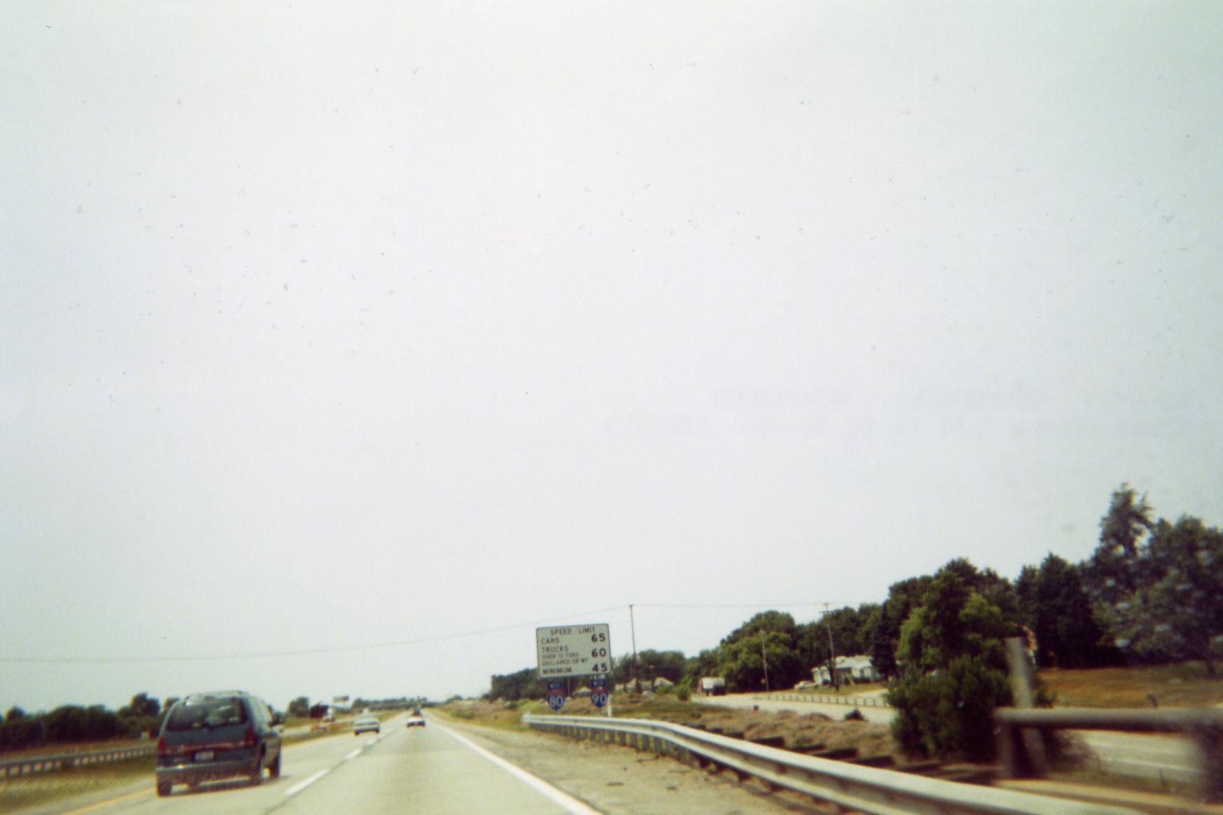
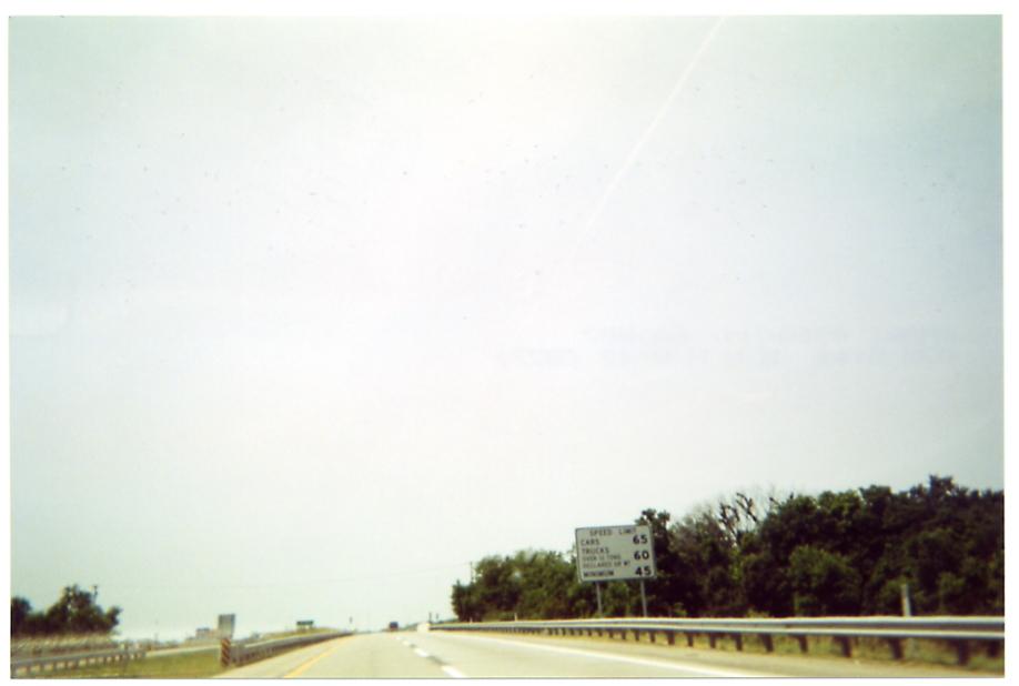
In 2002 the Toll Road District began installing billboard-type speed limit signs, with the Interstate marker confirmation assemblies on the posts underneath (I-80 on the left one, I-90 on the right). Photo | Photo, no shields Prior to that, most speed limit signs were as pictured above. (In 2005, the speed limit on the Toll Road, as well as many other Indiana Interstates, was raised to 70 mph, effective July 1 of that year.) The distance sign in the background in the above photo (still extant) is for Lagrange, Elkhart, and Chicago.
This road is uncool! Actually this is a poor shot of the symbol version of the "No Hitch Hiking" sign found on entrance ramps to freeways in Indiana, this one being a ramp from a service area between Angola and Elkhart. Here is a clear rendering of the sign, courtesy Richard Moeur's Manual of Traffic Signs.
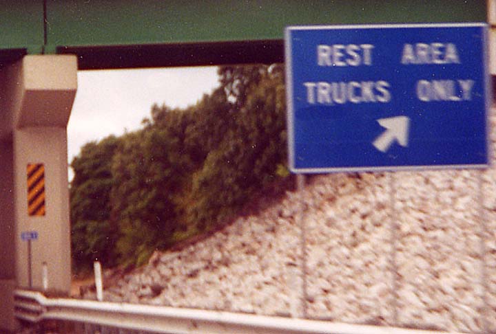
In the early 1980's the service areas just east of the US 131/Indiana 13 Constantine [Michigan]/Middlebury [Indiana] exit, Exit 107 (where US 131 ends -- go here for photos) were abandoned, and eventually their buildings were torn down. Sometime in the late 1990's, their pavement was regraded and now they serve as truck-only parking areas. In the background is another new-style bridge marker. As of July 2002, these signs had been replaced by full-size signs.
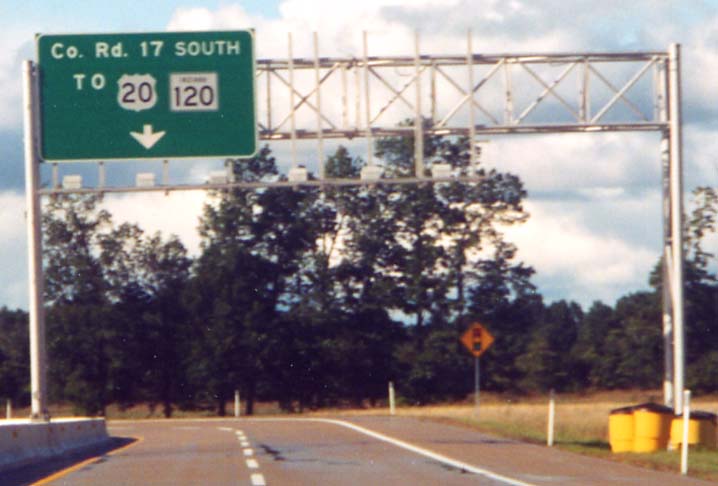
The Toll Road at Elkhart County Road 17 (Michiana Parkway)
CR 17 is used as a connection between the Toll Road at its
Exit 96, which opened in 1997, and the eastern of the St. Joseph
Valley Parkway freeway southeast of Elkhart. Although the gantry
pictured does not convey it, there is also access to CR 17 Northbound
(the gantry is obviously designed for a sign indicating this).
The sign will probably be added once CR 17 is completed to the
Michigan state line and its continuation, M-217 is built to US 12 (information).
Since this was originally written, a sign was added, and the advance signs now also mention M-217, as part of an area sign upgrade sometime in 2005.
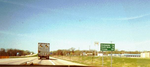
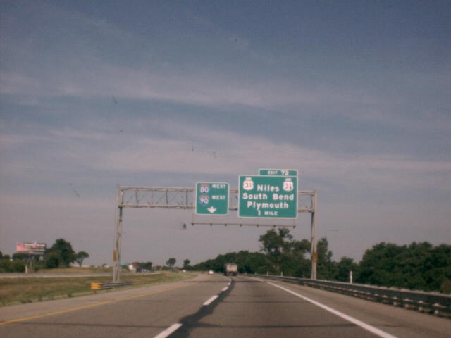
Standard Indiana freeway mileage sign, heading away from the Indiana 19/Elkhart interchange (Exit 92). It says "Mishawaka 16/South Bend 19/Chicago 107".
The new pedestrian walkways at Grape Road (South Bend-Mishawaka)
Where Grape Road crosses the Toll Road between Exit 77 (SR 933/Bus US 31 - Notre Dame) and Exit 83 (Mishawaka - SR 331 to SR 23), there is a major shopping area, including University Park Mall in the northwest corner. On December 30, 2002, new walkways were opened both over and parallel to the Toll Road so that pedestrians may now access all quadrants of the Grape/Toll Road crossing. See also this INDOT press release and the South Bend Tribune, December 31, 2002
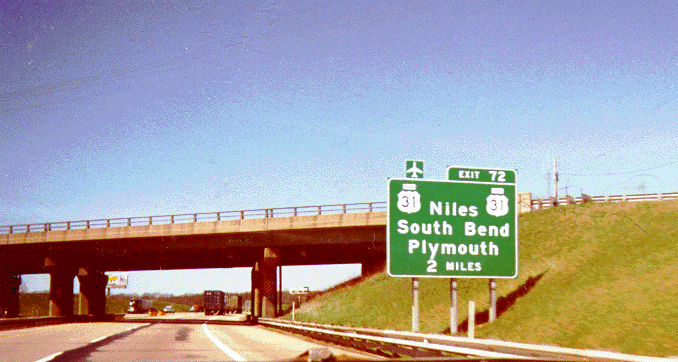
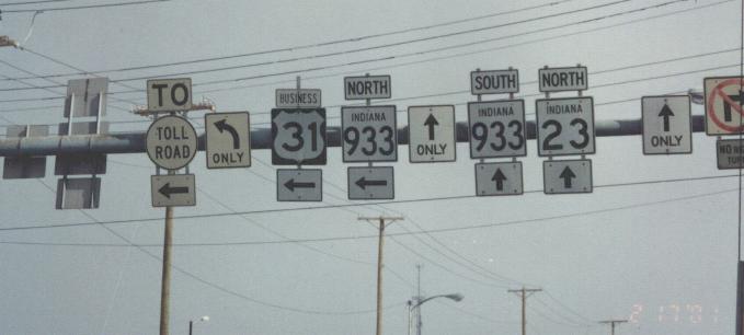
The SR-933/Business US-31/Notre Dame exit
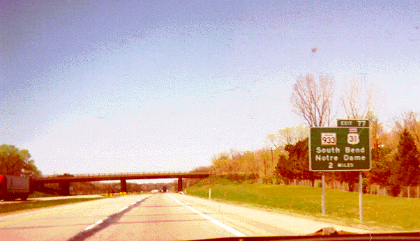
This used to be the exit for US 31 and US 33. Business US 31
replaced US 31, and later Indiana 933 replaced US 33 (go here
for more information on both these route changes). Note the "BUSINESS"
plaque in place of text. This Business US 31 has unique shields
in places (see link at bottom of page). The overpass in the distance
carries Ironwood Road.
Here is a photo of the same sign taken three months later by Jeremy Lance.
The ramps from the Toll Road do not meet Indiana 933/Business 31 (old US 31/33) until well away from the Toll Road, due to the intervening town of Roseland (map -- the two sides are not aligned properly). The intersection pictured was a trumpet interchange until 1995, when, due to the removal of a railroad track paralleling 933/Bus. 31 to the west around 1984-'85, the railroad bridge on the ramps and the interchange were removed in order to better use the surrounding land (that's why the map linked above portrays an interchange here). The current signalized configuration was completed and opened May 8, 1995. The mound on the left side of the picture formerly carried the access ramps to and from 933/Bus. 31 Northbound. The cones and police are present due to the fact that a Notre Dame football game had just finished (The University of Notre Dame is just ahead on the left).
The US 31/St. Joseph Valley Parkway exit
This exit opened in 1979 according to this report. This interchange won an award in December 2002.
The overpass in this photo carries Bendix Drive. A relatively new retail area is just up the embankment.

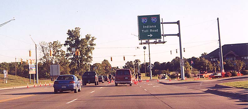
Note the pull-through sign for I-80/I-90, which implies that
only the left lane is for through traffic (in reality both lanes
continue through the interchange).
Jeremy Lance also took a photo of this sign three months later (it's here).
This color, close up (1.5 MB) aerial photo of the interchange complex was contributed by P.E. Gary Fisk/DLZ and here is a TerraServer image of the same area
Looking toward the Toll Road, on the right is a more-clearly rendered "No Hitchhiking" sign (see above).
Looking toward US 31

Through traffic can actually continue in both lanes. The ramps between 31 Northbound and Nimtz Parkway (east-west road paralleling the Toll Road to the south, partially the former Cleveland Road, also known as F. Jay Nimtz Parkway) were built like they were to avoid an adjacent golf course as well as to minimize conflict between traffic going from Nimtz to 31 Northbound and that going from 31 Northbound to the Toll Road.
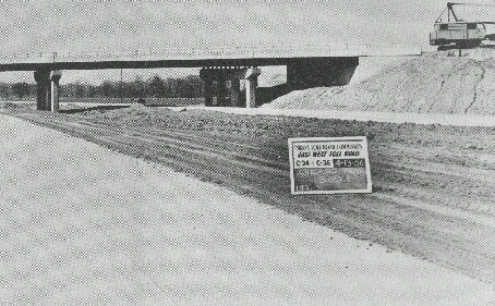
P.E. Gary Fisk/DLZ Contributed this photo of The Toll Road in St. Joseph County in 1954, just before its opening
The Toll Road crosses the Eastern/Central Time Zone boundary at the St. Joseph/LaPorte County line. At the time this photo was taken, the time on both sides of the boundary was the same, for this reason.
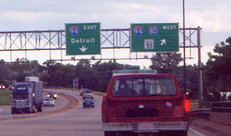
The I-80/I-90/I-94/Toll Road/Borman Expressway interchange
This interchange is not as cut and dried as one would think. Here is a diagram of the interchange and corresponding aerial photo
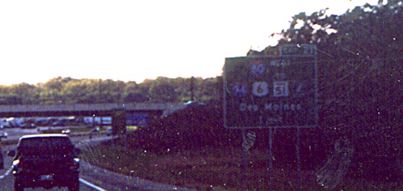
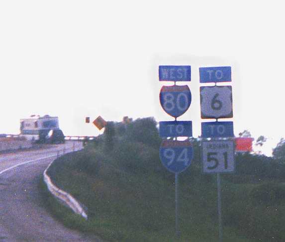
Westbound Toll Road approaching the I-94/Borman Expressway.
The symbol to the right of the Indiana 51 marker is an Illinois Tollway marker,
referring to the Tri-State
Tollway.
We acknowledge our error in photographing
into the sun, so we located a better photo here.
The Borman Expresway (I-80/I-94/US 6) is covered on Calumet River Valley Road Photos.
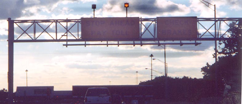
The Westpoint toll booth east of I-94/Borman Expressway, This is the end of the ticket system heading west.
Exit listing sign, Westbound east of I-94/Borman Expressway. Many shields are listed. The overpass identifier in the background is standard on the Toll Road.
Sign assembly on the ramp from the Indiana Toll Road Westbound to the access road to I-94
Split on the access road from the Indiana Toll Road to I-94. This is just past where the toll booth used to be.

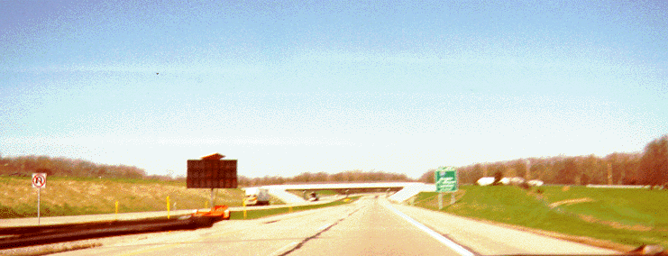
Indiana is marking mileage at overpasses with these new signs. Mileage was formerly indicated by paint on the bridge supports.
As of the evening of December 6, 2000, the Toll Road started using a new style of toll ticket (see this story - thanks to "PrincessofTolls2" for the date correction). Unfortunately both tries with a camera resulted in wash-outs. Fortunately, this page has clear photos.
Animal/vehicle accident prevention systems
There are two systems in use on the Toll Road for prevention of accidents between vehicles and animals (usually deer). One involves a double-sided reflector (all green, all red, or red and green), and the other is a system in Steuben County (east end of the Toll Road) which uses a sensor beam to detect animals, sending signals to flashing lights. This WNDU-TV story has a photo of the first system and describes both systems; this article describes in further detail the second system, with this page by its manufacturer showing graphic examples (the photo is missing the signage visible in the diagram below it; the text is "ANIMAL/PRESENT/WHEN/FLASHING" on the top sign with "NEXT MILE" or "NEXT 1/2 MILE" on the supplemental bottom sign -- the WSBT-TV website had a photo but it is gone at this time). This page has a photo of the second.
Off-Toll Road photos:
This trailblazer is very unusual. Photo contributed by Stephen Summers
Northbound US 31 (SJVP) at Lincolnway West (US 20), approaching the Toll Road, west of South Bend
This was contributed by Jody Aho, and was taken on the way back on a May, 2000 trip from Minnesota to Kentucky. His comments regarding the Toll Road sign:
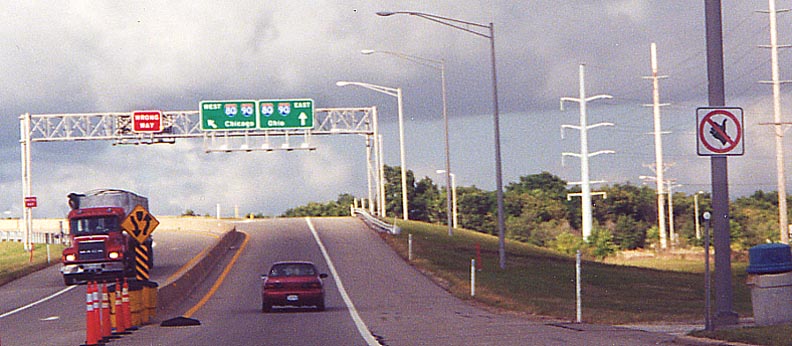
The upcoming junction with the Indiana East-West Toll Road, complete with its marker and the I-80/I-90 multiplex, is signed. By looking really close, you may note that the I-80 marker has the state name in the shield, while the I-90 marker is the newer variety without the state name! Chicago and Ohio are listed as control destinations.
Other pages with Indiana Toll Road photos:
This page created Monday, July 23, 2001/Reformatted August 4, 2004/Last revised December 16, 2006
If you have comments about this page, e-mail Marc Fannin at musxf579@hotmail.com (alternate: musxf579@kent.edu).
Return to Michiana Road Photos or Routes in South Bend and Metro Northern Indiana