

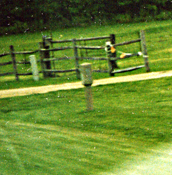
Wood railing. The appearance of this (and on other sections
between Ft. Wayne and Columbia City) was a big surprise to me
as I continued on "Old 30."
Washington
Center Rd, somewhere between Ft. Wayne and the Allen/Whitley Co
line (March, 2003)
This concrete marker hasn't always been here. Reportedly this replica was placed here in the last couple of years. Along Lincolnway/Washington Center Rd between Ft. Wayne and Columbia City (June, 2003)
Columbia City
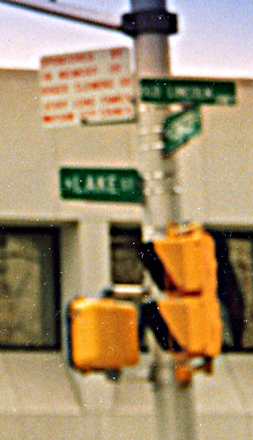
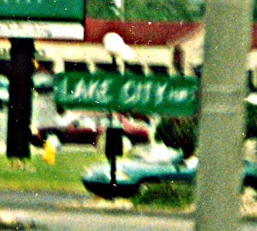
Yeah, I know bad photos (not necessarily bad photos, just can't
be zoomed in legibly).
Left Photo - Besides Lake
Dr being renamed Old Lincoln Hwy, the blurry red text mentions
something about Roger Clemons, Sr. Any relation to famed Red Sox-Blue
Jay-Yankee pitcher Roger Clemons (Jr?)?
Right Photo
- What's the Lake City Hwy?
Both photos are in
Columbia City, left photo from March, 2003/ Right photo from June,
2003

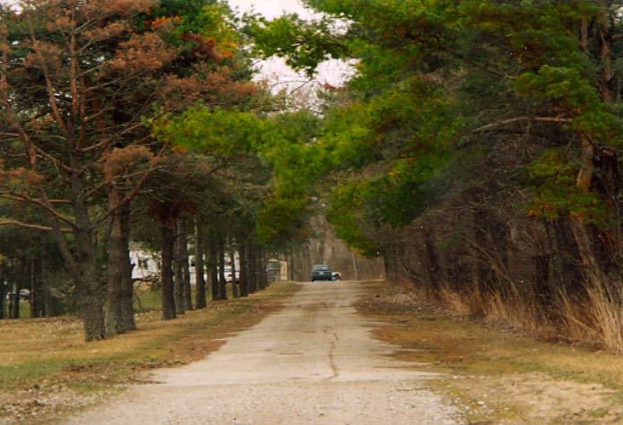
Both of these photos deal with the same road remnant of the Lincoln Hwy between Columbia City and Warsaw. The top photo is looking west at the improved curve to the right, and the old highway to the left. You can see a house, behind some trees, between the roads. The bottom photo just looks at the old roadbed, with the house from the top photo using the road as a driveway here. Along Lincolnway between Columbia City and Warsaw (both photos from March, 2003)
Warsaw
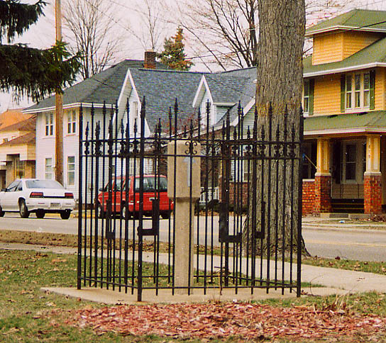
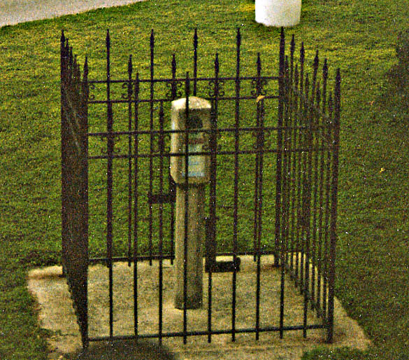
Here's two different views of the last original 1928 LH concrete marker standing in Indiana. You can find this marker caged, in Funk Park, about a 1/2 mile NW of the Kosciusko County courthouse on Lake St. (Left photo from March, 2003 / Right photo from June, 2003)
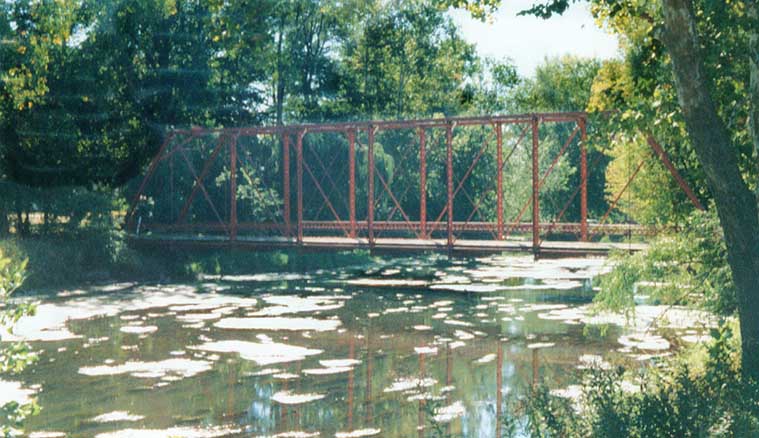
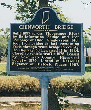
Chinworth Bridge - The last Pratt through truss bridge in the county. Ironicly, the placard (see photo below) says US 30 bypassed this in 1924. However, US 30 wasn't established till 1926 (and the Lincoln Highway wouldn't be routed here till 1928) (west of Warsaw, Sept. 1999)
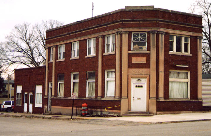
This is the old Atwood Bank (you barely make out the name above the door). I think it's use as someones home now. Funny story, someone from a gas station (would be located behind me in this photo) asked what I was doing photographing this building. I mentioned something about the architecture of the building grabbing my attention. (from March, 2003)


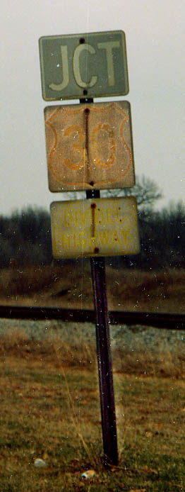
I thought the Yellowstone Trail followed US 20?! Well yes, and no. In Indiana, when the Lincoln Highway Association original took the far-northern route from Ft Wayne to South Bend back to Valparaiso, due to the lack of "good roads for a direct route", the Yellowstone Trail Association had their road follow "modern US 30." Actually the Yellowstone Trail followed the Sauk Indian trail for the most part in Indiana. Thus there are a handful of locations that the Yellowstone Trail and the "modern" Lincoln Hwy share the same road, or are neighboring roads.
The top photo is of a remnant of the Yellowstone Trail (the
old Penn RR, then modern US 30/Lincoln Hwy are to the right out
of the picture)
The bottom photo is of a roadsign
for the Yellowstone Trail. (both photo locations are at Ind 23
in Grovertown. Both from March, 2003)
Left photo - Very old and warn out US 30 shield (I did my best to highlight the features) at the east end of Hamlet (March, 2003). P.S. I did not noticed this particular sign still standing when the LHA caravan came by here in June, 2003 (but I might have been sleeping at the time).
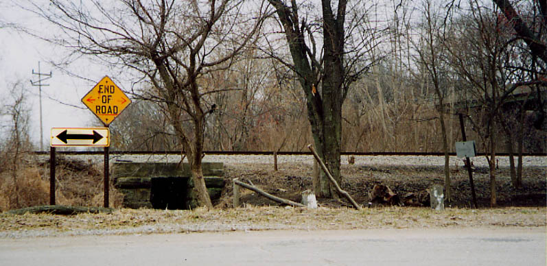
Above photo - intersection of Old US 30 and Old US 35. The double-headed arrow and 'End of Road' sign are fairly old. There used to be an US 35 shield on the far right (with the arrow). Before the US 35 bridge was built (sort of see it to the right) the old right-of-way followed the electric pole (far left), even if scenery doesn't show it now. (from March 2003)

InDOT was ready to widen US 30 through here if the day came.
However, they decided to just build a bypass to the right (out
of the picture) instead
Or did they "narrow"
the road after the bypass was built? Hmmmm.
Old
US 30, west of Hanna (east of Wanatah)(March, 2003)
Page created on July 24, 2003
Questions, comments, and submissions can be sent to Sandor Gulyas
Go west to Valparaiso to Illinois border section | Go east to Ft. Wayne to Ohio border section | Return to Indiana LH home page