
When the Lincoln Highway was originally
routed through Indiana, it roughly followed present day US 33,
US 20, and Ind 2 from Ft. Wayne to Elkart-South Bend back to Valparaiso.
It would follow this route till 1928. Also of note, the original
Lincoln Highway was numbered as Ind 2 for the entire length.
This page covers the section from NW of Ft Wayne to
Goshen.
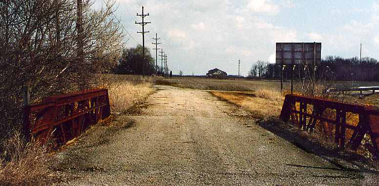
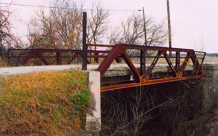
Old Bridge NW of Ft. Wayne. Here's a perfect example
of the old road following the property lines to benefit farmers,
while the newer road got softer curves to benefit drivers.
Top picture - across the bridge following the old
road (follow the electric poles and lines)
Bottom
picture - crossview of the old bridge.
Both
pictures taken in March, 2003
Merriam
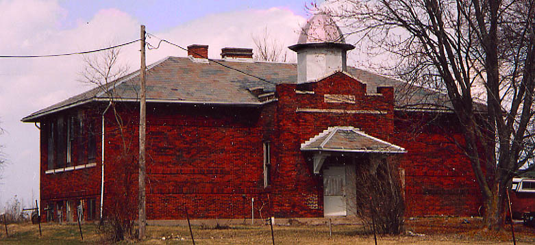
This oddly shaped building used to be a schoolhouse at one
time. Now it's just private property
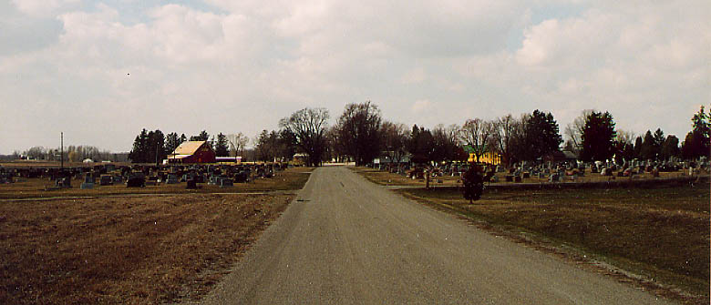
This is one of two instances that the 1913 routing of the Lincoln
goes through a cemetery. In this case, the road is still open
to the public.
Ahead lays present day US 33 routed
to bypass Merriam. (both pictures above taken in March, 2003)

Back in 1999, Floresecent yellow school crossing signs were
new and coming upon this in the middle of US 33 in Wolflake, I
had to get a picture
From Sept. 1999
Kimmel
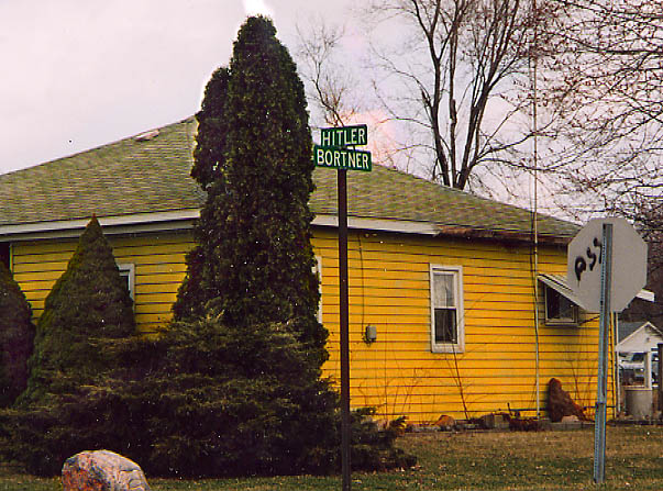
Lets see, how can I describe this without getting alot of unwanted
traffic. ;-)
This street was named after a local
farmer from the 19th century. The name has nothing to do with
an Austrian/German who came to power in the 1930s and sought the
death of millions of Jewish people (actually, how did this street
NOT get its name changed?)
Intersection of Bortner
Rd and US 33, south of Kimmel (from March, 2003)
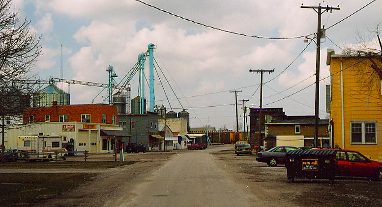
Downtown Kimmel and its business district. US 33 bypasses this
to the left (and over the RR Tracks). From March, 2003
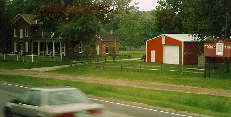
An old road remnant at the bottom of Stone Hill, in front of
Stone Tavern (which is much older than the LH).
US
33 between Ligonier and Kimmel, from June, 2003
Ligonier
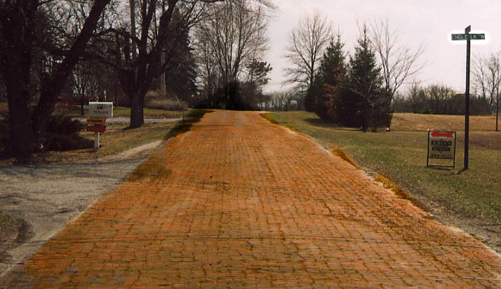
This is the last section of brick paved LH in Indiana. It still
gets used for local access (and the occasional tour bus).
US 33 south of Ligonier, from March 2003
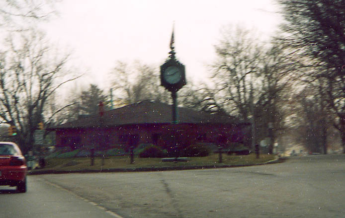
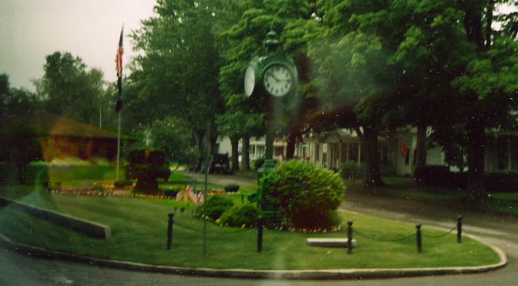
I tried twice to get a picture of this park in Ligonier, both
with unsatisfactory results. Regardless, it is a nice bit of landscaping.
Top clock picture from March, 2003, Bottom clock
picture from June, 2003
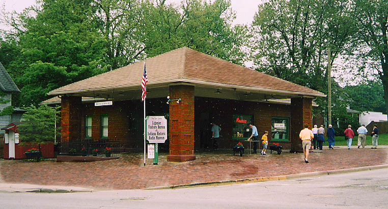
You think you have a radio of historic importance? Then send
it to the Historic Radio Museum (especially if it has ties to
Indiana). This building also serves as Ligonier's Visitor Bureau.
This building was a gas station in a prior life. (from June,
2003)
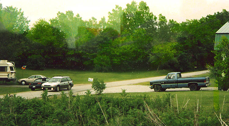
Here's another old alignment. Similar to the top pictures,
this was routed along section lines-later routing eases the curves
for drivers, but this alignment is still open for local traffic.
Old US 33, west of Ligonier (June, 2003)
Goshen
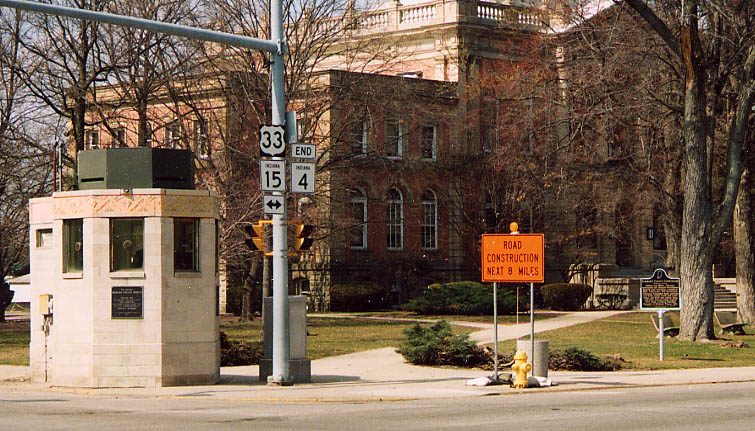
Top left picture - Goshen Police tower and Elkhart Co Courthouse.
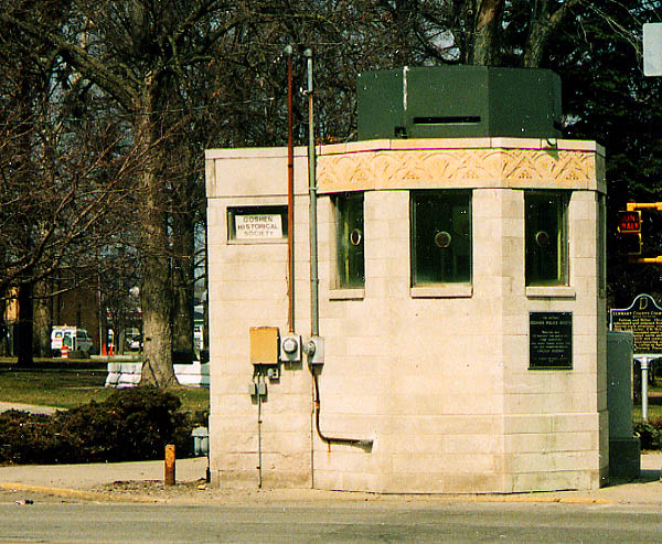
Above right picture - Goshen Police tower. This octagon brick
structure was built in the 1920s due to all the gangsters (from
Chicago?) that were "terrorizing" Goshen's banks back
then. If you look closely you can see some signs in an attempt
to save/show it's significance.
Laura Coyle, Community
Development Program Coordinator for Goshen, Indiana, e-mailed
me in October, 2003 with the real reason for the Police Booth
-
The police booth, for example, was erected IN CASE gangsters
came through on their way across county, using the Lincoln Highway.
Some of them were from Chicago but others didn't really have
a home... John Dillinger was the worst fear because he did hit
on some of the banks in surrounding communities. But by the time
the police booth was erected (1939) Dillinger had been in the
ground 5 years... news traveled slower than the gangsters back
then.
Thanks for the info/correction Laura.
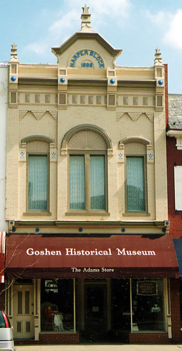
Left picture - Goshen's Historical Museum in the restored Harper
Block building (from 1898)
All three pictures from March, 2003
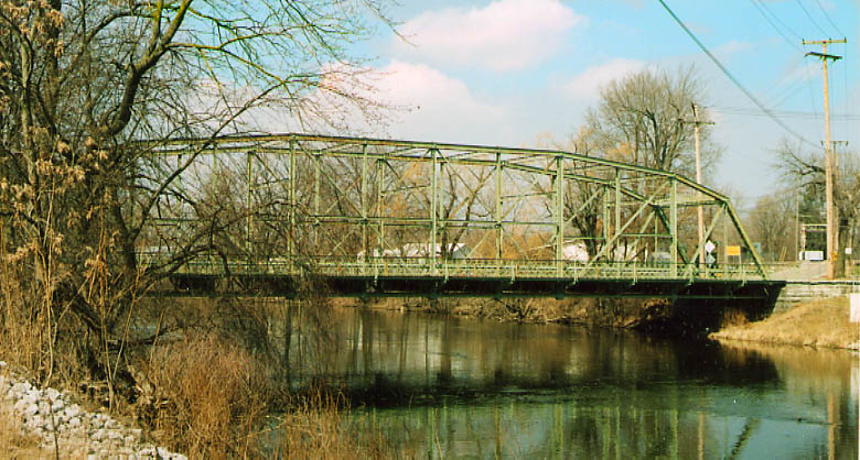
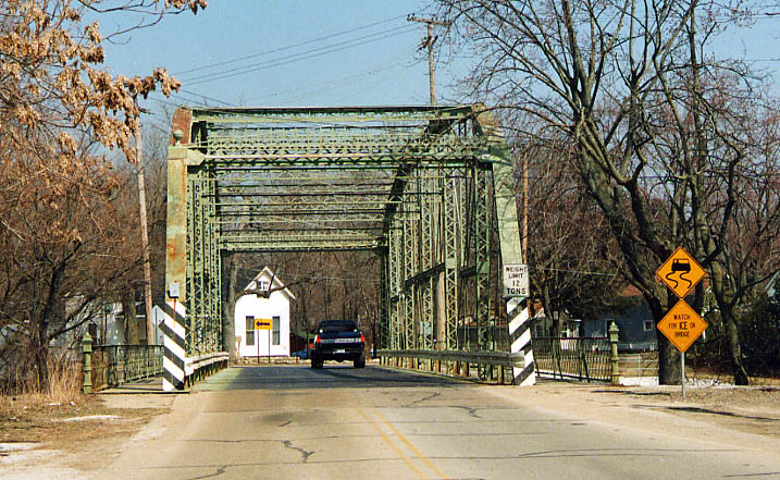
I don't think this bridge has anything to do with the Lincoln
Highway, but it has a nice story (and is right next to an old
LH alignment)
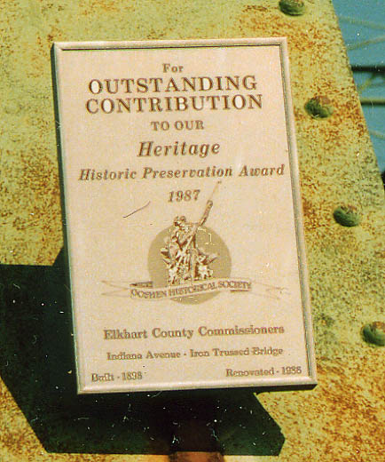
This Iron Truss bridge was originally
built in 1898(!), and was refurbished in 1986. Unlike the Ft Wayne
bridge refurbishment, this one was done so well, it received a
plaque from the Goshen Historical Society commerating the work
done (see right).
Indiana Ave at Chicago Ave
in Goshen, all three pictures from March, 2003
Page created on July 24, 2003/last updated on October 7,
2003
Questions, comments, and submissions can be sent to Sandor
Gulyas
Go west to 1913 Route West Photo page
| Go East to Ft. Wayne LH Photos | Return
to Indiana LH page

