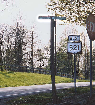
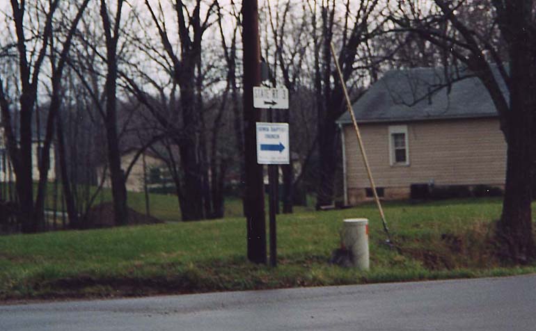
No, this street doesn't make it to Columbus. It could just be wishful thinking of a nearby homeowner since that is not an "official" Delaware County street sign as well. Near the intersection of Oh 656 and 521 in Olive Green.
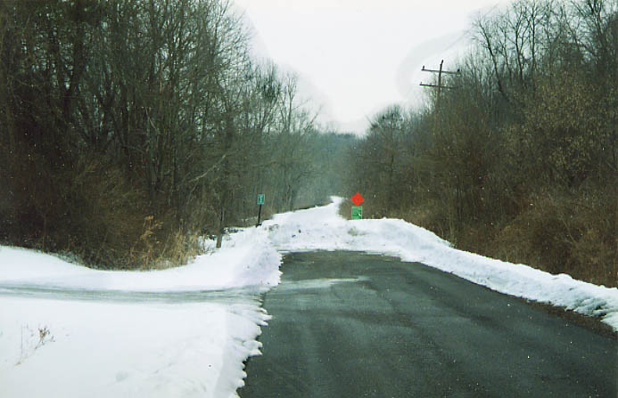
For those keeping score, Oh 521 ends 50 ft. behind where this picture was taken.
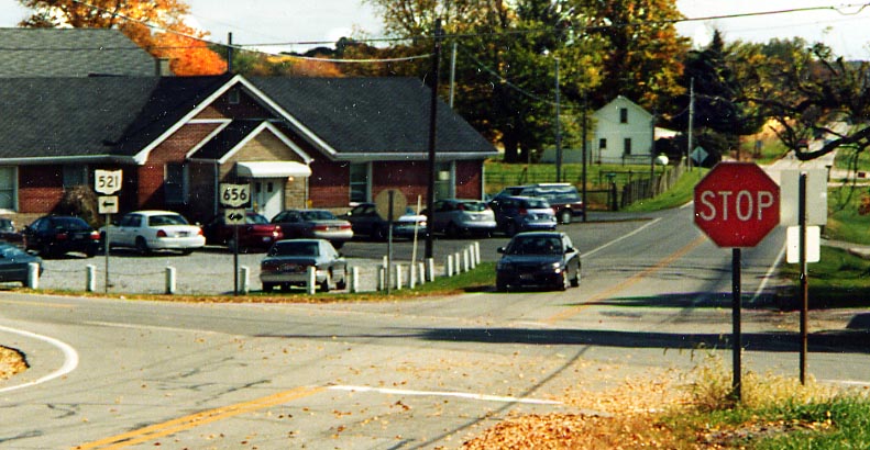
Speaking of the end of Oh 521, here it is at Oh 656 in Olive Green. (Photo from October 2003)
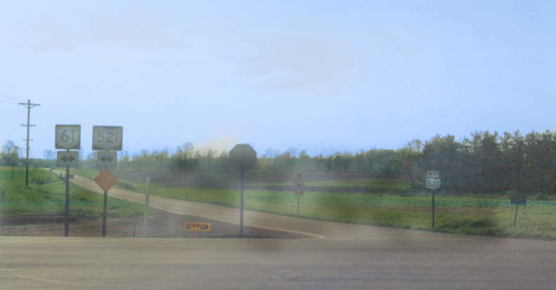
The shield in the foreground (left) suggests you have to turn left or right. The shield to the distant right suggests you can go straight. The lack of a straight crossroad here is due to either lack of eminent domain, or 19th century superstistion. Intersection of Oh 61 and OH 521 near Olive Green.
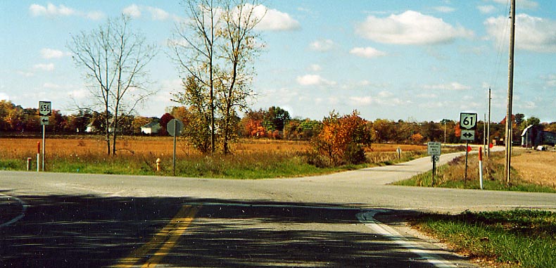
2 miles south of all the above photos is the south end of Oh 656 at Oh 61.
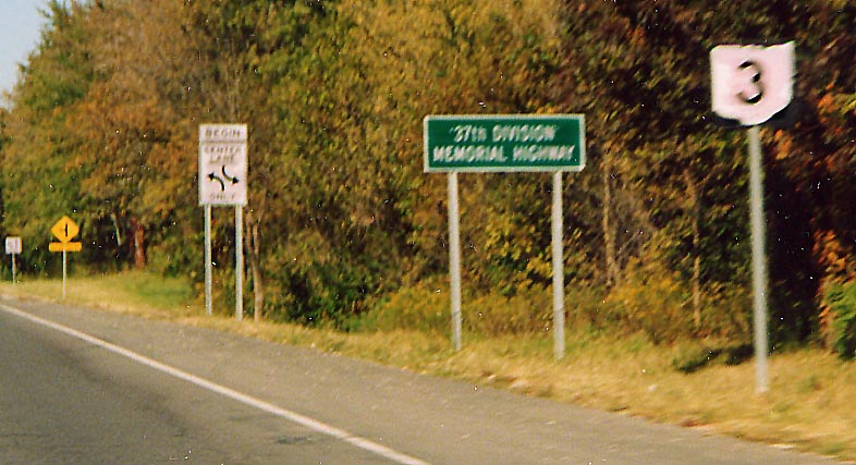
I thought US routes were supposed to get preferential treatment over state routes. So why does OH 3 get mentioned, but not US 36? Intersection of US 36-Oh 3 and Old US 36 - Oh 3 (named Old 3C Hwy in Delaware County) at the NE corner of Sunbury.
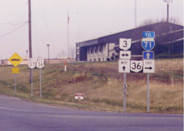
A downgrade for US 36? Technically it is in the books as Ohio State Route 36. Of note in this picture also the correct reassurance assembly in the background: A state route is posted to the left of a lower-numbered U.S. route, and the directional banners overlap the route markers. And yes the state shield overlapping directional banners have long since been corrected. Intersection of US 36, Oh 37, and Oh 3 in Sunbury
The Strange Case of Oh
605
The decade of the 1990s was rough on
this route. Oh 605 got cut down to the north from US 36/Oh 3,
in Condit, to OH 37 in 1994, in conjunction with the Oh 750 extension
from Oh 315 to I-71. In 1997 the southern end was left hanging
with completion of the New Albany bypass and the rerouting of
Oh 161 with it. The following photos (from October, 2003) document
the northern end of this route.
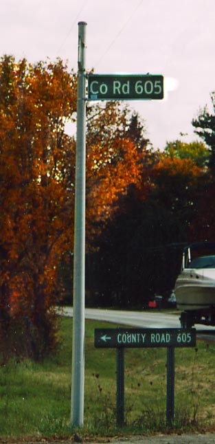
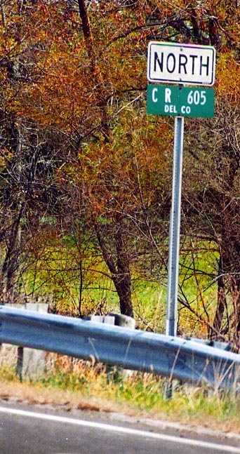
Photo on far left -
The most recent style of Delaware County road markers is used here to alert traffic on Oh 37 of the renamed and downgraded Oh to County Rt 605. Beneith it, is what the county used to notify drivers of the route change before the new signs, above, were installed.
Photo on left -
When Oh 605 was cut back, the state route shield was removed but the directional marker was left behind and a county road sign was installed to go along with it.
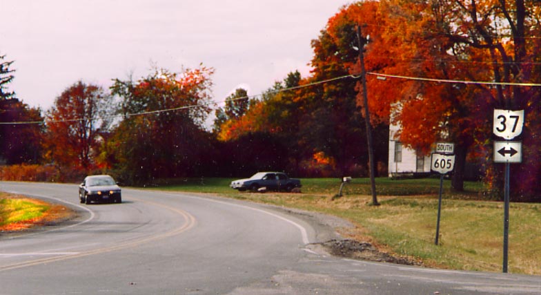
The current north end of Oh 605. Where the car is parked on the north is a former routing for Oh 605 (it used to do a right-left curve combination with Oh 37 till the 1960s).
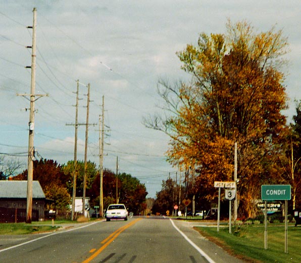
The former north end for Oh 605. The state left the Junction US 36-Oh 3 shields behind, but no one (county responsibilty now?) has come to replace the missing US 36 shield above. (All the Oh 605 series photos were taken in October, 2003)
And here is the southern end of Oh 605 in New Albany (actually in Franklin Co). The crossing road here was designated as Oh 161 till the New Albany bypass was completed in 1997. (Photo taken in January, 2004)
The Galena Post Office. In opperation since the 1800s.
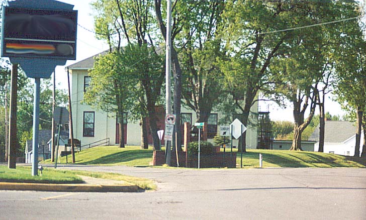
In the middle of the photo is a sign that tell drivers to bare right to head towards Sunbury. One would be following the original route for Ohio 3 (aka 3-C Highway) in that direction. If you bare left, you turn onto County Rd 34 (S & N Galena Rds) and head towards Berkshire and eventually Ashley, both in Delaware Co. I think the building in the middle (behind the trees) is the former Galena school, but I'm not certain.
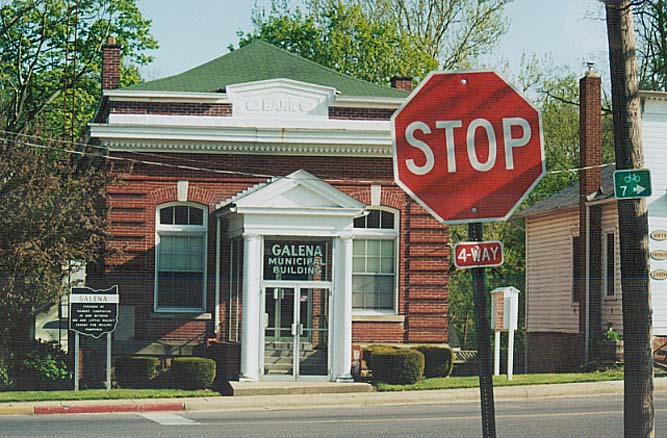
The former Galena Bank now houses the government offices of Galena. Also in this picture is a historical marker for Galena (to the left of the "bank") and a small marker on the far right directing those following Ohio Bike route 7.

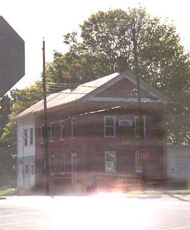
Unlike the other buildings, the history for this building is less obvious. However, due to it's design I can surmise that it was a 19th century tavern or hotel. Now it holds several businesses (a lawyer and maybe a doctor). Along the west end of Galena town square. (Photo from Feburary, 2003)
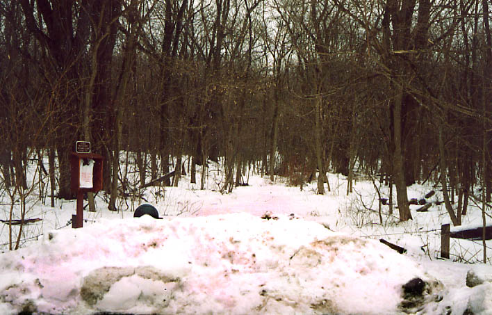
These trees hide what would been the original routing for Sunbury Rd heading south from Galena. Sunbury Rd got rerouted due to the construction of Hoover Reservoir in SE Delaware County and NE Franklin County. (Photo from Feburary, 2003)
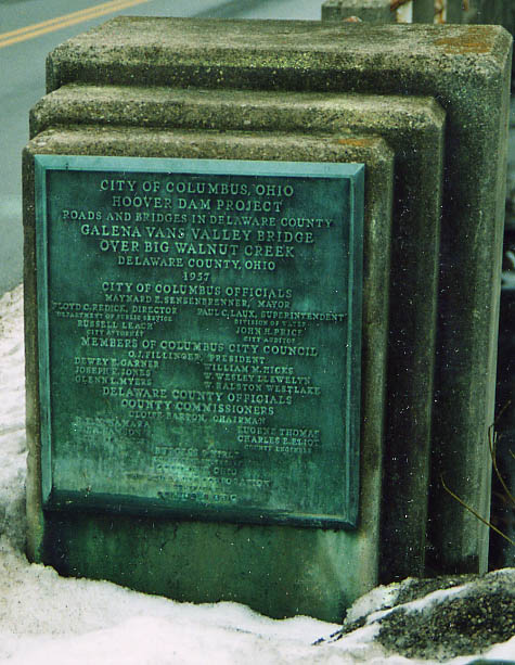
This placard is on the end of the "new" Sunbury Rd bridge built to cross Big Walnut Creek/Hoover Reservoir in 1957.
Van Valley Rd evidently used to cross here before the advent of Hoover Reservoir, for it currently ends at (the rerouted) Sunbury Rd on east end of this bridge (outside of Galena).
Photo taken in Feburary, 2003
Sunbury Rd wasn't the only road that got rerouted due to Hoover Reservoir. Oh 3 also got rerouted (twice) on the west side of Hoover Reservoir. This was the first routing of Oh 3 and just beyond where the white ribbon disappears it will run into Hoover Reservoir. The road that replaced this one would also soon get bypassed by an "Super 2" in 1957 as well. (Photo taken in Feburary, 2003)
This directional sign has been up as long as I can remember so I don't know who originally made it (homeowner, county, state?), but it serves as reminder for motorists wanting to continue north to Sunbury & Mt. Vernon to turn right and head over 1/4 mile to continue their trip. At the intersection of Worthington & Lewis Center Rds in SE Delaware County
Sometime after the turn of the millenium, someone decide to give a name to Oh 3. This sign is located in Southern Delaware County, just pass the northern edge of the Westerville Corp. line (Photo from September, 2003).
Page created on November 25, 2002, last updated on April 7, 2004
Questions, comments, and submissions can be sent to Sandor Gulyas
Return to Delaware County Photos