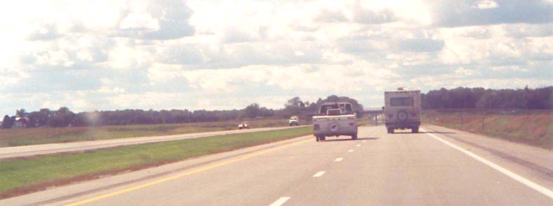
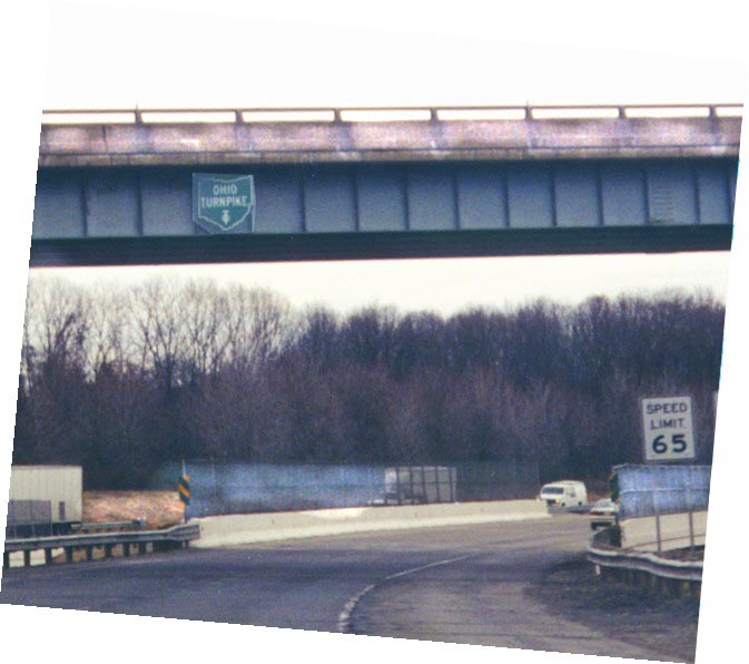
This is pretty much what the whole section of the Turnpike west of Toledo looks like.
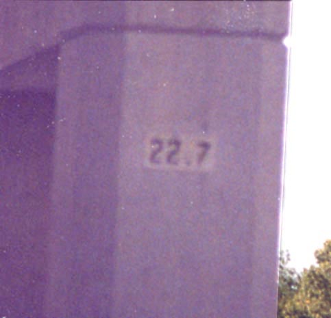
Overpass milemarker on the Ohio Turnpike - These signs are found on the structures of the overpasses over the Turnpike (this one is 22 miles from the Indiana border). The Turnpike also labels tenth-miles with tiny signs under every other road reflector.
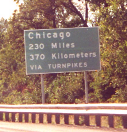
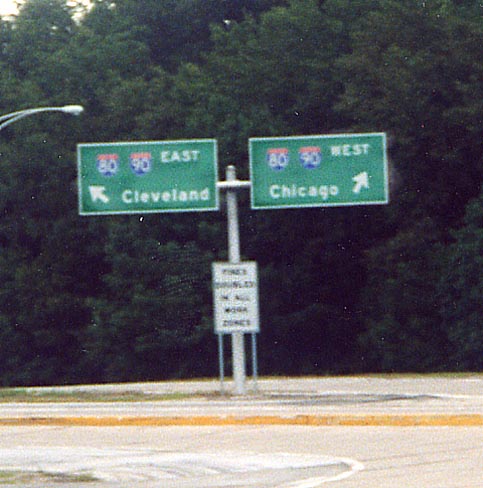
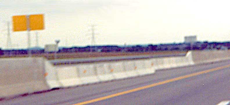
Distance sign for Chicago on the Turnpike. A similar sign exists in the opposite direction for New York City.
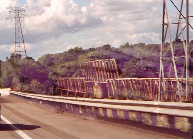
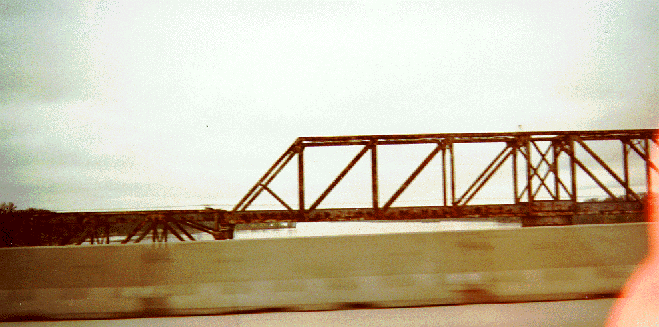
Top Picture - The train bridge (structure on the right)
used to carry a Toledo Terminal track, but now carries nothing
and hasn't since the 1980's.
Bottom Picture
- Partial view of the truss bridge looking across
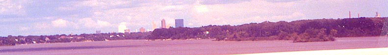
You may see this view of the Toledo skyline if you look upriver over the Maumee (to the right, north).
Exit 4A/64: The I-75/Ohio 795 interchange south of Toledo. Information about this interchange is on this page.
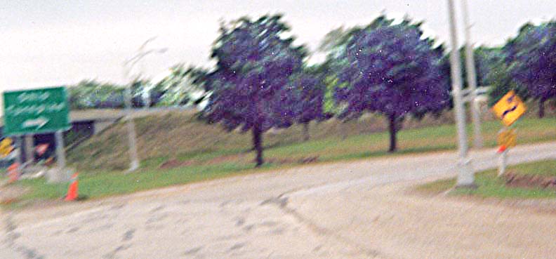
Although the photo is blurry, it's possible to see a Turnpike entrance sign on the left and a diamond sign with a question-mark-shaped legend on the right. At Exit 91/6 (Ohio 53)
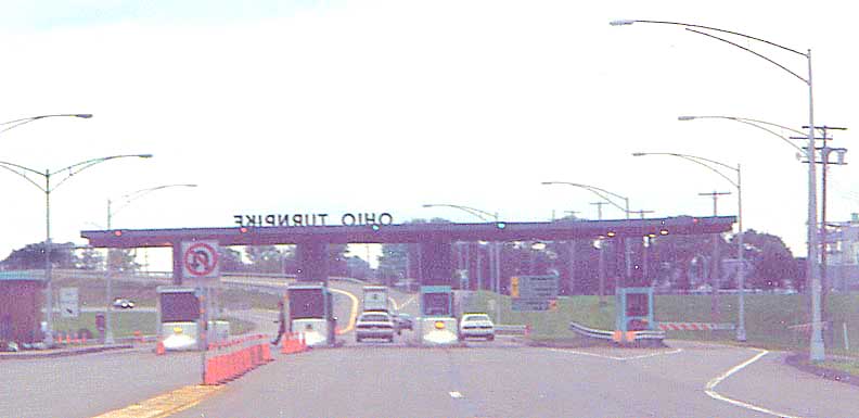
Toll booth (newer style) At Exit 91/6 (Ohio 53)
An older style of toll booth is shown in the Exit
118/7 entry.
The destination signs one would see west of Cleveland on the Turnpike access ramps. At Exit 91/6 (Ohio 53)
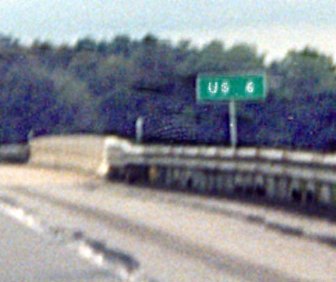
Turnpike overpass road signage (in this case for US 6)
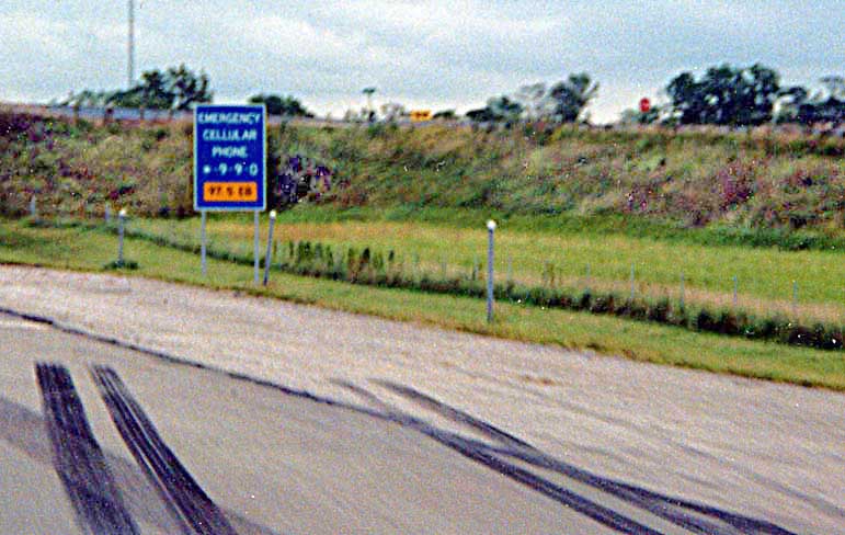
Turnpike emergency cell phone number sign
Note
these signs include the mile to the tenths place beneith the cell
phone number for assistance.
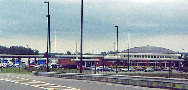
Many service areas on the Turnpike are being renovated to provide better facilities (for details, see this page). This is the Commodore Perry Service Area at Mile 100.0 eastbound. This page has a photo of this service area, and this page has a photo at the bottom of another recently-renovated service area.
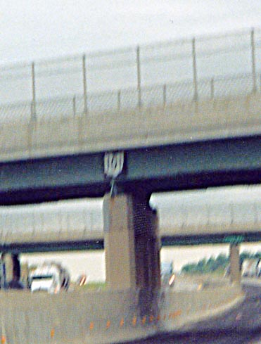
US/State route signage on underpasses (in this case, Oh 101). When the Turnpike was first built, markers identifying overcrossing routes were placed on the overpasses of those routes. They were removed during the 1980's. Now, they, along with signs for unnumbered streets, are going up again on portions of the Turnpike where the third lane has been completed.
Authorized vehicle crossover - The style of these is different than those on other Ohio freeways.
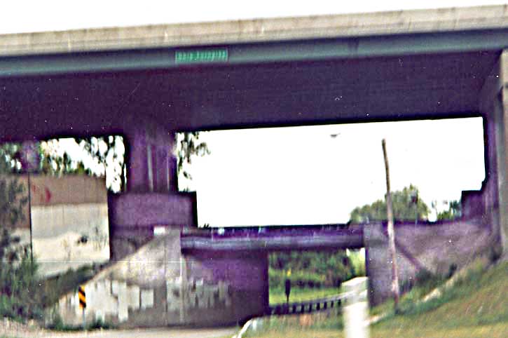
Three-level Ohio Turnpike/Norfolk Southern railroad/Kelley Road crossing. This interesting crossing occurs just west of US 250 (map). Notice that even though the Turnpike is much higher than Kelley Road, it still gets a new-style identifier.
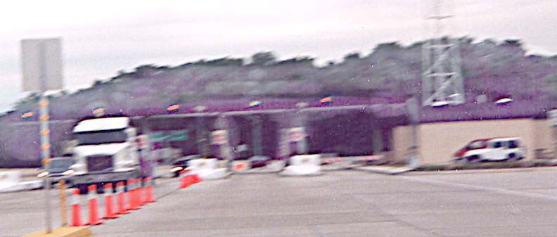
Exit 118/7 (US 250): Toll booth (older style)
The older-style toll booths on the Turnpike included the Turnpike name in block letters on top of the booth. The Official Ohio Turnpike website now has another example of one, soon after the Turnpike opened, on its pages. The newer style is shown in the Exit 91/6 entry.
The Ohio Turnpike exit-number conversion
The Ohio Turnpike completed a conversion from consecutive exit numbers to mileage-based ones in 2002 (see this page for details). During the conversion, the Turnpike had installed exit tabs with the word "EXIT" and the new number, and a tab with just the old number immediately to the right, so that when the conversion is over, workers can simply remove the number-only tab and realign the permanent tab.
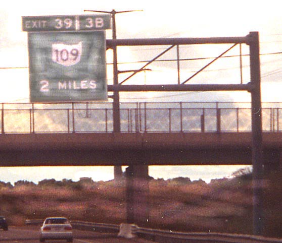
Exit 39/3B (Ohio 109) - Sometimes the combined width of the two tabs is greater than that of the main sign.
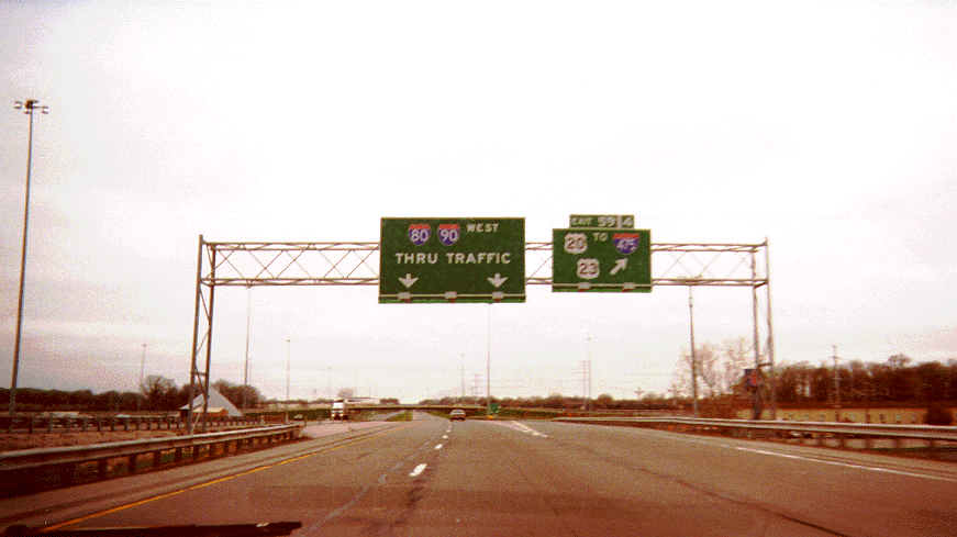
Exit 59/4 (US 20) on the south side of Toledo (the placement of the US 23 shield can lead to some doubt as to its location). The ubitiquous "THRU TRAFFIC" pictured on the sign on this and the following photos is being replaced gradually by actual destination names (thanks to J. Choate).
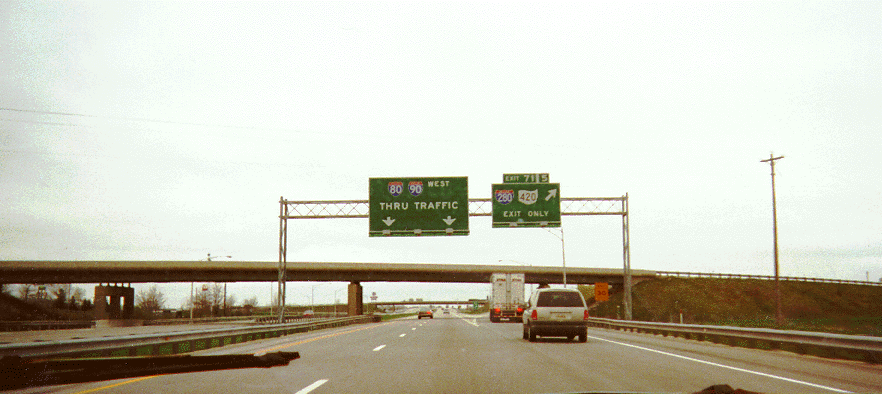
Exit 71/5 (I-280/Ohio 420) southeast of Toledo
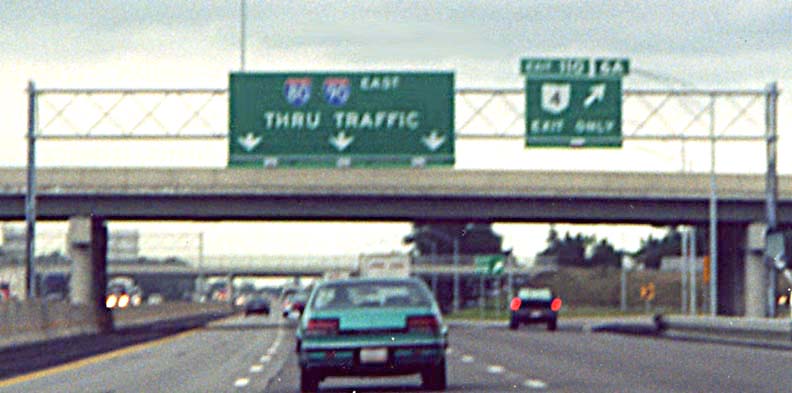
Exit 110/6A (Ohio 4) - Another example of a wide double-tab.
The Ohio 21/I-77 interchange was remodeled in 2001-2. Information about this can be found on this page.
At the point where Interstate 271 crosses the Turnpike, the roadways of the Turnpike are separated by about 50 feet of elevation. The underpass in the picture is the eastbound roadway (note the older version of the Turnpike sign, complete with an "O" on top of a "T"), and the overpasses just beyond it traverse the westbound roadway. The old sign is now gone due to the rebuild of the overpass to accomodate the third lane.
The western Cuyahoga River bridges
Vista approaching the river
The new eastbound bridge
In the distance is the arch bridge carrying Olde Eight Road (old Ohio 8).
For more information about the rebuild, go here.
There are also Ohio Turnpike trailblazers to help direct travelers to the turnpike. They can be found on the following pages:
Port Clinton on old Ohio 53
The arrow is on a disk which can be rotated to make
the arrow point in any direction.
Conneaut on Ohio 7 (Mentioning that it's 63 Miles ahead!)
Lorain at the Interstate 90/Ohio 2 (western) split. From here, I-90 follows the Ohio 2/Ohio Turnpike connector (map).
The "bump" between I-76 eastbound approaching the Ohio Turnpike and I-80 near Youngstown
Other pages with Ohio Turnpike photos:
Day 1 -- Ohio Part 1 , Day 1 -- Ohio Part 2 and Day 2 -- Ohio from Chris Saylor's 2001 Roadtrip
Ohio Gateway featuring Interstate 76 and Interstate 80, from AARoads - Andrew Field and Alex Nitzman
Ohio Turnpike [photos] by Bill Burmaster
Ohio Road Photos by Adam Prince
Bridges at Implosionworld.com
This book has reprints of official photos of the Turnpike while under construction.
This page created Thursday, July 19, 2001/Last revised March 1, 2006
Comments and suggestions about this page can be sent to Sandor Gulyas or Marc Fannin
Return to Northeast Ohio Roads or Northwest Ohio Roads or The Ohio Turnpike exit guide