
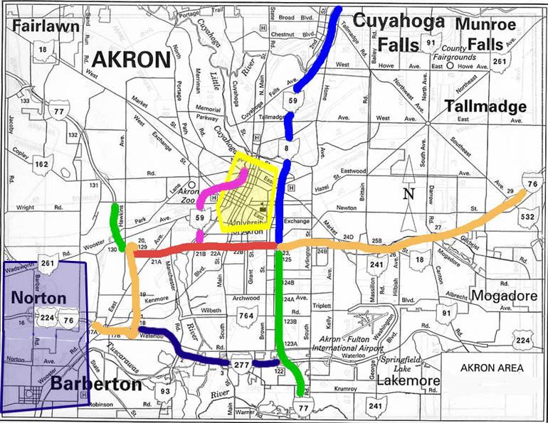
Click on the colored line or region of your interest (or follow the links below the map)
Akron Map 1962
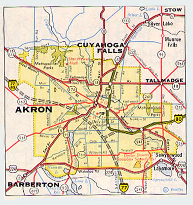
Although the Central Interchange (the current I-76/I-77/Ohio 8 interchange) was built to accomodate southward and westward extensions, which ultimately were built, I-80 is shown branching to the southwest before reaching the Central Interchange and connecting with an I-77 which was to take a much more sweeping route through Akron than it does today.
See also the 1957 proposal, which include an I-79.
Links
Akron Beacon Journal traffic reports
Akron Metro Area Transportation Study
ODOT District 4 - Covers Akron
Innerbelt Integration Initiative (Proposal to keep the Akron Innerbelt and expand it(?))
1963 Freeway Plan for Akron (Requires Adobe Acrobat to read)
Roadfan Stuff by John N. Dziurlaj
Book: Written on the Hills: The Making of the Akron Landscape by Frances McGovern (University of Akron Press) - Historical essay which includes mention of the street pattern. (Roadfan.com does not necessarily endorse any business) Thanks to Tom Bates, who also pointed out the Akronism of "devil's strip" as a term for the space between the street and the sidewalk
Akron's own Y-bridge, All America Bridge (the more famous one on Ohio is in Zanesville)
Page created on December 29, 2002/Last updated on July 3, 2006
Questions and comments can be sent to Sandor Gulyas or Marc Fannin
Return to NE Ohio Roads