
Click on the colored region of your interest (or follow the links below the map)

Links
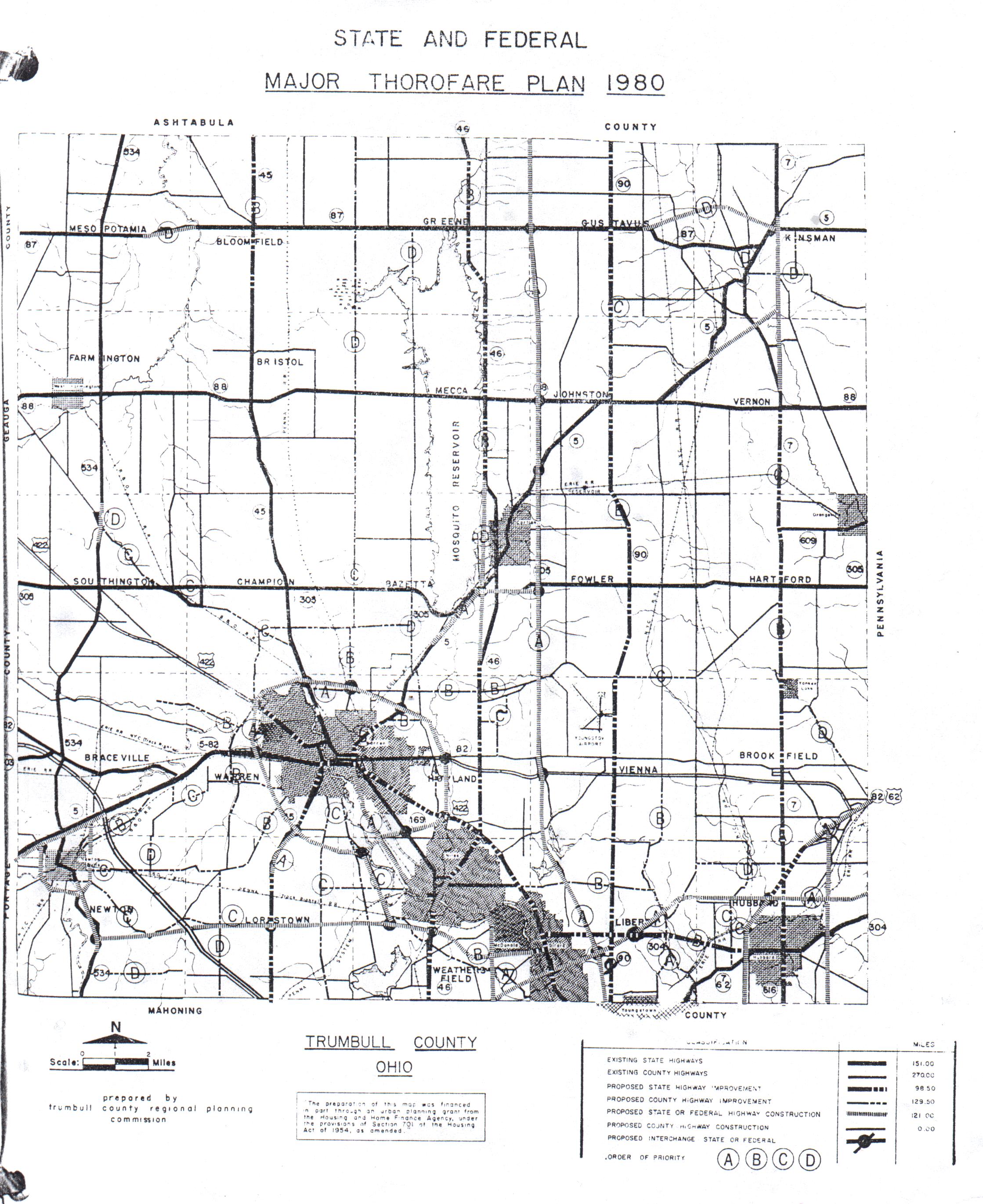
1961 Trumbull County Comprehensive Plan: "State and Federal Major Thorofare Plan 1980" (801K)
This map by the Trumbull County Planning Commission shows plans for many highways in Trumbull County. Some were built, some weren't (compare to this map of Trumbull County today, part of the official Ohio DOT transportation map). This was contributed by Mahoning Valley resident Matt Walcoff (read his comments about it here).
See also the 1958 Interstate proposals for Ohio, which include an I-78 and an I-84 in the Youngstown/Warren/Sharon area.
Eastgate Regional Council of Governments - Mahoning and Trumbull Counties Metro planning agency
Trumbull Co. Planning Commission
Page created on December 31, 2002/Last revised July 3, 2006
Comments, questions, and submissions can be sent to Sandor
Gulyas or Marc Fannin
(Both of us also would like to thank Matt Walcoff
for his submissions to help flesh out this portion of our site)
Return to NE Ohio Roads