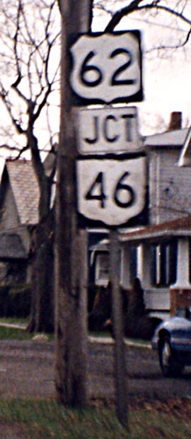
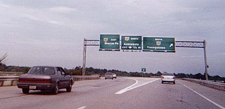
For unknown reasons, the "JCT" banner was placed
in the middle of this assembly rather than on top.
On
US 224 westbound in Canfield
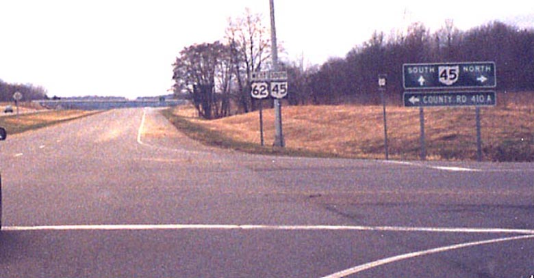
Ohio 45 joins US 62 on the Salem segment at a signalized intersection (foreground), then both exit at a diamond interchange immediately after (background) and the highway continues as Ohio 14 F. The large exit sign for the interchange off-ramp is obscured somewhat by a tree next to the highway. (for more see the Stark Co. page)
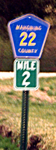
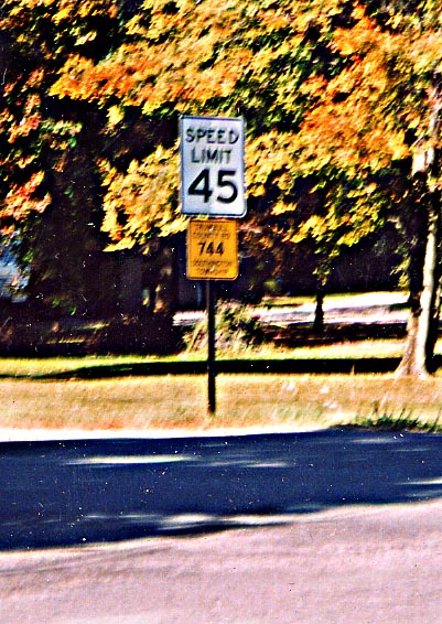
Mahoning County only signs its highways at one-mile intervals
above milemarkers.
On Courtney Road Eastbound
northwest of Sebring, near Alliance
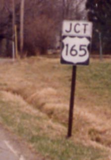
Occasionally U.S. highways in Ohio are posted as state highways
(see the Geauga County page). Here
is a state highway posted as a U.S. highway.
On
Courtney Road (Mahoning County Road 22) Eastbound north of Beloit
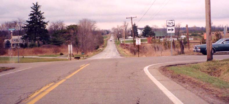
Where Ohio 165 turns from north to east just west of Ohio 534
and Ohio 14 there is this assembly with the oversized right arrow.
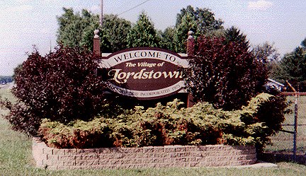
Lordstown is the home of a large auto plant along the Turnpike. Contributed by Matt Walcoff
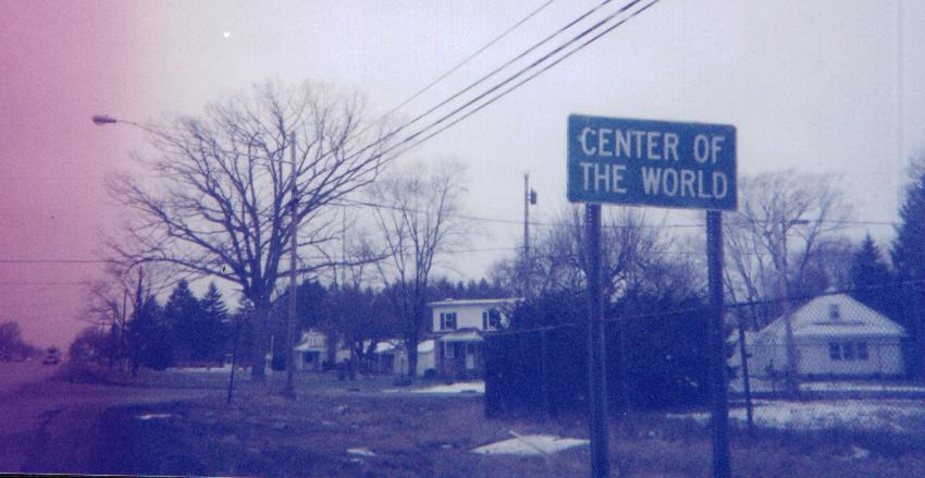
Center of the World, Ohio, at the western intersection of Ohio 5 and Ohio 82 between the Turnpike and the Warren bypass. Matt Walcoff explains the name:
In case you're curious, the area's name comes from an eccentric store owner who painted the words on the side of his building. When the railroads came through, putting him out of business, he moved to a house he called "End of the World."
Contributed by Matt Walcoff
Warren
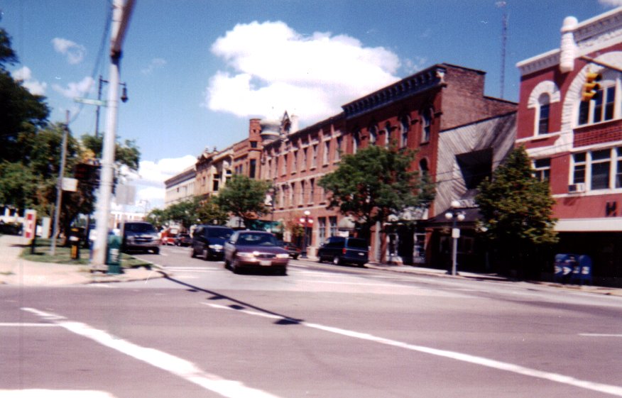
Warren streetscape - Contributed by Matt Walcoff
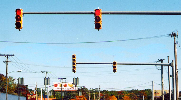
The second set of traffic lights in this photo is a rarity in Ohio, a 5 light vertical traffic light assembly! Normally Ohio uses a "dog house" style for 5 light assemblies. On US 422 in NE Warren (Photo from September, 2003)
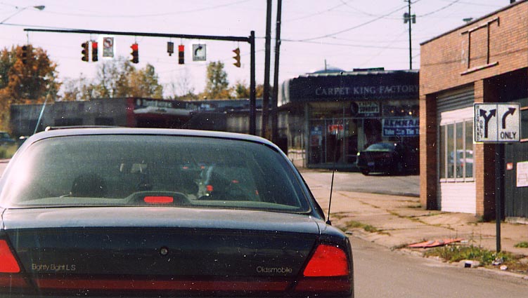
The directional sign on the right is sort of misleading. Even with the text it appears one can turn left, when in actuality you can either go straight or turn right (see the No Left Turn sign with the traffic lights on the upper left?). A strange make up. Intersection of Highland, South (US 422), and Market Sts (US 422, Old Oh 5 & 82). Photo from September, 2003.
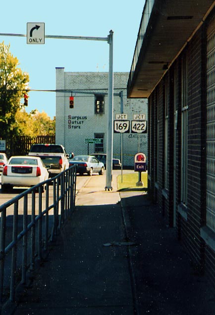
Left Photo: New shields and new error. That should be
US 422, not a state route (though Warren has been devalued as
well in the last 30-40 years)
Right Photo: The
north end for Oh 169. Oh 169 joins with US 422 for it's last couple
of miles through Warren (Both photos from September, 2003)
Ohio 82 Eastbound at Ohio 11 east of Warren - Contributed by Matt Walcoff
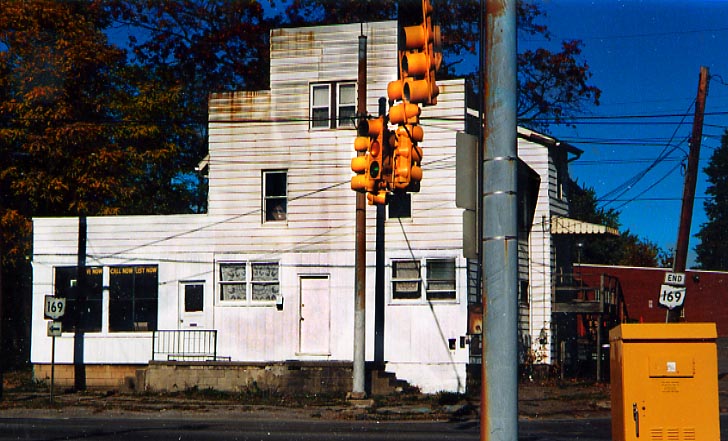
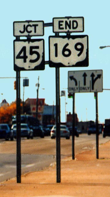
With the north end of Oh 169 in Warren, the south end of Oh
169 is at US 422 in McKinley Hts (east of Niles).
Interestingly,
US
422 was always routed as a bypass of Niles, while Oh
169 was the through route to Niles.
And how
does one removed the lense covers on a traffic light? I notice
4 missing in this photo. (From September. 2003)
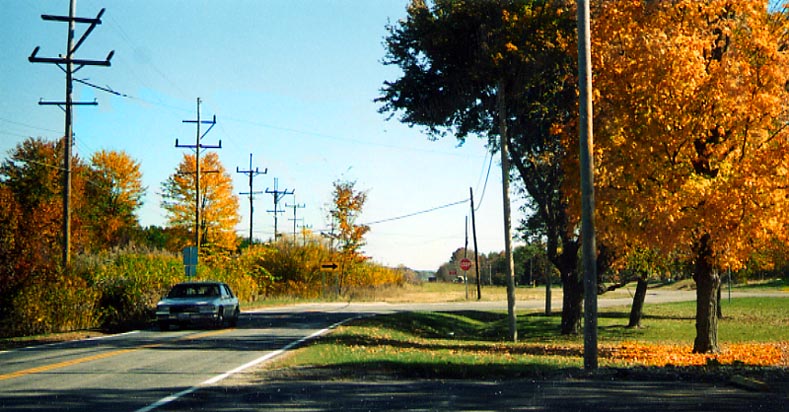
Northwest of Warren, there is a former routing of US 422 from Southington to Delightful and is quite open to traffic. (Photo from September, 2003)
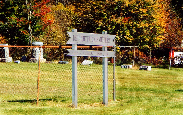
Speaking of Delightful. Is there anything Delightful about
a cemetery? Yes, boys and girls this does exist along Warren-Burton
Rd (Old US 422, see above).
Photo from September,
2003
 The standard Trumbull
County roadsign. (Photo from September, 2003)
The standard Trumbull
County roadsign. (Photo from September, 2003)
Links
The I-76/I-80 Corridor Study by ODOT District 4
Page created on December 30, 2002/Last revised January 29, 2004
Questions and comments can be sent to Sandor Gulyas or Marc Fannin
Return to Youngstown Virtual Roadtrip or The Western Reserve Photo Index