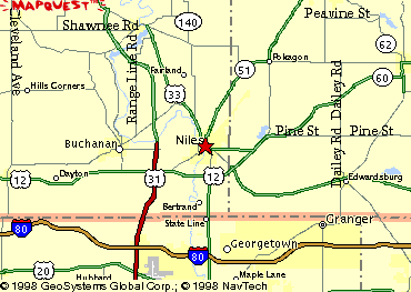
The yellow areas (cities) not labeled are as follows:
- Northwest corner: Baroda
- Near north edge, just east of US 31: Berrien Springs
- North edge, near northeast corner: Dowagiac (pronounced doh-wah-jyak)
- East edge, jct. M-60 and M-62: Cassopolis
- Southeast corner: Northwest extreme of Elkhart, Indiana
- South edge: Northern fringe of South Bend, Indiana
- Southwest corner: New Carlisle, Indiana
- West edge, on US 12: Galien
- The boundary outlined in red is the Michigan/Indiana state line, and the
north-south stream is the St. Joseph River.
This page spun off May 31, 1998/Moved to XOOM November 2, 1999/Last revised November 2, 1999
Back to Routes in Niles, Michigan
