Did you find what you needed from this page? Let us know! musxf579@hotmail.com sgulya1@cox.net
Jump to Interstate Yellow Book information
Go to information on the current Interstate system
Interregional highways were to be a series of routes which resembled the later Interstate Highway System. The system also resembled today's National Highway System (which includes all Interstates). The plans imply that the highways would employ the existing route designations at the time. This system was never implemented.
The source for this page is Interregional highways. Message from the President of the United States, transmitting a report of the National interregional highway committee, outlining and recommending a national system of interregional highways by the National Interregional Highway Committee, US GPO 1944, Library of Congress call number TE23 .A5 1944 (more info)
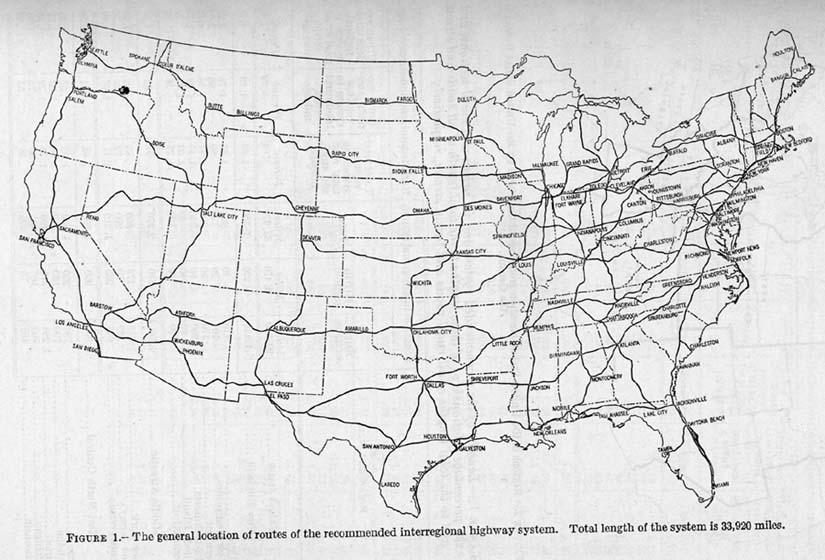
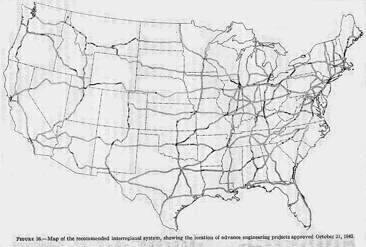
Map 1 -- The proposed recommended system
Map 2 -- Comparison of the Secretary of War's Strategic Highway Network from May of 1941 and the proposed interregionals
Map 3 -- This is a meshing of three proposals
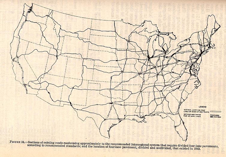
Map 4 -- Capacity concerns
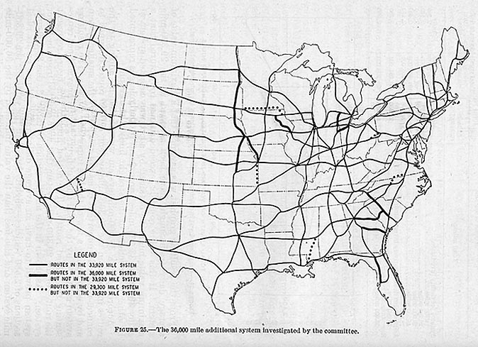
Map 5 -- Larger proposed system (selected routes from system in Map 6)
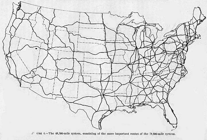
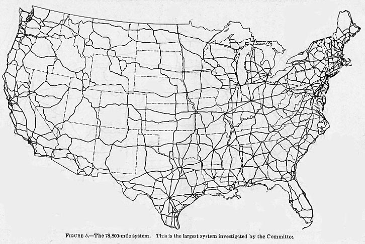
Map 6 -- Largest proposed system
Map 7 -- Proposed recommended system (Map 1) with upgrade locations
Toll Roads and Free Roads
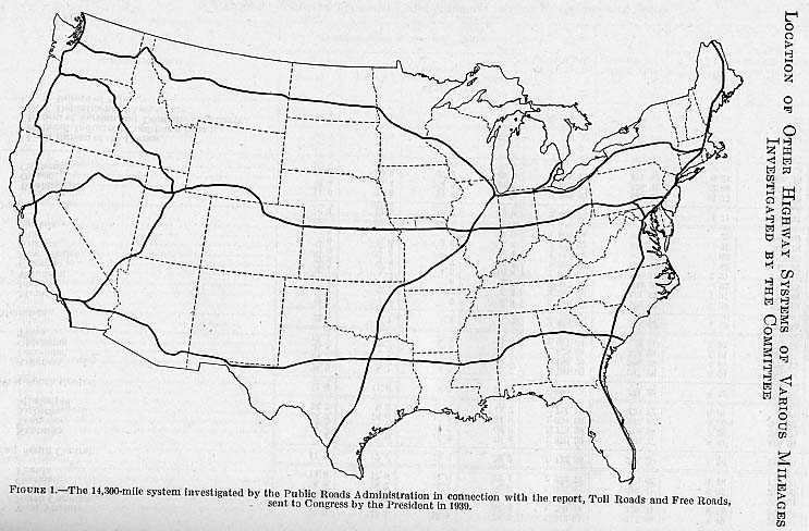
Interregional Highways was related to an earlier publication, Toll Roads and Free Roads (1939), and both of these were influenced greatly by Herbert S. Fairbank (see this page for details). Because of the correlation, some material from Toll Roads and Free Roads was included in Interregional Highways, including the following maps:Map 1 -- Smaller proposed system
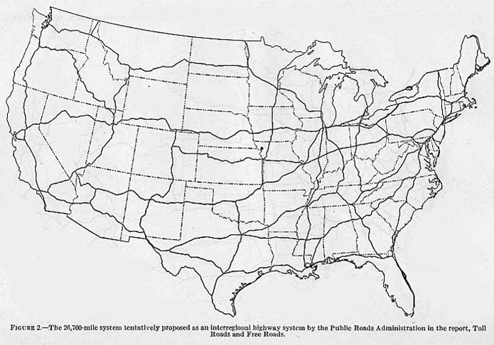
Map 2 -- Larger proposed system
The "Yellow Book", official title General location of national system of interstate highways, including all additional routes at urban areas designated in September, 1955 (go here for more information), is the original plan for the Interstate system. No numbers were assigned to the highways at first. Adam Froehlig has map scans from this book at http://www.ajfroggie.com/roads/yellowbook/ (the national map is also here on Roadfan.com if Adam's is down). The national map was also overlaid with two sets of planned route numbers, one from 1957 and one from 1958: See this page (the 1958 one is purported to be the finalized system, but contains some Interstates never actually signposted in the field). More information of this scope is at this page by Scott "Kurumi" Oglesby. Other official Interstate history may be obtained here.
This page created Monday, May 7, 2001/Last revised October 1, 2005
Return to the roadfan.com front page