
Note: This series of pages was originally part of the Corridor 5: Great Lakes/Mid-Atlantic Corridor page from the Congressional High Priority Corridors site by Andrew Field and Alex Nitzman. All commentary not attributed to Sandor Gulyas is Andrew's (except for minor alterations by Marc Fannin), and the design and graphics are also his. Comments may be sent to Sandor at roadfan@copper.net .

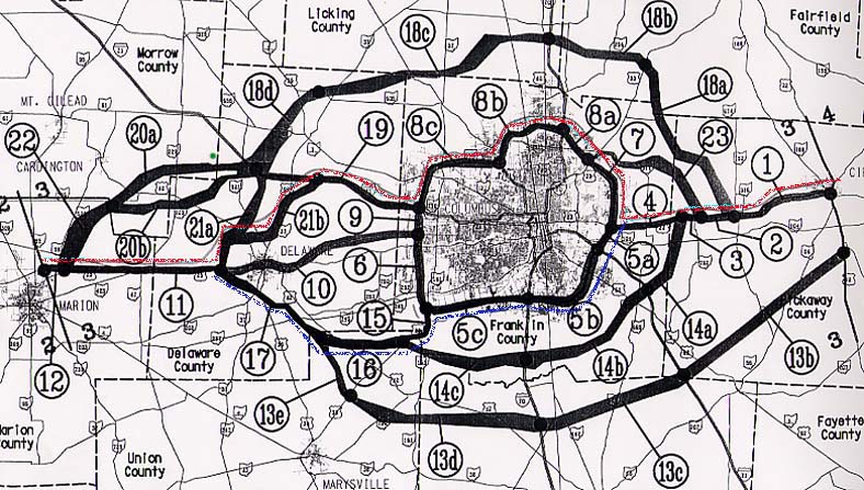
The section of Interstate 73 between Marion and Circleville was the most complicated section to plan. The red line is the final routing that was agreed on in 1996, and the blue line was the only other route that was under serious consideration when the map was completed in 1995. The west side of Columbus has a watershed that is protected (Big and Little Darby Creeks), so that all but eliminated any western routing, and the far eastern route would be too expensive due to all the new construction required. The question was whether to build along U.S. 23 and tear up all the businesses along it or multiplex it with Interstate 71. Note that Interstate 73 was not considered to be routed along Ohio State Route 315.
The following links connect to the six planning maps for each major segment of
Interstates 73 and 74 in Ohio:
Updated October 2, 2001; moved to roadfan.com October 2, 2001
© 2000 Andy Field Used by permission
