 |
|
 |
|
|
|
|
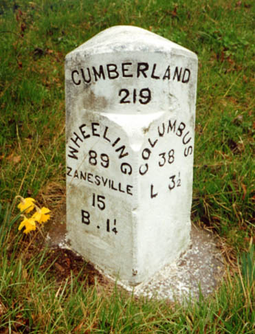
An original National Road milemarker in Eastern Licking County (L is for Linnville, B is for Brownsville)

Picture on left
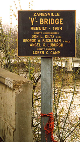
- Ohio Historical Marker for the Y Bridge
Picture
on right - County placard for the reopening of the Y-bridge
in 1984
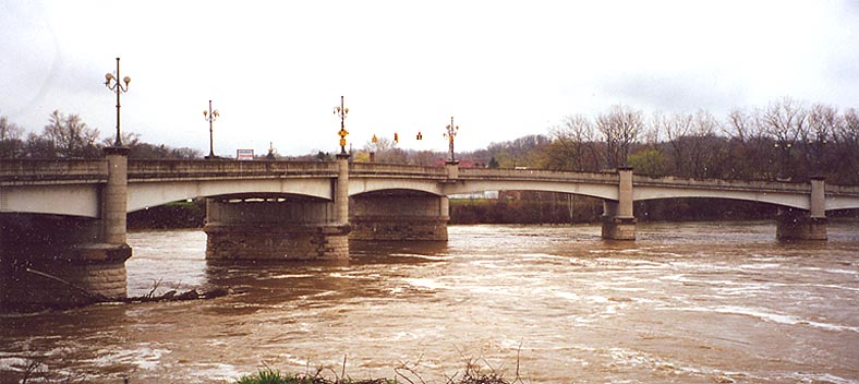
Photo of the Y-Bridge, looking SW
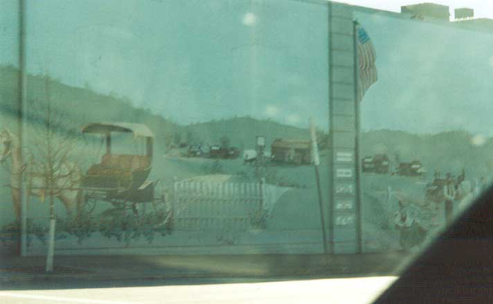
Zanesville started it's own streetscape program in 2001(?). Part of that program included painting this mural on the history of the National Road on the side of a building (along US 40 naturally). On the west end of the business district, looking east.
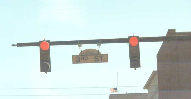
Black text on a yellow background (not FHWA standard) with a streetscene above the name on a Zanesville streetsign.
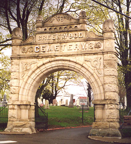
Entrance arch to Greenwood Cemetery on the eastside of Zanesville
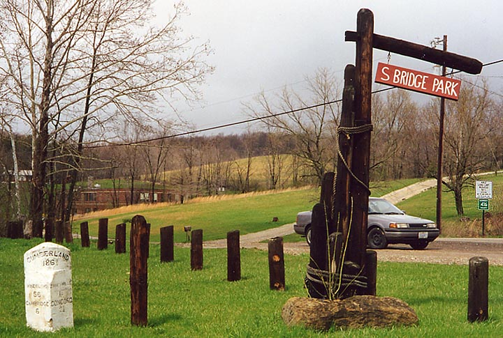
Sign on right announcing the park. Original National Rd milemarker on left. This is located between New Concord and Cambridge (though closer to the latter).
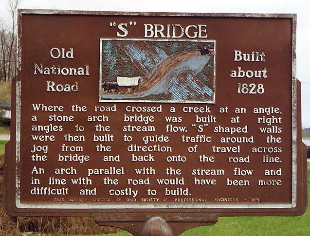
Ohio Historical Placard about S-bridges at the park, placed in 1953.
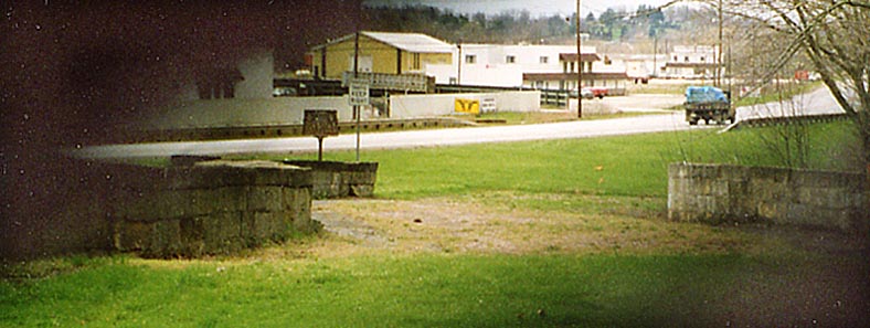
On the east end of the "S-Bridge" looking west across it to present day US 40-22.
Looking at a cross section of the "S-Bridge."
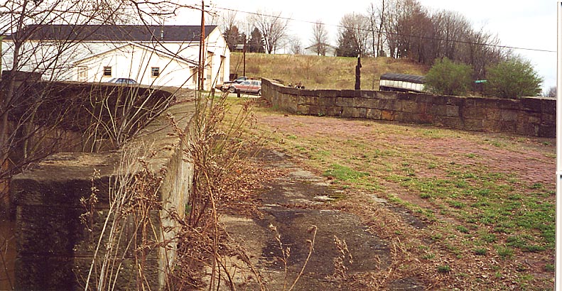
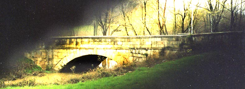
Close up of the bridge (looking east from the NW corner of it), alot of the brick roadway is still present.

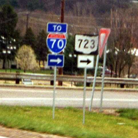
Ohio 723 is the name of the connector from I-70 to US 22/40 on the west side of Cambridge (map). It is one of Ohio's shortest state highways at 0.78 mile (see its entry on this page - Need Acrobat Reader to view it) and is marked minimally (and not identified on signs on I-70).
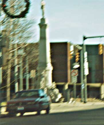
Statue remembering those who've parished for us (in front of the Courthouse)
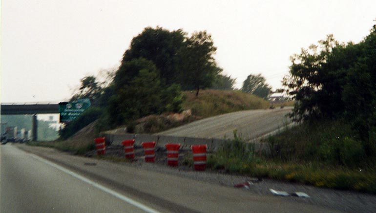
Between Hendrysburg and Morristown, the
original path for the National Rd and US 40 got paved over by
I-70 (map below).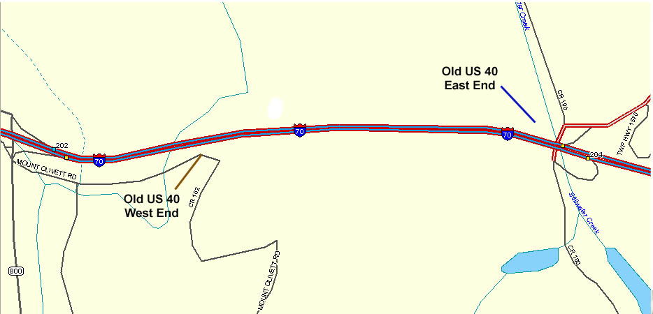 The
road to the right of Oh 800 (south of I-70) is the original routing
for Oh 8 from Old US 40. The split between the two ends is roughly
a mile.
The
road to the right of Oh 800 (south of I-70) is the original routing
for Oh 8 from Old US 40. The split between the two ends is roughly
a mile.
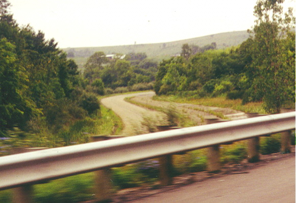
Photo above
- Here, the west end ofold US 40 narrows down and becomes part
of a pre-existing local road beyond the trees (not visible). The
westbound lanes (right) have been abandoned and only the old eastbound
lanes still carry traffic (on the Hendrysburg side).
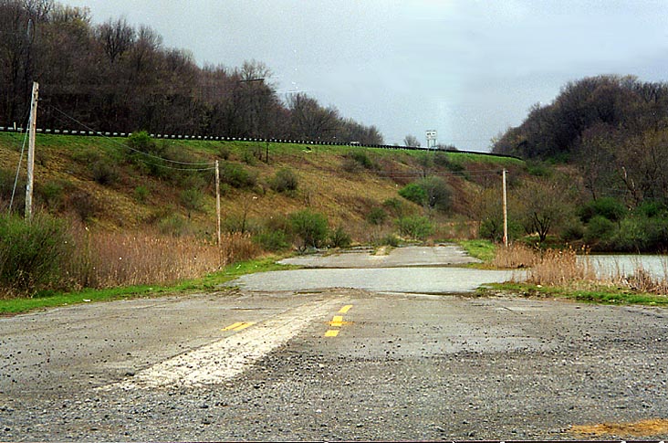
Photo
below - old US 40 simply stops dead at the embankment of I-70
and current US 40 (on the Morristown side).
![]()
Also at the east end is this abandoned medium tension wire pole. How it got left behind in this pond is beyond me (no others as far as the eye can see near this spot) [A contributor to this site mentioned that it may have been associated with a nearby strip mine - MGF]
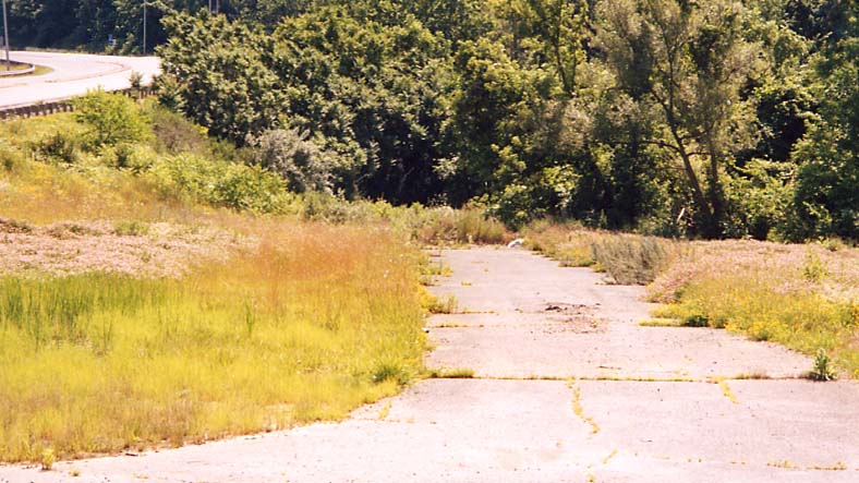
Mystery road - This goes east just north of the I-70 overpass. Current US 40 is visible on the left.
This follow information is courtesy of Malcolm Spence:
Blaine-Bridgeport (Ohio suburbs for Wheeling, West Virginia)
Blaine "S-bridge" rehab
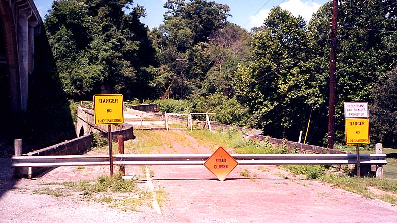
This bridge was being rehabed (2000-1), so access was cut short. Looking east from eye level with the bridge.
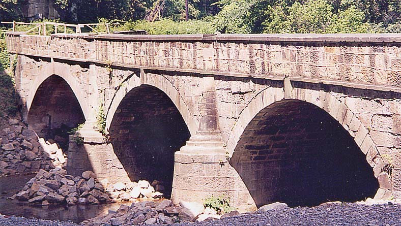
East side again but looking north at the side of the bridge.
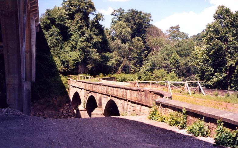
Another view of the bridge from the east end (in the shadow of the US 40 bridge)
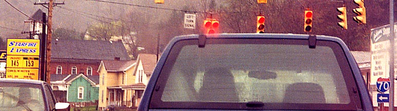
Double red traffic lights? Did someone
hang the light upside down? And both red lights go on and off
at the same time.
US 40 and a service road
to I-70 in Bridgeport
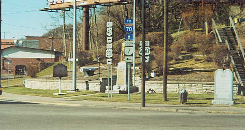
Overview of a collection of signs and
memorials at the NW corner of US 40-250 and access road to Oh
7.
(from left to right) An Ohio historical placard,
a cannon, route directions, a statue, a monolith, and some stairs.
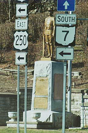
Picture on left -
Bracketed by route markers, memorial for fallen soldiers.
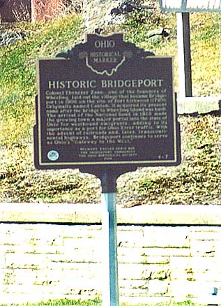
Picture on right - Placard about the history
of Bridgeport (for the state bicentenial), founded by Ebenezer
Zane
Other Regional National Road websites
Brian
Powell - Blaine Hill reconstruction Project
If you wish to follow the National Road on roadfan.com,
you can continue west to Licking
County or east to Wheeling,
W.Va
Map of US 40/I-70 from DeLormes Maps
Page created on December 3, 2002/Last updated on April 30, 2004 (Minor revision June 27, 2005)
Questions, comments, and submissions can be directed to Sandor Gulyas
Return to SE Ohio Page or the National Road in Ohio Index Page