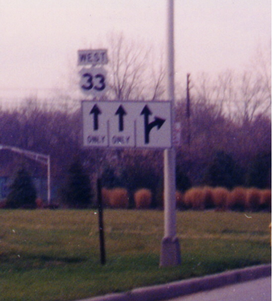
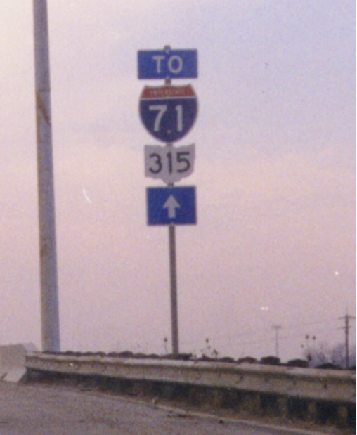
Columbus cut-out shields
These are not the old-style cutout markers that were found on highways in the first half of the 20th Century, but are what appear to be the cutout markers designed for placement on large green guide signs. Perhaps these were all that were available at the time. The Interstate 71/Ohio 315 trailblazer assembly is on I-70 Westbound near the Mound St. interchange. The US 33 cutout was along Spring St. near Neil Ave. (has since gone away)
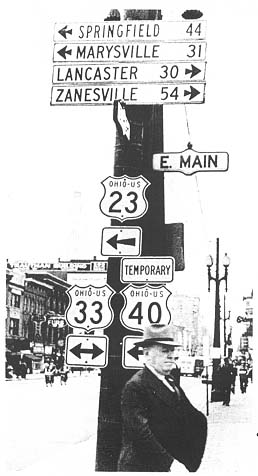
These cutout shields go back to the time when they were a standard feature across the nation. This black and white photograph dates back to 1953. It also shows a Temporary US 40 shield (There was a Temp US 40 routing along Main St from Bexley to Downtown Columbus for several decades. No one has come with any solid end and beginning points for this routing though). This photo was in the Ohio Department of Highway's 1953 annual report.
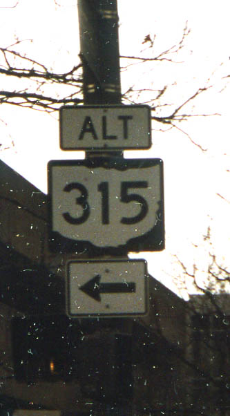
There is no official alternate routing for Oh 315 through Columbus. Perhaps it was left over from the Spring-Sandusky rebuild when Oh 315 was closed from I-670 to I-70/71 split for a couple of years.
An interesting find never the less. Along Spring St @ Front St (photo from March, 2003)
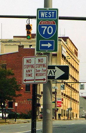
Columbus is using one piece sign assemblies for freeway markers around town (and as far out as Polaris Mall), instead of having the direction, route shield, and direction arrows as separate entities. This one is at Main and Front Sts. (Photo taken in Spring, 2003)
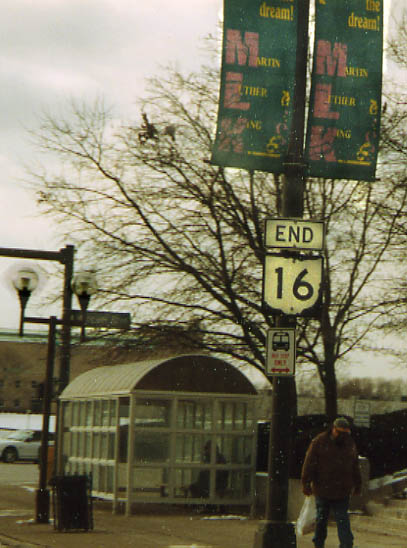
The western end of Oh 16, at the banks of the base of the Broad St bridge over Scioto River. I have wondered why ODOT had Oh 16 end here and not back at US 40 in Bexley. It is my belief that Oh 16 ends here because Civic Center Dr. was the original routing for OH 31 (later to US 33) through Columbus before the Federal Highway System (US 40, 23, 62, 33) came into play. Now Oh 16 just has this odd "dangling end" like several other state routes have inherited via route changes over the year. (Both Oh 16 photos are from March, 2003)
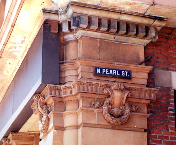
So when did Pearl St become Pearl Alley? This old streetsign, attached to a building, is facing westbound traffic on Broad St between the Rhodes Office building and High St. (Photo taken in May, 2004)
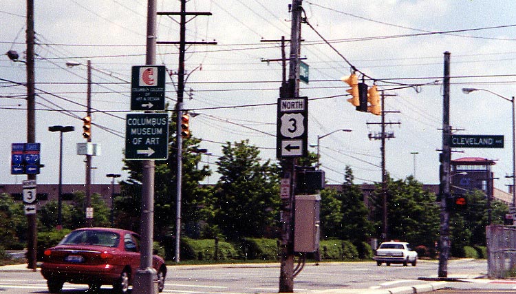
It's about time the country realized the importance of the
3-C Highway and upgraded OH 3 to US 3.
Alas, the
US numbering system would not allow such a change, thus this US
3 sign is in error (as evident by the Oh 3 sign on the left side
of this photo).
I guess the City of Columbus is
not as professent concerning proper signage as the State of Ohio
is.
(Intersection of Cleveland Ave and Long St.)
Photo taken in May, 2004
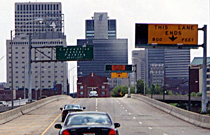
Why do I have to go left to reach the Convention Center (when
it's to the right)? Why not use the ramp to the right? The reason
is....(see next photo below)
3rd St. over I-670,
Photo taken in May, 2004.
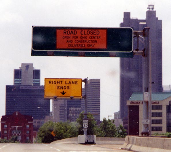
What was this ramp and sign supposed to be for originally? It's essentially a back entrance to the Convention Center now (referred to by it's original name on the sign, ironically). Actually I'm surprised this sign hasn't been replaced yet. (3rd St, just south of I-670) Photo taken in May, 2004.
![]()
I'm not sure when I took this photo, I was taking note of the covered up sign on the right. It was covered up due to Oh 315 being closed between I-70/71 and I-670 due to the Spring Sandusky reconstruction project (1998-2003). I don't know when I took this photo, other than it was in that 5 year period.
Page created on December 10, 2003/last updated on March 15, 2006
Questions, comments, and submissions can be sent to Sandor Gulyas
Return to Downtown Columbus Page or Columbus Virtual Roadtrip