
New photos are here, here, and here
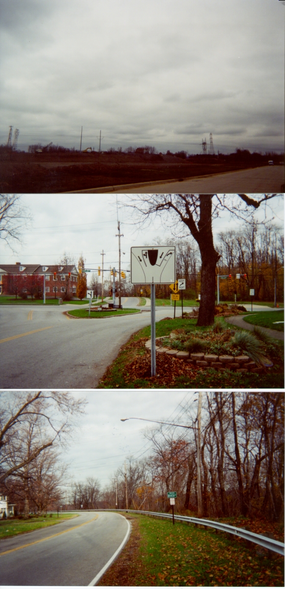
The Eastern end of Euclid Avenue in Willoughby (the building in the background is the Willoughby-Eastlake Technical Center and traffic lights with arrows anything other than at a 90 degree angle such as pictured are not common)
The western end of this famous street is at Public Square in Cleveland (see the Downtown Cleveland page of the Cleveland Virtual Roadtrip).

Downtown Willoughby streetscape. Looking south along Erie Street (US 20/SR 174)
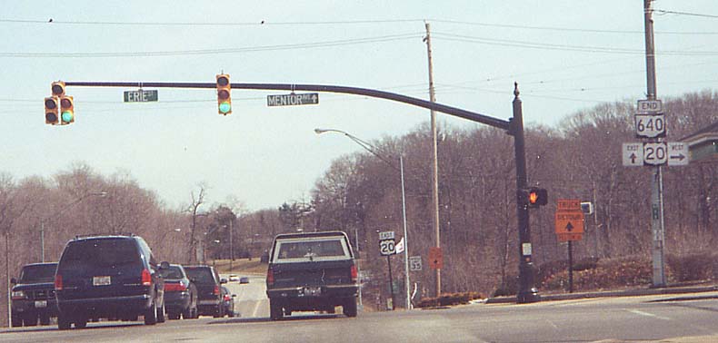
Eastern end Ohio 640/Vine Street, western end of Mentor Avenue (eastern end of Mentor Ave is in Painesville). This is also officially the north end of Ohio Route 174, although signage for that route is scarce in the downtown area and absent altogether from the US 20/SR 174 concurrency (Erie Street to the south).
By December 2003, coincident with the end of the Vine Street/SR 640 reconstruction project, the US 20 shield in the foreground assembly had been erroneously replaced with an Ohio Route 2 shield. This had been rectified by February 2004.
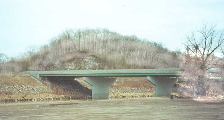
The bridge in the background on US 20 over the Chagrin River (at the low point on the road) was opened on October 23, 1979, replacing a high-level bridge that had opened in 1921 (see sources note at bottom of page).
This intersection was used as a test intersection for one of Garrett Morgan's traffic signals (at the time Mentor Avenue intersected Erie Street further south than here) according to the Willoughby Historical Society. (Garrett Morgan is commonly credited with inventing the traffic signal although many other versions existed prior to his - see this page.)
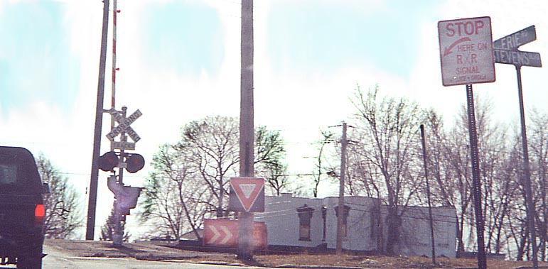
List all the pecularities here. Erie Street southbound at the CSXT tracks north of downtown Willoughby.
The Pelton Road bridge over the Chagrin River connecting Erie Street and Lost Nation Road north of downtown. (More photos are here, beginning with "pelt") A replacement, running SW-NE between the existing bridge and the St. Clair Street bridge next to SR 2, began to be built beginning in late Spring 2004 (see this NOACA .pdf, #1-24), hampered by an accidental gas pipeline rupture June 24, 2004 (story | video), and opened as Gilson Parkway on about January 6, 2005, at the same time causing the Pelton Road bridge to close, awaiting eventual demolition. One former plan (source: Cleveland Plain Dealer, February 17, 1995) was to build the replacement bridge about ¼-mile downstream (north), which would be tied into a project to build a set of railroad overpasses on Erie Street, so between the two projects there would be smoother access between State Route 2 and downtown Willoughby. More views
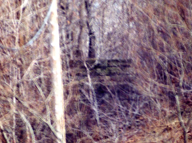
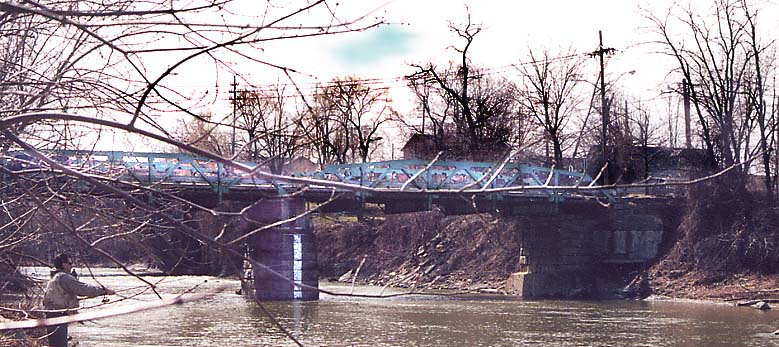
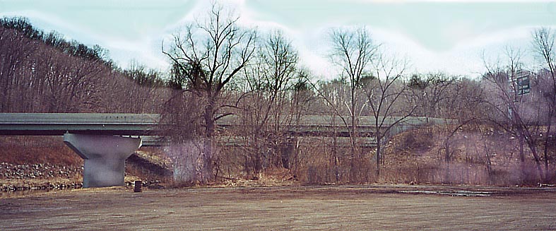
A former bridge pier on the east bank of the Chagrin River just south of the existing US 20 bridge northeast of downtown. According to the 1907 USGS 15-minute Mentor quadrangle map (NW section) this bridge carried the Cleveland, Painesville, and Eastern interurban line (additional information), labelled on the map as "Cleveland, Euclid, and Painesville Electric R.R.", and an early alignment of what became Mentor Avenue (prior to this crossing the only east-west crossing was over the Pelton Bridge further north - see above).
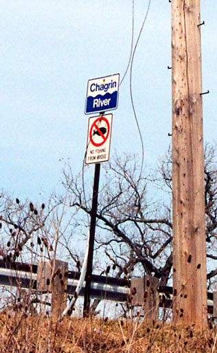
Non-standard (non-traditional?) Chagrin River sign on Ohio 84 Eastbound on the south side of Willoughby. By April 30, 2005, signs with a variant of this design had been installed on each end of the river's US-20/Mentor Avenue bridge (see above).
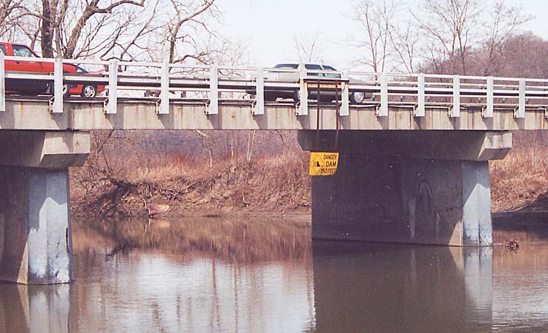
A roadsign underneath a road? Actually this sign is for boaters along the Chagrin River. The Ohio 84 bridge just makes for a good support for the sign. NOTE: The dam to which the sign referred was washed away sometime in the first few days of 2005: "Dam breaks", Willoughby News-Herald, 1/3/05
I-90 bridge over the Chagrin River (looking south towards the bridge). East end (top) West end (bottom)
While probably not a standard sign, it conveys the meaning well. NOTE: This particular sign had been removed by March 19, 2005, although other examples still remain in the area.
On Ohio 84 Eastbound in Willoughby, just before crossing into Mentor
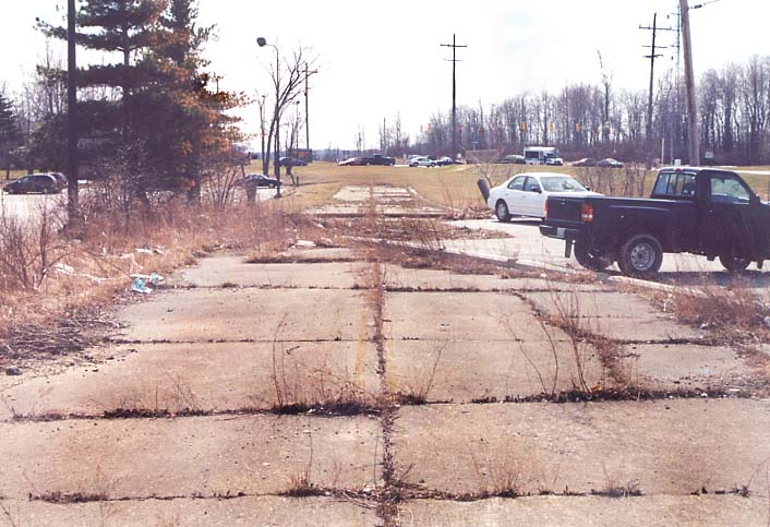
Somewhere along the line, Oh 306 got rerouted near I-90 and Kirtland's Lakeland Community College. This picture shows a remnant of the old routing, behind some businesses on the eastside of current Oh 306. (In the background is the main entrance to the college.) Another part of the former 306 (behind the camera) was converted to a parking area lane. Map of area
Sources (in part):
Willoughby, the first 150 years: the picture story of Willoughby, Ohio from 1800 to 1950 by Clarence F. Sindy (Duke Printing and Mailing Services, Eastlake, Ohio) - DBCN number: AJP-8202 (has photos and information on the Mentor Avenue bridges and the interurban bridge)
R. Fleming
Page created on January 9, 2003/Last updated on May 23, 2005
Questions and comments can be sent to Sandor Gulyas or Marc Fannin
Return to The Lake County Photo Flow Chart