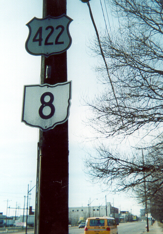
Although a 2001-2002 project along Woodland Avenue and Kinsman Road replaced old cutout signs for US 422, Ohio 8, and Ohio 87 with modern shields, two sets of cutouts still remained as of January 27, 2002 -- this one on Woodland at West 40th Street and another set just up the road at East 37th Street, just short of I-77 near its end.
The MetroHealth Curve
The "MetroHealth Curve", formerly the "Metro General Curve", is the common name for the curve on Interstate 71 where it meets the Jennings Freeway (Ohio 176) and passes between the MetroHealth Medical Center (formerly Metropolitan General Hospital) and the ISG (formerly the LTV Steel Corporation) plant site. This is an interesting section of highway which includes a double-decker section. Map of the immediate area.
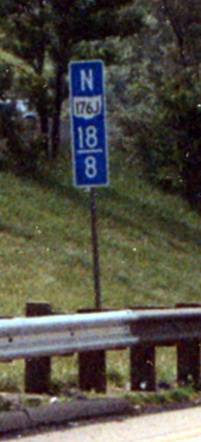
The mystery milemarker. Why do the milemarkers along the Jennings show Oh 176 J ?
The J does not stand for junk, Japanese ownership, or the Jennings Freeway. According to this ODOT Document, "J" signifies awaiting abandonment. Of course that leads to the next question, why is ODOT signaling that they want to abandon something they just built?
Photo taken in June, 2004
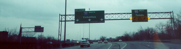
Because of the low clearance created by the top deck of the double-decker section which carries I-71 Northbound, the Ohio Department of Transportation had to install a smaller version of overhead guide signs for the northbound Jennings Freeway. An interesting side note is that the lower deck here is also on a bridge over a ravine, while the southbound lanes of I-71, which are immediately to the left and at the same level, are on solid ground.
Despite consistent signage including this example, it is doubtful that many locals realize that the Jennings Freeway carries the northernmost miles of Ohio 176.

In front is the access to I-71 Southbound from I-90 Eastbound and I-490 Westbound; to the left is I-71 Southbound itself. The sign bridge over I-71 was featured in the long version of the "Five O'clock World" (Vogues) opening sequence of the Drew Carey Show, except that the Jennings Freeway hadn't been finished by that time, so the left sign read "Denison Ave/Jennings Road" rather than "[176] SOUTH/Parma".
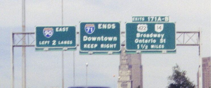
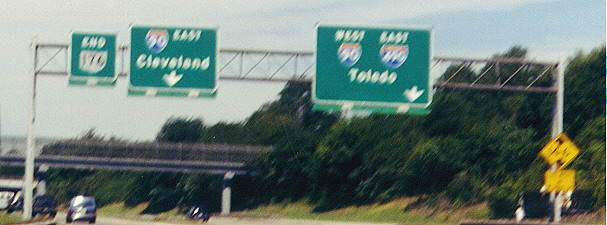
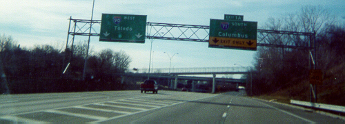
Probably the most consistent error in reference to Cleveland's highways is the pairing of Interstate 71 with Interstate 90 on the Inner Belt Freeway (due principlely to former plans for I-90 that never came about). As you can see, I-71 does in fact end at I-90 (this gantry is above the top level of the four-level I-71/I-90/I-490 interchange). Visible in the background are Cleveland's three tallest buildings.
Interstate
90 WB at Interstate 71 and Interstate 490
This is in virtually the same spot as above, just looking the other direction. Note that there is no access to I-490 (I-490 cannot access I-90 EB, either).
Interstate 90 EB at Interstate 71 and Interstate 490
Approaching
At
the split
Interstate 490 WB's end at Interstate 90 and Interstate 71
I-77
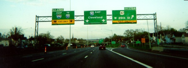
Northbound at I-490
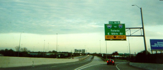
Unfortunately since this was taken underneath the Broadway (Ohio 14) overpass, the photo is washed out. Just barely readable are the signs, the rightmost of which is interesting: I-490 connects to I-71 Southbound and I-90 Westbound, but only the I-71 shield and the control city for I-90 (Toledo) are listed on approach signage, rather than both Interstates and their respective control cities (Toledo, Columbus) or one Interstate with its own control city (I-71/Columbus, I-90/Toledo).
I-77
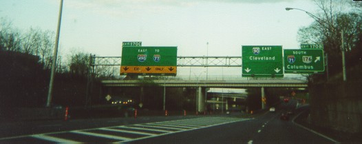
Southbound at I-490
Fortunately this one is much clearer.
See also I-71 and I-490 by AARoadtrips.
Links
Fulton Road Bridge Replacement Project Website - This bridge crosses Big Creek just south of I-71.
Page created on December 25, 2002/Last revised July 3, 2006
Questions and comments about this page can be sent to Sandor Gulyas or Marc Fannin
Return to Cleveland Virtual Roadtrip