|
|
If you visited (The!) Ohio State University back in 1960 and didn't visit again till 2002, you'd notice the vanishing of some significant streets (and the addition of a bunch of buildings!). Most notable of the subtractions would be North Oval Mall (Location obvious to those who know OSU), and Neil Ave from 18th Ave. to Lane Ave. Also missing is a trafficlight or two along 17th Ave. |
Columbus cut-out shields
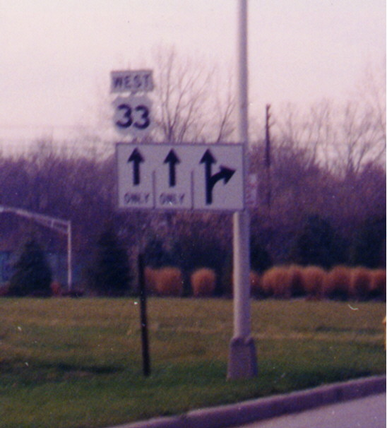
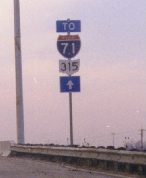
These are not the old-style cutout markers that were found on highways in the first half of the 20th Century, but are what appear to be the cutout markers designed for placement on large green guide signs. Perhaps these were all that were available at the time. The Interstate 71/Ohio 315 trailblazer assembly is on I-70 Westbound near the Mound St. interchange. The US 33 cutout was along Spring St. near Neil Ave. (has since gone away)
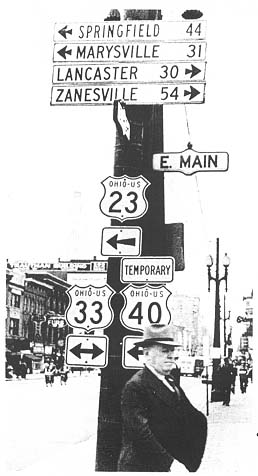
These cutout shields go back to the time when they were a standard feature across the nation. This black and white photograph dates back to 1953. It also shows a Temporary US 40 shield (There was a Temp US 40 routing along Main St from Bexley to Downtown Columbus for several decades. No one has come with any solid end and beginning points for this routing though). This photo was in the Ohio Department of Highway's 1953 annual report.
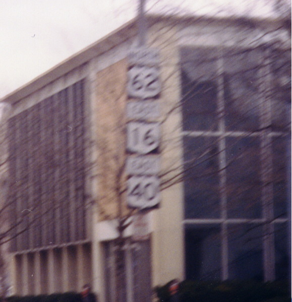
Like the 37/36 pairing in Sunbury (see Road Photos of Central Ohio main page), this sign assembly has its markers in an unconventional order. The marker for U.S. 40, a transcontinental highway, is under one for a shorter, higher-numbered U.S. route, and even under one for a state route. (Also note that U.S. 62 is signed "NORTH" and not "EAST" here.) Along E Broad St near I-71
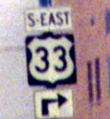
Go here to see a diagonal direction on a US 33 sign (see this page for details).
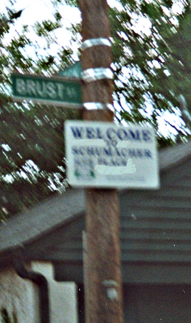
An unofficial suburb of an unofficial suburb of Columbus. This sign is just east of German Village, which is noted by everyone in Central Ohio as an geographical area, but is not a political entity of itself. Schumacher Village doesn't get any sort of run. It's not noted by anyone or entity other than for the odd sign or two around it's perimeter.
Anyone need a BGS? This collection was along the [median] of OH 315 during it's reconstructuring in 2000-1, just north of the I-70-71 west split.
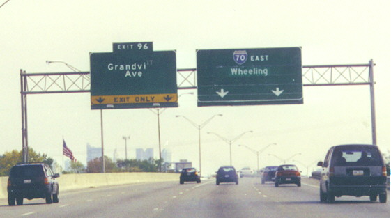
Will the mystery guess please sign in...
You can tell ODOT (District 6) didn't have much invested in the
sign maintenance dept. We wait to see what this sign said before
Grandview Ave was plastered on it. It could be...
I-670 EB
I-70 (N?) EB
US 33 EB (nah!)
Grandview Ave.
Maybe we will find out, but for now the answer is unclear. (along
I-70 EB between I-670 and I-270, west of Downtown)
Update With the opening of I-670 west, the sign in question was finally put to pasture and replaced in June 2002.
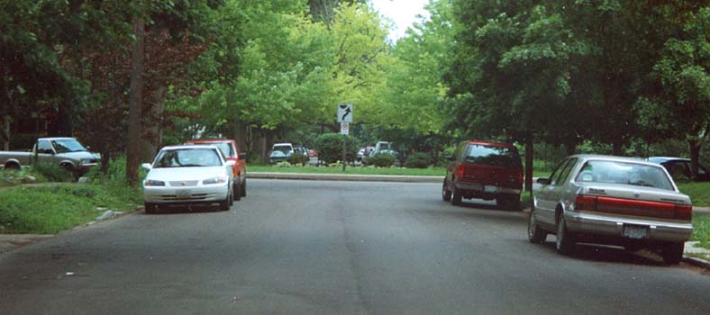
A Traffic Circle traffic direction sign. Mind you, the circles were implimented on residential streets as traffic calming measure. This one is in Victorian Village (just south of the OSU campus) somewhere within King Ave, Neil Ave, I-670, and Oh 315
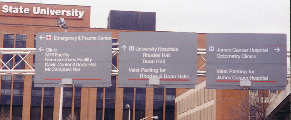
The Ohio State style on road signage. Taken within the Ohio State University Medical Center complex on the SW corner of the OSU campus.
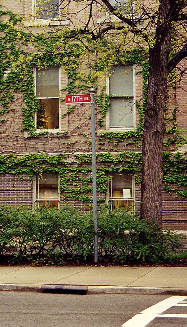
A solitary streetmarker in the Ohio State Campus. This particular street was semi-corden off in the mid 1990s (gates block the way, but busses and cars with special passes still can come through) There used to be a cross street here (thus the reason for the streetsign), but that particular steet was done away with back in the 60's. BTW, the building behind the sign is Brown Hall.
Link to OSU Transportation & Parking
New OSU Hospital exit: Official plans | Discussion
Columbus Crossroads, the I-70/I-71 South Innerbelt Corridor Study (ODOT)
2003 Delaware Trip notes by Eric Stuve
Page created on November 7, 2002, last updated on September 2, 2003
Questions and comments can be directed to Sandor Gulyas
Return to Columbus Virtual Roadtrip