
Zoomed in on the Roebling Bridge (more info on this bridge later) from the end of Main St near Cinergy Field.
The Roebling Suspension Bridge. The street on the far right side of the picture is Mehring Way (US 52).

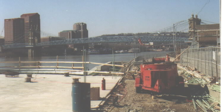
Yet another shot of the famous Roebling Bridge. Notice the parking lot in the foreground - park at your own risk when the river is rising!
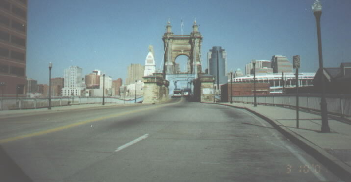
Approaching the Roebling Bridge. This historic bridge opened in 1866 as the world’s longest central bridge span. It was Cincinnati’s first Ohio River bridge, and was used as a model for the Brooklyn Bridge, which was also constructed by John A. Roebling. During the 1937 flood, it was the only bridge on the entire 981-mile Ohio River that remained open.
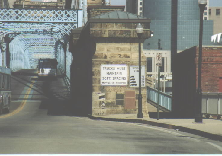
Weight restrictions apply. More info on this bridge can be found here.
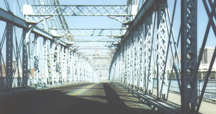
The bridge still has a grated deck.
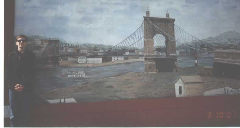
This mural of the Roebling Bridge is on the outside of a liquor store at the foot of L&N bridge in Kentucky. I normally would be seen in clear glasses…
Going west on Third Street approaching the Clay Wade Bailey Bridge. The sign indicates that US 25 reaches Ohio. [In reality, US 25 does enter Ohio -- it runs from the state line near the north edge of the river a very short distance north to the end of the bridge (0.026 miles) -- but is entirely Kentucky-maintained, because Kentucky maintains the entirety of this bridge (and many other bridges) across the Ohio River. Compare the Kenton County listing here to the Hamilton County listing here. -- MGF]
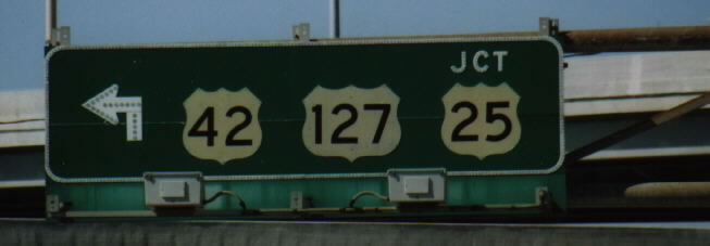
The Clay Wade Bailey Bridge carries US 25, 42, and 127. The bridge also has a railroad bridge attatched to it. This is further explained on this page.
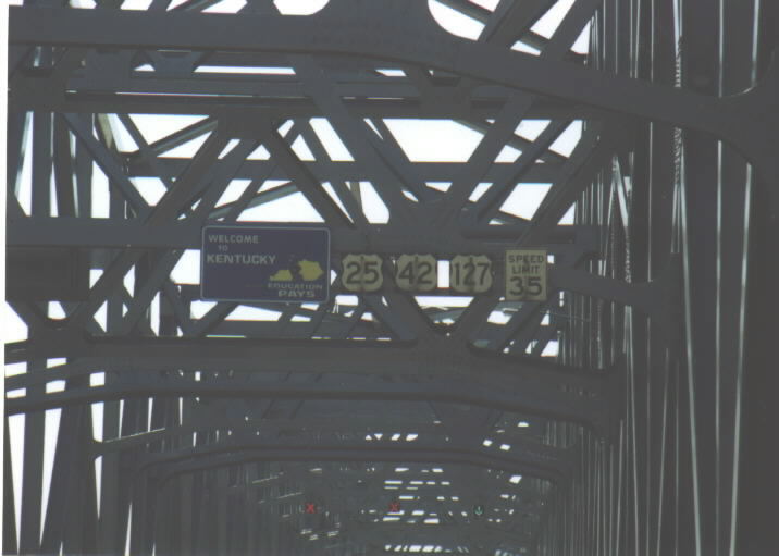
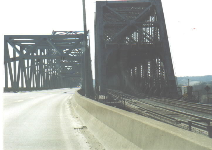
Signage on the Clay Wade Bailey Bridge. Note the interchangeable lanes. The current bridge opened in 1970, there had been an older bridge in its place.
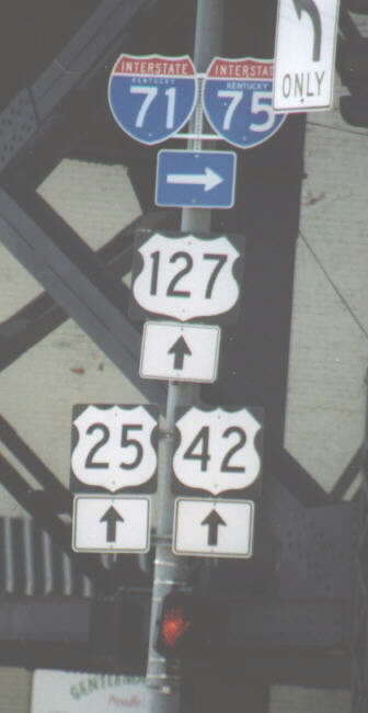
Signage seen in Kentucky upon leaving the Clay Wade Bailey Bridge.

Crossing back into Ohio on the Clay Wade Bailey Bridge. Again note the interchangeable lanes.
Looking west to the Brent Spence Bridge, which carries I-71/75. This photo was taken from the Clay Wade Bailey Bridge.
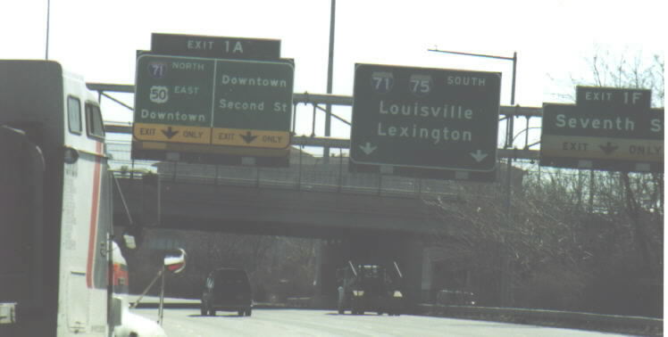
Heading south on I-75 towards the Ohio River and the junction with I-71 and US 50 (FWW).
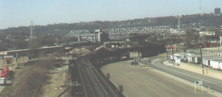
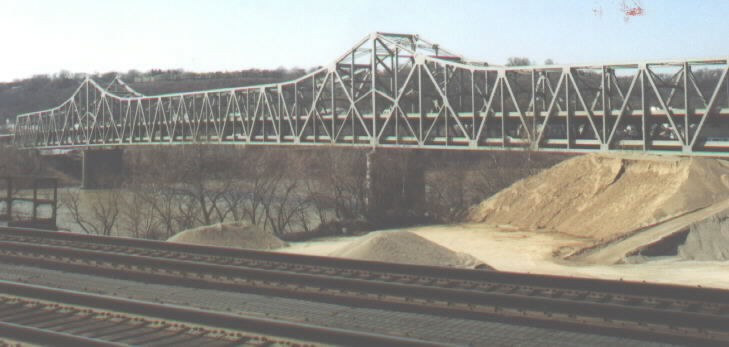
Looking westward from the Brent Spence (I-71/75) Bridge. The low railroad bridge in the foreground leads into Union Terminal. I believe that it is the longest bridge in Ohio at more than 7,000 feet in length. The hill in the background is an old neighborhood known as Price Hill. The Ohio River bridge in the background in a railroad-only bridge. It is the Cincinnati Southern Bridge, built in 1922 as a replacement of an earlier (1877) bridge. The bridge is very busy and leads into the rail yard of Union Terminal. It is not possible to walk across the bridge. More info is here.
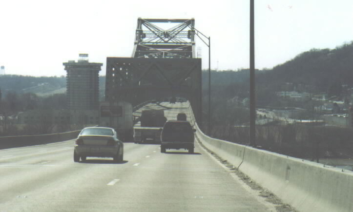
Crossing into Kentucky on the upper/southbound level of the Brent Spence Bridge, which carries I-71/75. The bridge originally had 3 lanes, but a fourth lane was added by eliminating the shoulders. The bridge opened in 1963, but it will soon be worn out. It will probably be replaced within a decade, but there are no specific plans yet. More info is here.
Page created on December 16, 2002/last updated on January 16, 2003
Question and Comments can be directed to Pete Jenior
Return to Pete Jenior's Cincinnati Tour