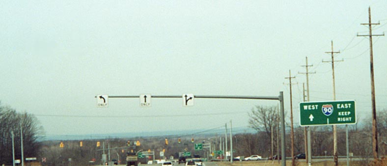
The I-90/Ohio Route 44 interchange
This interchange had just finished being reconstructed when this photo was taken in March 2001 (see the bottom of this page for details). The intersection with Auburn Road (foreground) was also redone; in the process, the left turn lanes were rebuilt inside the median and in fact are closer to the opposite roadway at the intersection than the roadway carrying traffic going the same direction. Also notice the background -- that thin blue-gray strip just above the trees is Lake Erie, showing just how close I-90 gets to it (I-90 is slightly recessed most of the way between Cleveland and Buffalo, so the lake is just out of view usually to those travelling on I-90).
Many things of note in this shot: The Interstate-style "MILE 2" marker just visible above the red truck on the right (with few exceptions these types of milemarkers are only found on Interstates in Ohio); the redundant Speed Limit 45 signs; the sign in the background saying "WEST [90]" instead of "[90] WEST"; and, of course, Lake Erie again.

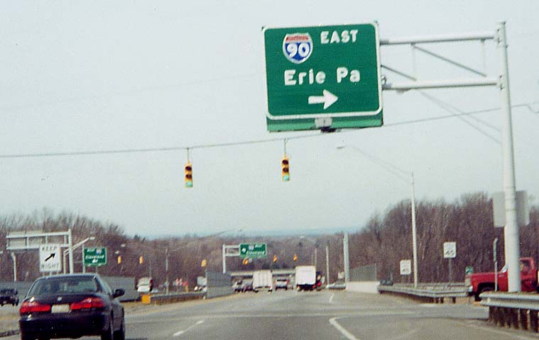
Exit sign for Ohio 44 along I-90 Eastbound.
Ohio Route 44 interchange with Ohio Route 84
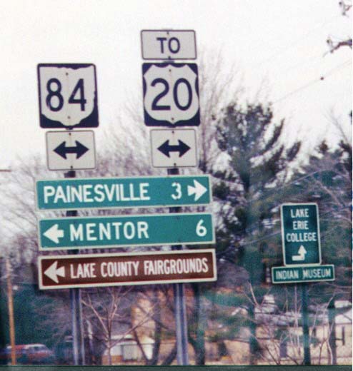
The Ohio Route 44 freeway interchange for U.S. 20 and Jackson Street
west of Painesville is incomplete; there is no access to Ohio
44 Southbound or from Ohio 44 Northbound (see Painesville page). To compensate for this,
the green guide signs for northbound traffic for the next exit
to the south, Ohio 84, include a "TO {U.S. 20}" indication.
However, when traffic arrives at the end of the offramp at this
exit, this sign assembly is all that they see regarding U.S. 20,
and there are no more mentions at all of U.S. 20 in either direction
on Ohio 84. (Side note: Ohio 44 isn't mentioned on U.S. 20, either.
The only guide signs at the Ohio 44 Northbound access there say
"TO {Ohio 2}" trailblazers.)
Sandor
also loves the arrow on the sign directing traffic to Lake Erie
College (right then up?)

September 2000 Update: New signage further back
on the ramp directs US 20 traffic to the right or east, but the
first assembly pictured above still remains, and there is still
no mention of US 20 beyond the interchange.
March
2001 Update: ODOT gives up trying to please us and the
sign assembly two pictures above is removed
(Thanks
for the memories ODOT).
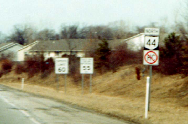
Signs like these occur on routes near major cities on which the transport of hazardous material is prohibited. There is a corresponding sign which identifies routes on which hazardous cargo is permitted (see this page). This particular assembly, just north of the Ohio 84 interchange, may not be around much longer, since a newer, bigger [NORTH][Ohio 44]/[TO][Ohio 2] assembly was installed just before this one as part of a reconstruction project.
Old bridge on old Ohio 44 (Ravenna Road) just south of Ohio 84
This was replaced, being reopened on September 12, 2003 (per the Lake County Engineer). NOACA page | More photos (official)
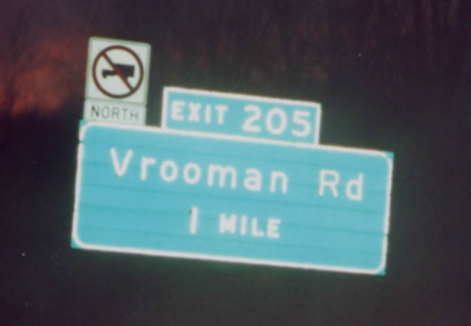
Vrooman Road exit, I-90 Westbound (between Painesville and Perry, in Leroy Township)
Interesting way of showing a truck prohibition (due to a steep, curvy drop to the Grand River just north of the interchange). This is planned to be bypassed by a high-level bridge, according to this September 1, 2003 article by the Willoughby News-Herald, as well as a September 2004 story in the Lake County Business Journal, which mentions possible planned completion by 2010. (See also Northeast Ohio Areawide Coordinating Agency's 2004 Fiscal Year proposals [.pdf document!] and the Lake County Engineer webpage)
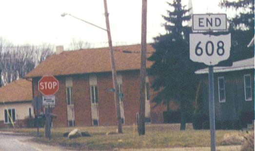
Ohio Route 608 used to end at Ohio Route 44. When Ohio 44 was rerouted to the west on new highway, nothing was done to the routing of Ohio 608, so now it is disconnected
from the rest of the state highway system. There is no indication
here of how to reconnect with the state highway system. And another
thing, Ohio 608 has a stop sign while old Ohio 44, which is now
only a county road, does not. Update: By Mid-summer 2002 LED flashing beacons had been installed at this intersection, but the traffic patterns remained the same (608 stops, old 44 does not).
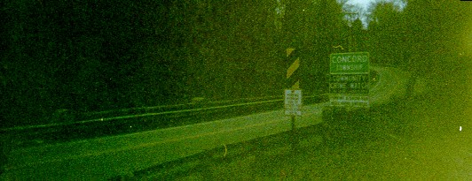
In the unincorporated
settlement of Concord
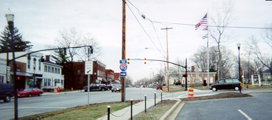
Downtown Madison
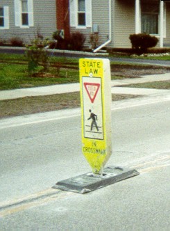
Pedestrian crossing "paddle" -- These are located throughout the village. They are often located as pictured, but are moved in the winter to accomodate snowplows. The federal Manual on Uniform Traffic Control Devices shows a similar version.
The signals had just been installed and were still flashing. Looking east on Ohio 84/528 at the western 84/528 junction
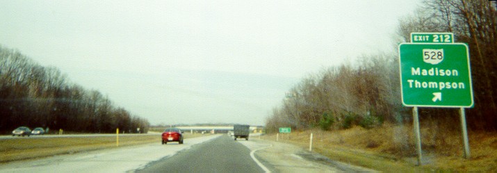
Ohio Route 528 exit sign along I-90 (eastbound) - Thompson (to the south) is unincorporated

Notice the flag in the bridge fencing over the eastbound roadway. This photo was coincidentally taken on the six-month anniversary of September 11. There was briefly a flag facing the westbound roadway as well.
The Grand River bridges on I-90
On May 24, 1996, the Friday of Memorial Day weekend, a gusset (steel plate) holding bridge beams together failed on the eastbound bridge (view faces eastward so it's directly ahead), so an emergency set of crossovers were built by June 14, and the bridge was repaired by November 4 after an unusual set-up of hydraulic jacks moved it back into place. Until the crossovers were built, traffic was rerouted along State Route 2, US 20, and through Madison on State Route 528. The crossover on the west side has a variety of warning devices on it now so it isn't mistaken for an offramp from both directions.
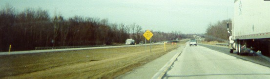
Wide view (not much to see)

Close-up - You can see the cross over ramp to the left to allow for work on the bridge -- since this photo was taken, a 2/10 milemarker (Mile 209.4) has been added near the crossover
This pair of bridges is planned to be completely replaced sometime after 2006.
Page created on January 10, 2003/Last revised April 16, 2005
Questions and comments can be sent to Sandor Gulyas or Marc Fannin
Return to The Lake County Photo Flow Chart