Old Beechwold
Before the City of Columbus
designated and created the current Clintonville district, the
area between Henderson-Cooke Rds and Morse Rd was called Beechwold.
Inside of Beechwold itself is Old Beechwold, which is a very exclusive
housing area in Columbus. Started with just the Jeffery family
mansion, it turned into one of those expensive subdivisions built
at the turn of the 20th Century. Residents there would routinely
thumbed their nose at "working class" Clintonville to
the south. Beechwold's claims to local fame are blocking the Morse-Bethel
Rd (and an early version of I-270)
connector and the original home for the Columbus Zoo, back at
the turn of the 20th century. Nowadays, references to Beechwold
have dwindled (ironicly they are now part of the Clintonville
district of Columbus) to several markets along High St and for
several stone pillars and plaques along the west side of N. High
St between Henderson and Morse Rds. The next several pictures
use one set of these pillars as examples.
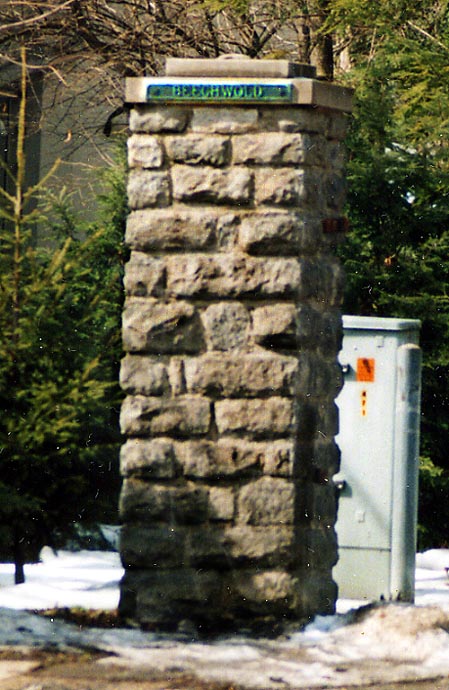
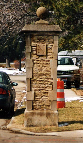
Picture on Left - This stone pillar is of note because it is the last one with the metal Beechwold plate at the top. None of the other Beechwold pillars have marker on them anymore
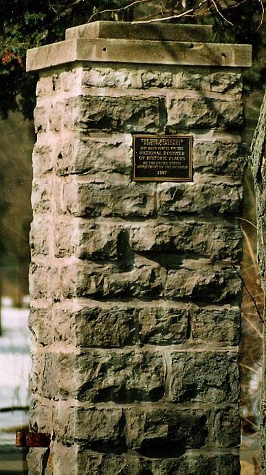
Picture on right - This stone pillar has a plaque mentioning that the Beechwold neighborhood was included into the national register of historic places. All roads leading into Beechwold, from High St, have one stone pillar with this plaque on them. You can also note at the top of this pillar where the metal Beechwold plate once stood (due to the holes into the masonry)
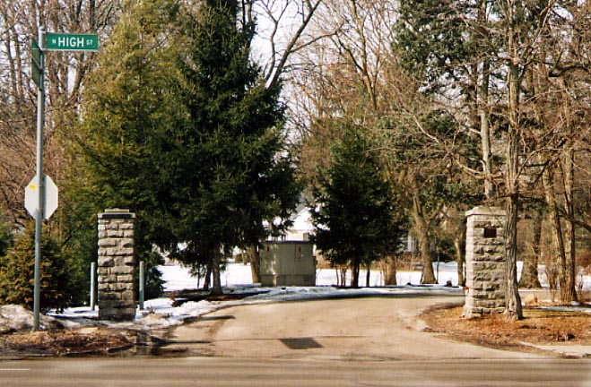
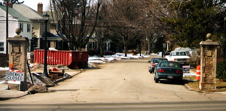
Here are the two stone pillars together at the intersection of N. High St and W. Beechwold St. at the south end of the Beechwold subdivision. (all Beechwold pictures were from March, 2003)
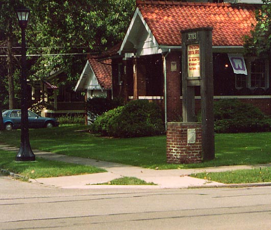
Near this house, turned dentist office, are several small brick
pillars. Unlike it's taller brothers along High St, there is no
identification with these smaller ones
(photo taken
in October, 2003)
Here's another remnant/marker of subdivisions past. These concrete (and stone?) posts are for the Northmor subdivision along N. High St, (located a 1/2 mile north of North Broadway). Unlike Beechwold, I know no history about Northmor. In fact, I was alerted to the existance of these pillars by an elderly couple while I was photographing the Beechwold pillars (above).
If anyone has anything to add about Northmor, feel free to contact me.
Northmor photos are from March, 2003
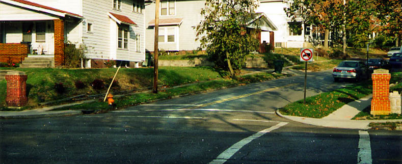
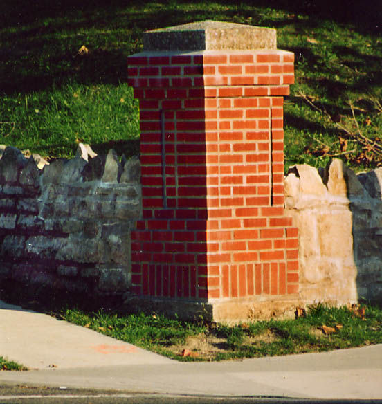
California St. The last pair of brick pillars one will see heading south on High St. in Clintonville.
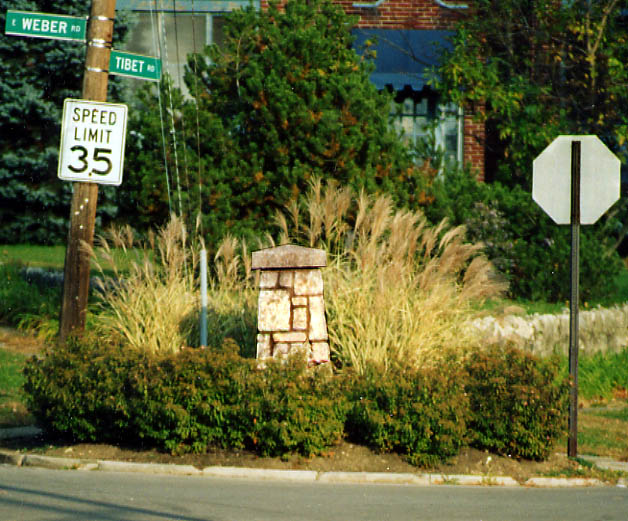
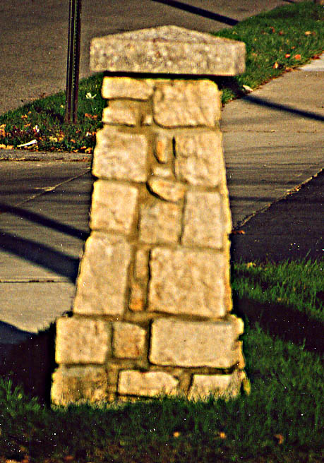
Starting at the Wye between Weber and Tibet Rds, there are a handful of pillars that were made with limestone, instead of brick (or concrete), and this continues south to Arcadia Ave (the designated south end of Clintonville).
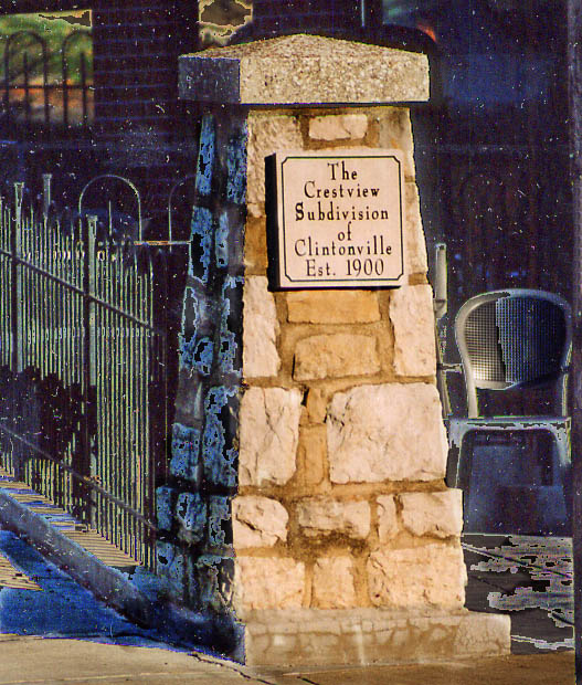
This limestone pillar has no partner on the other side of the street. But it does have something that the other pillars do not. A written sign attached to it. This is the only pillar, out of the South Clintonville collection, that mentions a Crestview Subdivision. At the SE corner of Kelso and High.
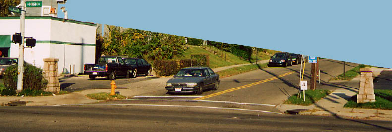
This pair of limestone pillars are the last ones along High Street, this pair is for Olentangy St, as you continue south towards Ohio State and downtown.
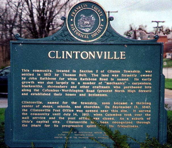
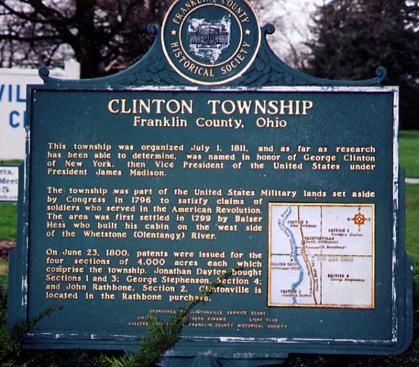
The next photos aren't really mesh with the rest of the page,
I just needed a home for them. Both deal with the History/founding
of Clintonville
(both taken in April, 2004)
Questions and comments can be sent to Sandor Gulyas
Return to Roadfan's Clintonville