Cincinnati
Freeway Signage
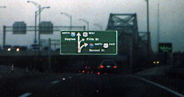 Diagramical sign, version 1 for northbound traffic
before the Ohio River crossing. (photo from December, 2004)
Diagramical sign, version 1 for northbound traffic
before the Ohio River crossing. (photo from December, 2004)
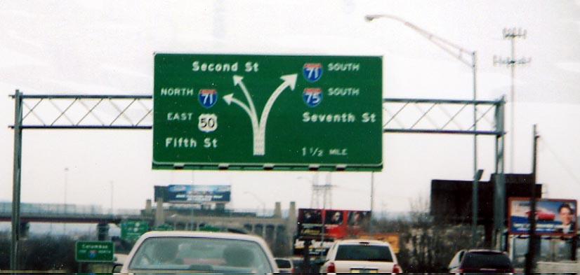 Diagramical sign, version 2 for I-75 southbound traffic
within Cincinnati (at least this photo wasn't taken at dusk) (Photo
taken in March, 2005)
Diagramical sign, version 2 for I-75 southbound traffic
within Cincinnati (at least this photo wasn't taken at dusk) (Photo
taken in March, 2005)
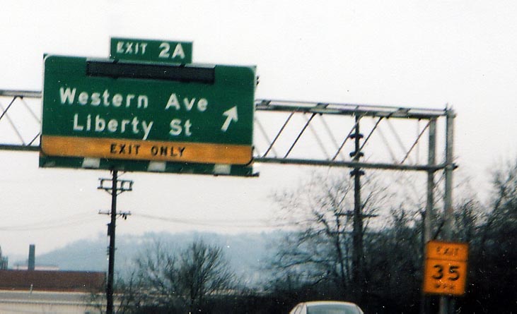
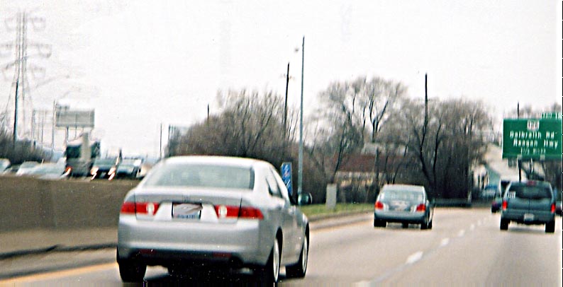
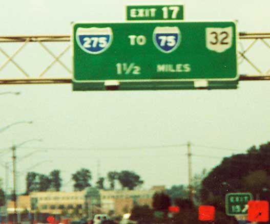
 Something that I've noticed when driving I-75 southbound,
approaching downtown Cincinnati, is these LED cutout on the top
of the exit signs (see photos above). Anyone know what they are
for, or if they are still in operation?
Something that I've noticed when driving I-75 southbound,
approaching downtown Cincinnati, is these LED cutout on the top
of the exit signs (see photos above). Anyone know what they are
for, or if they are still in operation?
 In the 1970s, I-75 was deemed to need widening north
of downtown Cincinnati. When ODOT came to the city of Arlington
Hts, they decided to build the new lanes for I-75 around the city.
Thus Arlington Hts. is known as the city in the medium of a freeway.
In the 1970s, I-75 was deemed to need widening north
of downtown Cincinnati. When ODOT came to the city of Arlington
Hts, they decided to build the new lanes for I-75 around the city.
Thus Arlington Hts. is known as the city in the medium of a freeway.
This first photo is at the north end of Arlington
as southbound traffic bears right and northbound merges back together
on the left (photo taken in March, 2005)
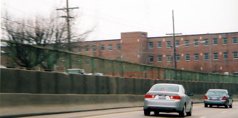 The building is nothing of note, just between the two
streams of traffic (Photo taken in March, 2005)
The building is nothing of note, just between the two
streams of traffic (Photo taken in March, 2005)
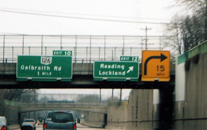 One thing that was not improved was the exit ramps.
A 15 mph curve is substandard (and not usual) along an interstate
One thing that was not improved was the exit ramps.
A 15 mph curve is substandard (and not usual) along an interstate
Also, why is the Galbraith Rd text shifted to the
left instead of being centered? (Photo taken in March, 2005)
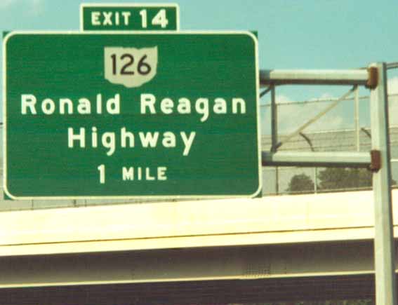 The former Cross-County Highway, renamed for the president
who help get funding for its completion. On I-71 NB (Photo from
September, 2001)
The former Cross-County Highway, renamed for the president
who help get funding for its completion. On I-71 NB (Photo from
September, 2001)
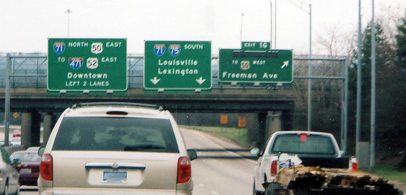
 Why are there a lack of control cities for I-275 when
approaching it along I-71 (and even I-75)? Why not Indianpolis
for the west and Chilocothe or Portsmouth for the east instead
of highway routes?! Along I-71 northbound approaching the I-275
north section. (Photo from September, 2001)
Why are there a lack of control cities for I-275 when
approaching it along I-71 (and even I-75)? Why not Indianpolis
for the west and Chilocothe or Portsmouth for the east instead
of highway routes?! Along I-71 northbound approaching the I-275
north section. (Photo from September, 2001)
 Stay right if you wish to continue to go around in
circles. Left unsaid is I-74 west to Indianapolis are the left
lanes. Or you can just find the next exit and turn around. Along
westbound I-275/I-74 in western Hamilton County (Photo from May,
2003)
Stay right if you wish to continue to go around in
circles. Left unsaid is I-74 west to Indianapolis are the left
lanes. Or you can just find the next exit and turn around. Along
westbound I-275/I-74 in western Hamilton County (Photo from May,
2003)
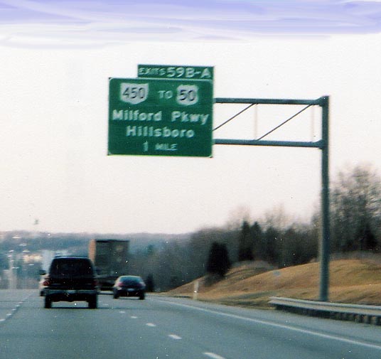 Ohio's newest state route and one of the shortest.
I guess that means the plans for an eastern US 50 freeway into
Cincinnati is officially off the books.
Ohio's newest state route and one of the shortest.
I guess that means the plans for an eastern US 50 freeway into
Cincinnati is officially off the books.
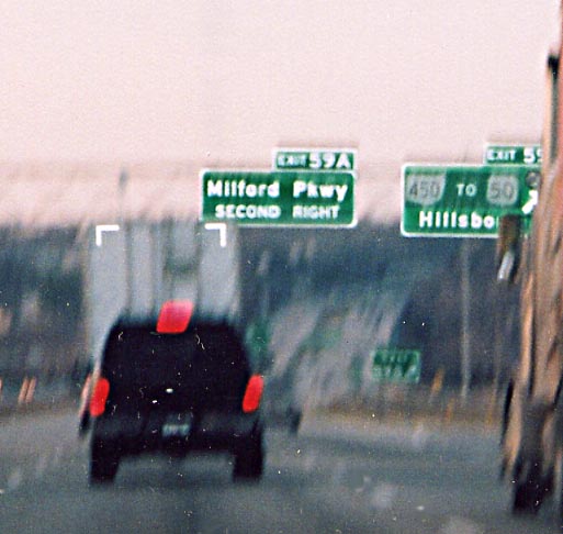 The would of been freeway is now a divided highway
connecting US 50 to I-275 and then a mall (to the west of I-275).
Photo taken in March, 2005
The would of been freeway is now a divided highway
connecting US 50 to I-275 and then a mall (to the west of I-275).
Photo taken in March, 2005
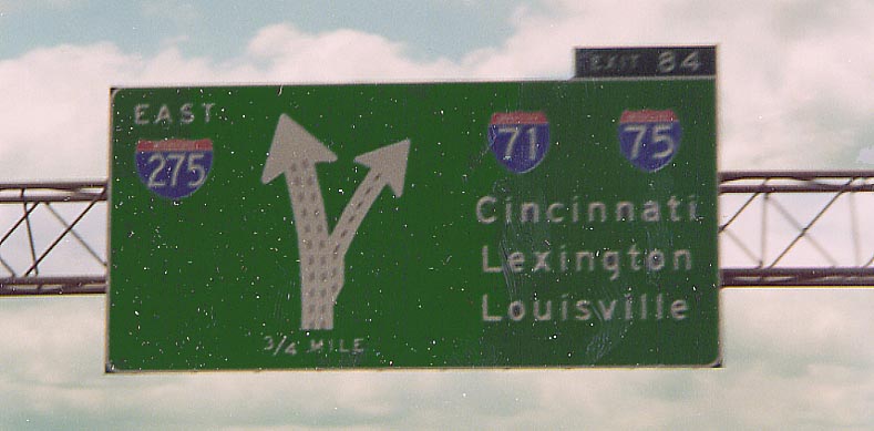 Diagramical signs are rare, any sort of freeway signs
with three(!) control cities are even more rare. This one exists
for a good cause south of Cincinnati
Diagramical signs are rare, any sort of freeway signs
with three(!) control cities are even more rare. This one exists
for a good cause south of Cincinnati
(Photo from
May, 2003)
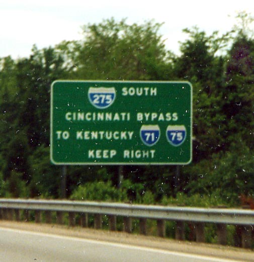
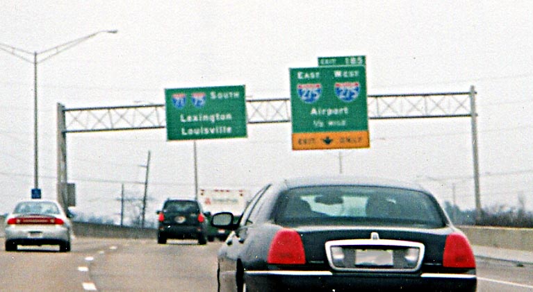 More bizarre signage concerning I-275 around Cincinnati.
This time we're in Kentucky and the sign for I-275 uses Two
(!!) I-275 shields to designate which direction the interstate
goes. How about a corresponding Control City/Point to go with
Airport instead of another shield. How dumb do they think people
are?!? (Photo taken in March, 2005)
More bizarre signage concerning I-275 around Cincinnati.
This time we're in Kentucky and the sign for I-275 uses Two
(!!) I-275 shields to designate which direction the interstate
goes. How about a corresponding Control City/Point to go with
Airport instead of another shield. How dumb do they think people
are?!? (Photo taken in March, 2005)
Page created on May 19, 2005
Questions, comments, and submissions can be sent to Sandor
Gulyas
Return to the Cincinnati Virtual Roadtrip