The First Baton
Rouge Expressway System
These following maps were from a 1948 Expressway plan
for Baton Rouge. They predate the interstate system.
 Originally, out of town traffic was to stay out on
Airline Hwy (US 61/US 190) with an expressway coming south from
the intersection of Airline and Scenic to near Goldby Stadium,
then through the Governor Mansion, skirting east of Downtown Baton
Rouge and finally dumping out onto Dalrymple Dr and the LSU campus.
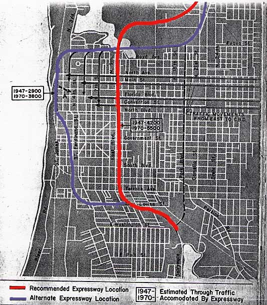
The alternate route was even worse, going through downtown Baton
Rouge and going in front of the front steps of the Louisiana capital.
Originally, out of town traffic was to stay out on
Airline Hwy (US 61/US 190) with an expressway coming south from
the intersection of Airline and Scenic to near Goldby Stadium,
then through the Governor Mansion, skirting east of Downtown Baton
Rouge and finally dumping out onto Dalrymple Dr and the LSU campus.
The alternate route was even worse, going through downtown Baton
Rouge and going in front of the front steps of the Louisiana capital.
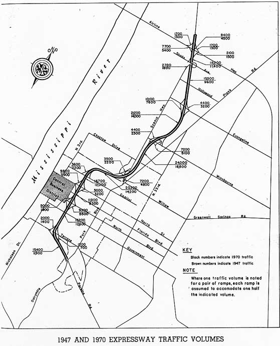 Besides showing the proposed traffic projections versus
current traffic numbers (1970 projection/1947 actual) and proposed
interchange design.
Besides showing the proposed traffic projections versus
current traffic numbers (1970 projection/1947 actual) and proposed
interchange design.
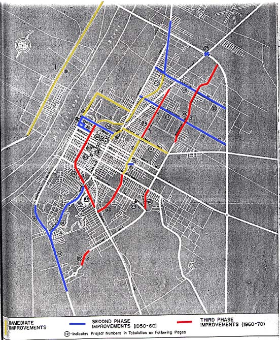 This last map is color coded to show which highway
projects the local government wanted to have completed between
1947-70. Amusing was the suggestion that the LSU to State Capital
section of the Expressway could wait 15 years after the northern
half of the Expressway was completed.
This last map is color coded to show which highway
projects the local government wanted to have completed between
1947-70. Amusing was the suggestion that the LSU to State Capital
section of the Expressway could wait 15 years after the northern
half of the Expressway was completed.
Interestingly
enough, the first section of the Baton Rouge Expressway system
to be completed was the east-west section between the State Capital
and 22nd St.
Thankfully, with the advent of the 1956 Federal Highway
Bill (which gave us our interstate system) these plans above were
scraped
Page created on March 3, 2006
Questions and comments can be sent to Sandor
Gulyas
Return to the Baton Rouge Virtual Tour